Home
All Products
Historic Maps
American Indian Maps
Birds Eye View Maps
Civil War Maps
Panoramic Maps
Railroad Maps
Revolutionary War Maps
State Maps
Historic Prints
Civil War Prints
Civil War Posters
Historic Portraits
Presidential Portraits
Contact Us
0
0
press
Enter
to search
Showing all results:
No products found.
State Maps
Search
Search Product or SKU
×
Sort By
Default
Price: Low to High
Price: High to Low
Alphabetical
SKU
Categories
All
American Indian Maps
American Indian Photos
Birds Eye View Maps
CD Collections
Civil War Maps
Civil War Posters
Civil War Prints
Panoramic Maps
Photo-chromes
Presidential Portraits
Railroad Maps
Revolutionary War Maps
St. Augustine
State Maps
Alabama
California
Canada
Georgia
Louisiana
Michigan
New Hampshire
New Jersey
New York
New York City
North Carolina
Ohio
South Carolina
Tennessee
Texas
Washington DC
Showing
“State Maps”
Campaign map of Texas, Louisiana and Arkansas
$
17.95
–
$
47.95
Campaign map of Texas, Louisiana and Arkansas
$
17.95
–
$
47.95
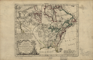
Canada and Louisiana
$
17.95
–
$
47.95
Canada and Louisiane
$
17.95
–
$
47.95
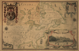
Canada and the north part of Louisiana with the adjacent countrys
$
17.95
–
$
47.95
Canada and the north part of Louisiana with the adjacent countrys
$
17.95
–
$
47.95
Canada et Louisiane, par le Sr. le Rouge ingénieur géographe du Roy.
$
17.95
–
$
47.95
Canada et Louisiane, par le Sr. le Rouge ingénieur géographe du Roy.
$
17.95
–
$
47.95
Canada IIe. feuille, XXXV, B 32
$
17.95
–
$
47.95
Canal Dover, Tuscarawas County, Ohio 1899. Drawn by A. E. Downs.
$
17.95
–
$
47.95
Carta que contiene parte de la costa de la California.
$
17.95
–
$
47.95
Carte de l'Amerique Septentrionnale
$
17.95
–
$
47.95
Carte de l'entrée de la rivière d'Hudson, dépuis Sandy-Hook jusques à New-York avec les bancs, sondes, marques de navigation
$
17.95
–
$
47.95
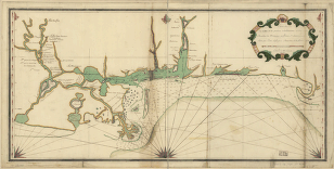
Carte de la coste de la province de la Louisiane et des bouches du Micissipy ou fleuve St. Louis, faite par Jean Lefargue, Bayonne, le 20 fevrier, 1768.
$
17.95
–
$
47.95
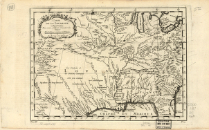
Carte de la Louisiane et des pays voisins dédiée à M. Rouillé sécretaire d'État, ayant le Département de la marine
$
17.95
–
$
47.95
Carte de la Louisiane et pays voisins, pour servir a l'Histoire générale des voyages
$
17.95
–
$
47.95
Carte des bayes, rades et port de Plaisance dans l'Isle de Terre-Neuve
$
17.95
–
$
47.95
Carte des possessions françoises et angloises dans le Canada, et partie de la Louisiane
$
17.95
–
$
47.95
Carte des possessions françoises et angloises dans le Canada, et partie de la Louisiane, 1756
$
17.95
–
$
47.95
Carte du Canada et de la Louisiane qui forment la Nouvelle France et des colonies angloises ou sont representez les pays contestez.
$
17.95
–
$
47.95
Carte du Canada et des Etats-Unis de l'Amérique Septentrionale
$
17.95
–
$
47.95
Carte du theatre de la guerre presente en Amerique, dressée d'après les nouvelles cartes anglaises par L. Denis.
$
17.95
–
$
47.95
Catalogue of points of historic interest : [Washington D.C. and metropolitan area]
$
17.95
–
$
47.95
Chapman's rail road map of Ohio, Indiana, Michigan, Illinois, Missouri, Minnesota, & Wisconsin.
$
17.95
–
$
47.95
Charleston Harbor
$
17.95
–
$
47.95
Charleston Harbor
$
17.95
–
$
47.95
Charleston Harbor and city defences
$
17.95
–
$
47.95
Charleston Harbor, S.C.
$
17.95
–
$
47.95
Charleston, South-Carolina
$
17.95
–
$
47.95
Chart showing the entrance of Rear Admiral Farragut into Mobile Bay. 5th of August 1864
$
17.95
–
$
47.95
Chart showing the entrance of Rear Admiral Farragut into Mobile Bay. 5th of August 1864
$
17.95
–
$
47.95
Chart showing the locality where seals were taken adjacent to the Commander Islands in 1892
$
17.95
–
$
47.95
Chattanooga and surrounding battlefields [By Reginald] Purse.
$
17.95
–
$
47.95
Chattanooga battle-fields, November, 1863
$
17.95
–
$
47.95
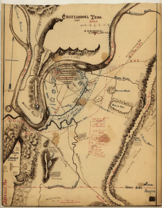
Chattanooga Tenn. 1863 / G.H. Blakeslee, U.S. Top. Eng.
$
17.95
–
$
47.95
Chattanooga, county seat of Hamilton County, Tennessee 1886. H. Wellge, del. Beck & Pauli, litho.
$
17.95
–
$
47.95
Chattanooga, Tenn. as seen from Bragg Hill, Missionary Ridge
$
17.95
–
$
47.95
Chickamauga and Chattanooga National Military Park, Ga. (Chickamauga Battlefield).
$
17.95
–
$
47.95
Chickamauga battle-field
$
17.95
–
$
47.95
Chickamauga battlefield
$
17.95
–
$
47.95
Chickamauga battlefield
$
17.95
–
$
47.95
Chickamauga battlefield. Accompanies The battle of Chickamauga
$
17.95
–
$
47.95
Childress, Texas 1890
$
17.95
–
$
47.95
Chorographical map Northern Department of North-America
$
17.95
–
$
47.95
City of Hoboken, New Jersey 1904.
$
17.95
–
$
47.95
City of New Brunswick, New Jersey / Packard & Butler Lith. Philada.
$
17.95
–
$
47.95
City of New York
$
17.95
–
$
47.95
City of Newark, N.J. / Parsons & Atwater, del
$
17.95
–
$
47.95
1
2
3
4
5
6
7
8
9
…
18
19
20
Load More
All products loaded.
Search Product or SKU
×
Home
All Products
Historic Maps
American Indian Maps
Birds Eye View Maps
Civil War Maps
Panoramic Maps
Railroad Maps
Revolutionary War Maps
State Maps
Historic Prints
Civil War Prints
Civil War Posters
Historic Portraits
Presidential Portraits
Contact Us
Cart
0
Cart
Close
Updating…
No products in the cart.
Continue shopping