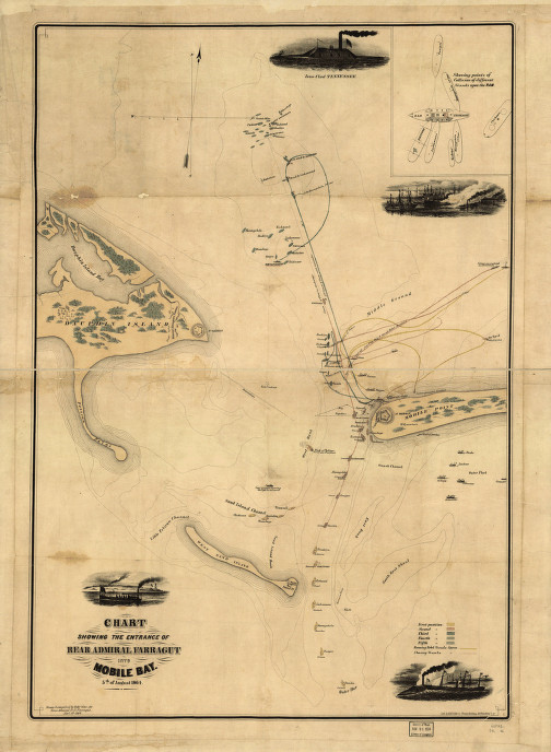
Drawn & compiled by Robt. Weir, for Rear Admiral D. G. Farragut, Novr. 1st 1864. Weir, Robert, 1836-1905. CREATED/PUBLISHED N.Y. Lith. by Hatch & Co. 1864 NOTES Scale ca. 1:22,500. Detailed map showing five positions and the tracks of the vessels during the sea battle, obstructions, channels, banks, and shoals. Includes small views of the 'Iron-clad Tennessee,' Federal ship colliding with the Ram Tennessee, a vessel sailing past what appears to be Mobile Point, and a general view of the battle. Inset: [Diagram] showing points of collision of different vessels upon the Ram [Tennessee].


