Home
All Products
Historic Maps
American Indian Maps
Birds Eye View Maps
Civil War Maps
Panoramic Maps
Railroad Maps
Revolutionary War Maps
State Maps
Historic Prints
Civil War Prints
Civil War Posters
Historic Portraits
Presidential Portraits
Contact Us
0
0
press
Enter
to search
Showing all results:
No products found.
State Maps
Search
Search Product or SKU
×
Sort By
Default
Price: Low to High
Price: High to Low
Alphabetical
SKU
Categories
All
American Indian Maps
American Indian Photos
Birds Eye View Maps
CD Collections
Civil War Maps
Civil War Posters
Civil War Prints
Panoramic Maps
Photo-chromes
Presidential Portraits
Railroad Maps
Revolutionary War Maps
St. Augustine
State Maps
Alabama
California
Canada
Georgia
Louisiana
Michigan
New Hampshire
New Jersey
New York
New York City
North Carolina
Ohio
South Carolina
Tennessee
Texas
Washington DC
Showing
“State Maps”
View of Los Angeles from the east
$
17.95
–
$
47.95
View of San Francisco, formerly Yerba Buena, in 1846-7 before the discovery of gold.
$
17.95
–
$
47.95
View of San Gabriel, Cal.
$
17.95
–
$
47.95
View of the borough of Larchmont, New York.
$
17.95
–
$
47.95
View of the city of Albany, Ga.
$
17.95
–
$
47.95
View of the city of Stockton, the Manufacturing City of California
$
17.95
–
$
47.95
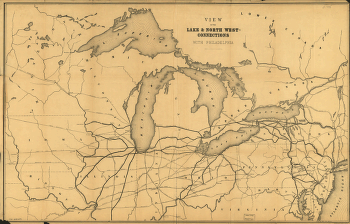
View of the lake & north west-connections with Philadelphia.
$
17.95
–
$
47.95
View of the Panamint Range Mountains, mines, mills and town site
$
17.95
–
$
47.95
View of Victoria, Vancouver Island
$
17.95
–
$
47.95
View of Washington
$
17.95
–
$
47.95
View of Washington City
$
17.95
–
$
47.95
Virginia and Maryland
$
17.95
–
$
47.95
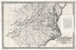
Virginia and West Va., North & part of South Carolina, Maryland & Delaware
$
17.95
–
$
47.95
Vue de San-Francisco Vista de San-Francisco
$
17.95
–
$
47.95
Waco, Texas 1892
$
17.95
–
$
47.95
Waco, Texas, county seat of McLennan Cy. 1886
$
17.95
–
$
47.95
Washington, D.C., and environs
$
17.95
–
$
47.95
Washington, the beautiful capital of the nation
$
17.95
–
$
47.95
Washington, the Mall and vicinity
$
17.95
–
$
47.95
Watson's new rail-road and distance map of the United States and Canada, 1871
$
17.95
–
$
47.95
Waverly, N.Y. 1881. Thomas Hunter Lith.
$
17.95
–
$
47.95
West Lebanon, N.H., and White River Junction, Vermont. Drawn & published by Geo. E. Norris. Burleigh Lith. Est.
$
17.95
–
$
47.95
West Point.
$
17.95
–
$
47.95
Western border states
$
17.95
–
$
47.95
Western Tennessee, and part of Kentucky
$
17.95
–
$
47.95
Wildwood Lake Park, Riverhead, Township of Southhampton, Suffolk County, N.Y.
$
17.95
–
$
47.95
Williams' commercial map of the United States and Canada with railroads, routes and distances
$
17.95
–
$
47.95
Winchester, N.H., Cheshire County, 1887 / drawn & published by Geo. E. Norris.
$
17.95
–
$
47.95
Winnipeg
$
17.95
–
$
47.95
Winter quarters 1864 : [vicinity of Lookout Mountain, Tennessee] / profile by G.H. Blakeslee T.E., March 10-1864.
$
17.95
–
$
47.95
Within sight of the White House : section of Washington, D.C.
$
17.95
–
$
47.95
Wolfe City, Texas 1891.
$
17.95
–
$
47.95
Wolfeborough, N.H., Lake Winnipesaukee. Drawn & published by Geo. E. Norris. Burleigh Lith. Est.
$
17.95
–
$
47.95
Woodsfield, Monroe County, Ohio, 1899
$
17.95
–
$
47.95
World's Fair, St Louis, 1904
$
17.95
–
$
47.95
Wyandotte, Michigan 1896. Drawn by T. M. Fowler.
$
17.95
–
$
47.95
Ypsilanti, Washtenaw Co., Michigan. Drawn & published by A. Ruger.
$
17.95
–
$
47.95
1
2
3
…
17
18
19
20
Load More
All products loaded.
Search Product or SKU
×
Home
All Products
Historic Maps
American Indian Maps
Birds Eye View Maps
Civil War Maps
Panoramic Maps
Railroad Maps
Revolutionary War Maps
State Maps
Historic Prints
Civil War Prints
Civil War Posters
Historic Portraits
Presidential Portraits
Contact Us
Cart
0
Cart
Close
Updating…
No products in the cart.
Continue shopping