New Jersey
-

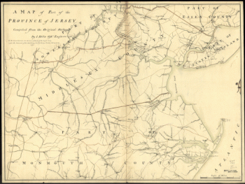
A map of part of the province of Jersey. Compiled from the original surveys by I. Hills, asst. engineer, 1781.
Price range: $39.95 through $69.95 -
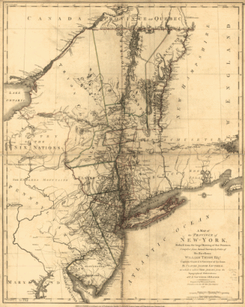
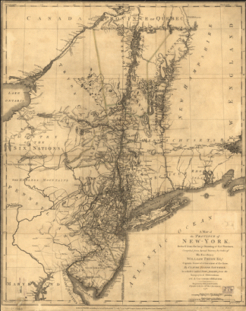
A map of the Province of New-York
Price range: $39.95 through $69.95 -
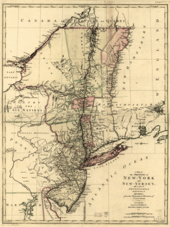
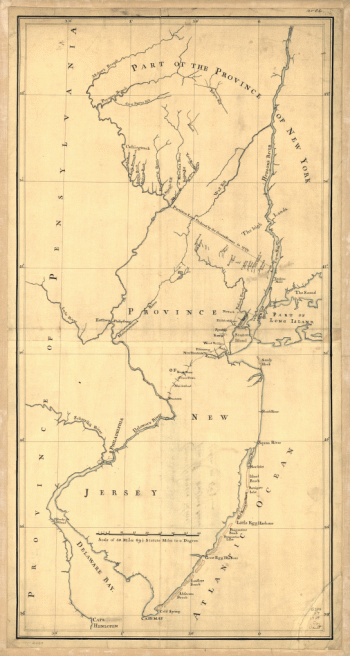
A map of the provinces of New-York and New-Yersey
Price range: $39.95 through $69.95 -
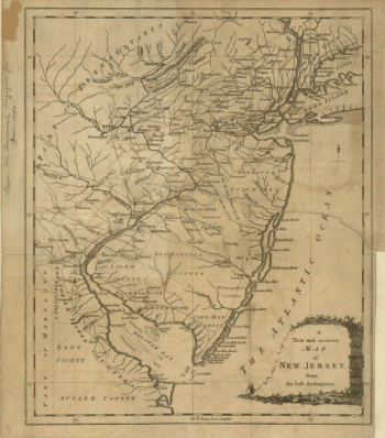
A new and accurate map of New Jersey, from the best authorities
Price range: $39.95 through $69.95 -
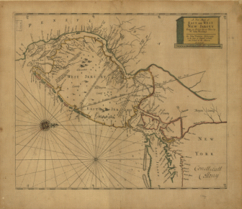
A new map of East and West New Jersey
Price range: $39.95 through $69.95 -
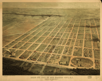
Aero view of Egg Harbor City, New Jersey.
Price range: $39.95 through $69.95 -
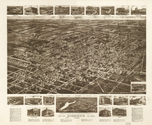
Aero view of Hammonton, New Jersey 1926.
Price range: $39.95 through $69.95 -
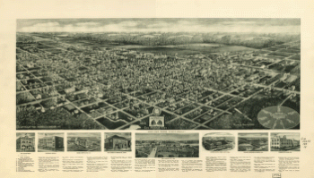
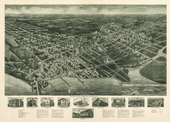
Aero-view of Absecon, New Jersey 1924.
Price range: $39.95 through $69.95 -
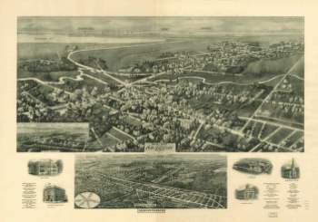
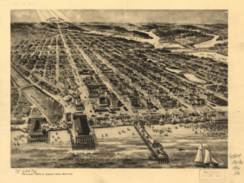
Aero-view of Somers-Point 1925, New Jersey. Drawn by R. Cinquin.
Price range: $39.95 through $69.95 -
Aeroplane view of Asbury Park, N.J. showing location of 'Asbury Park Estates' among the hills on Asbury Ave
Price range: $39.95 through $69.95 -
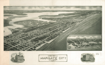
Aeroview of Margate City, New Jersey 1925.
Price range: $39.95 through $69.95 -
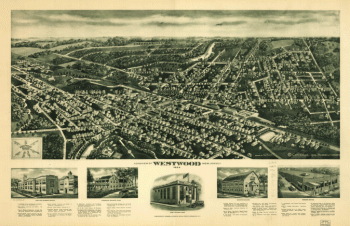
Aeroview of Westwood, New Jersey 1924.
Price range: $39.95 through $69.95 -
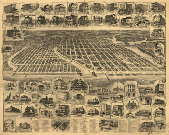
Asbury Park, Ocean Grove and vicinity, New Jersey 1897.
Price range: $39.95 through $69.95 -
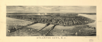
Atlantic City, N.J.
Price range: $39.95 through $69.95 -
Atlantic Highlands, New Jersey 1894.
Price range: $39.95 through $69.95 -
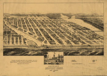
Bird's eye view of Asbury Park, New Jersey, 1881.
Price range: $39.95 through $69.95 -
Birds eye view of Egg Harbor City, N.J. Herline & Hensel, lith.
Price range: $39.95 through $69.95 -
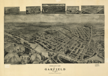
Birds eye view of Garfield, New Jersey 1909. Drawn and published by T. M. Fowler.
Price range: $39.95 through $69.95 -
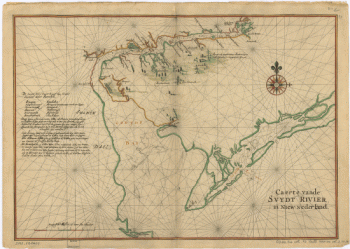
Caert vande Svydt Rivier in Niew Nederland.
Price range: $39.95 through $69.95 -
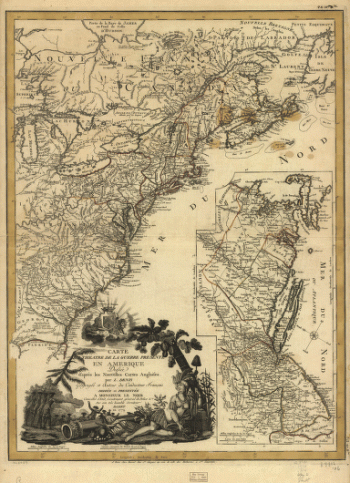
Carte du theatre de la guerre presente en Amerique, dressée d'après les nouvelles cartes anglaises par L. Denis.
Price range: $39.95 through $69.95 -
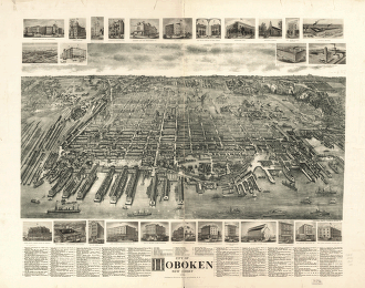
City of Hoboken, New Jersey 1904.
Price range: $39.95 through $69.95 -
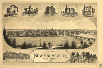
City of New Brunswick, New Jersey / Packard & Butler Lith. Philada.
Price range: $39.95 through $69.95 -
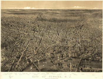
City of Newark, N.J. / Parsons & Atwater, del
Price range: $39.95 through $69.95 -
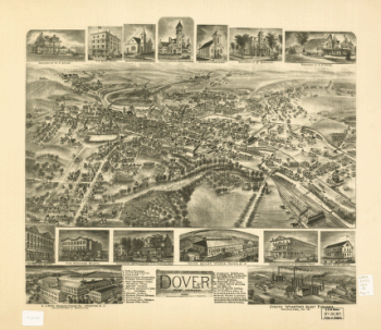
Dover, New Jersey 1903.
Price range: $39.95 through $69.95 -
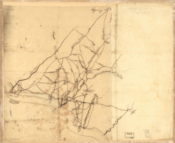
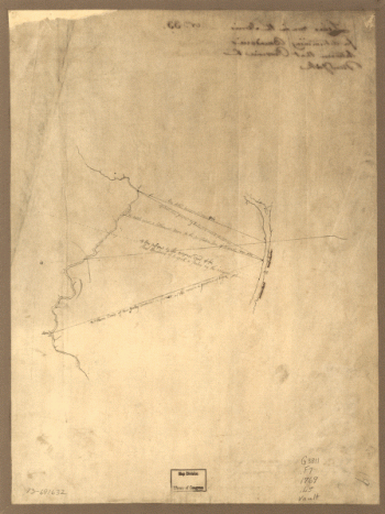
Draft of roads in New Jersey.
Price range: $39.95 through $69.95 -
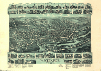
Hackensack, New Jersey / O.H. Bailey & Co., lith. & pub.
Price range: $39.95 through $69.95 -
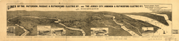
Lines of the Paterson, Passaic, & Rutherford Electric Railway
Price range: $39.95 through $69.95 -
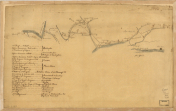
Lines run in the Jersies for determining boundaries between that Province & New York.
Price range: $39.95 through $69.95 -
Map of British outposts between Burlington and New Bridge, New Jersey, December 1776.
Price range: $39.95 through $69.95 -
Map of the coast of New Jersey from Barnegat Inlet to Cape May.
Price range: $39.95 through $69.95 -
Map of the environs of Camden, N.J.
Price range: $39.95 through $69.95 -
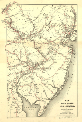
Map of the rail roads of New Jersey, and parts of adjoining states.
Price range: $39.95 through $69.95 -
New York & New Jersey commissioners line from 41 on Hudson's River taken in 1769.
Price range: $39.95 through $69.95 -
New York reduced from the large drawing of that Province
Price range: $39.95 through $69.95 -
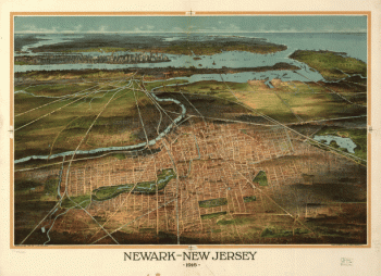
Newark-New Jersey 1916.
Price range: $39.95 through $69.95 -
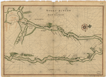
Noort Rivier in Niew Neerlandt.
Price range: $39.95 through $69.95 -
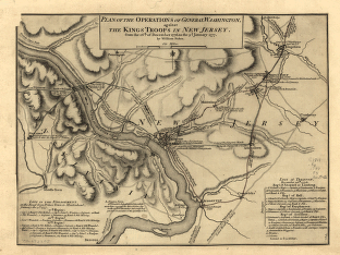
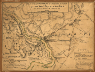
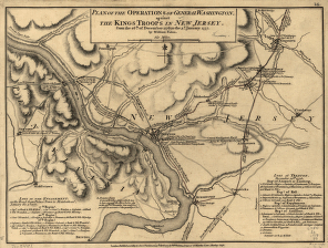
Operations of General Washington, against the Kings troops in New Jersey, from the 26th, of December, 1776, to the 3d. January 1777
Price range: $39.95 through $69.95 -
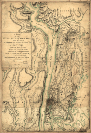
Operations of the King's army under the command of General Sir William Howe, K.B. in New York and east New Jersey
Price range: $39.95 through $69.95 -
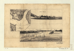
Plan d'Amboy. Vues de la rade de Charles-Town et de Fort Sulivan, mai 1780.
Price range: $39.95 through $69.95 -
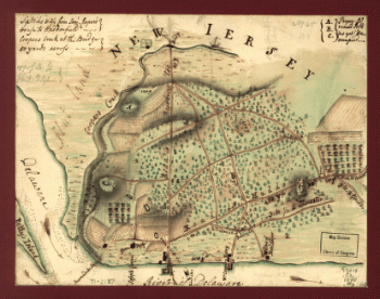
Plan de notre camp à New Brunswick
Price range: $39.95 through $69.95 -
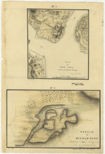
Plan of Perth Amboy from an actual survey. Sketch of Bonham Town
Price range: $39.95 through $69.95 -
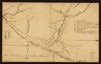
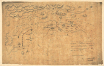
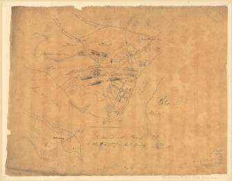
Plan of Princeton, Dec. 31, 1776.
Price range: $39.95 through $69.95 -
Plano de la Bahia de la Ware y entrada de Filadelfie
Price range: $39.95 through $69.95 -
Position de notre camp le 24 juin 1777 à Perth Amboy
Price range: $39.95 through $69.95 -
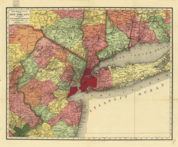
Rand, McNally & Co.'s map of New York city and vicinity showing steam railroads and electric lines.
Price range: $39.95 through $69.95 -
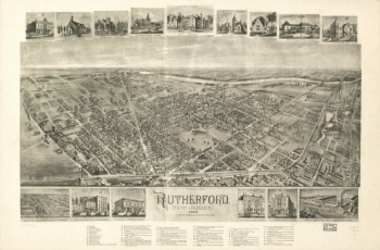
Rutherford, New Jersey 1904.
Price range: $39.95 through $69.95