Home
All Products
Historic Maps
American Indian Maps
Birds Eye View Maps
Civil War Maps
Panoramic Maps
Railroad Maps
Revolutionary War Maps
State Maps
Historic Prints
Civil War Prints
Civil War Posters
Historic Portraits
Presidential Portraits
Contact Us
0
0
press
Enter
to search
Showing all results:
No products found.
State Maps
Search
Search Product or SKU
×
Sort By
Default
Price: Low to High
Price: High to Low
Alphabetical
SKU
Categories
All
American Indian Maps
American Indian Photos
Birds Eye View Maps
CD Collections
Civil War Maps
Civil War Posters
Civil War Prints
Panoramic Maps
Photo-chromes
Presidential Portraits
Railroad Maps
Revolutionary War Maps
St. Augustine
State Maps
Alabama
California
Canada
Georgia
Louisiana
Michigan
New Hampshire
New Jersey
New York
New York City
North Carolina
Ohio
South Carolina
Tennessee
Texas
Washington DC
Showing
“State Maps”
Ashtabula Harbor, Ohio 1896.
$
17.95
–
$
47.95
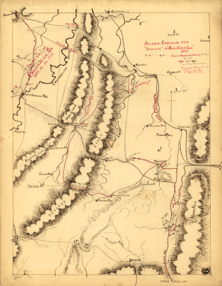
Atlanta campaign-1864. 'Rossville' to 'Snake Creek Gap.'
$
17.95
–
$
47.95
Atlanta.
$
17.95
–
$
47.95
Atlantic City, N.J.
$
17.95
–
$
47.95
Atlantic Highlands, New Jersey 1894.
$
17.95
–
$
47.95
Attack of Fort Sulivan, the key of Charlestown, in South Carolina, on the 28th. of June 1776
$
17.95
–
$
47.95
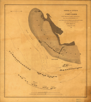
Attack on Fort Fisher
$
17.95
–
$
47.95
Attaque de l'armée des provinciaux dans Long Island du 27. aoust 1776; dessin de l'isle de New-York et des Etats
$
17.95
–
$
47.95
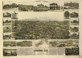
Auburn, Cal.
$
17.95
–
$
47.95
B.H. Warner & Co.'s Map
$
17.95
–
$
47.95
Bakersfield, Kern County, California, 1901. Photo-lith. Britton & Rey.
$
17.95
–
$
47.95
Barnesville, Ohio 1899
$
17.95
–
$
47.95
Battle field of Chickamauga, Georgia
$
17.95
–
$
47.95
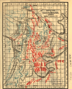
Battle map of Chickamauga, Georgia. Saturday 19 and Sunday, 20 September 1863.
$
17.95
–
$
47.95
Battle of Pittsburgh Landing [i.e., Shiloh] Engraved for 'Grant and his campaigns.' [April 6-7, 1862]
$
17.95
–
$
47.95
Battle of–'Chickamauga'–Sep. 19th & 20th 1863 / under Col. W.E. Merrill.
$
17.95
–
$
47.95
Battlefield in front of Franklin, Ten. November 30th, 1864
$
17.95
–
$
47.95
Battlefield in front of Franklin, Ten. November 30th, 1864
$
17.95
–
$
47.95
Battlefields of Chattanooga, movement against Orchard Knob
$
17.95
–
$
47.95
Bay Side Park, 3d ward, borough of Queens, New York City.
$
17.95
–
$
47.95
Bay Side Park, 3d ward, borough of Queens, New York City.
$
17.95
–
$
47.95
Baye et port d'Yorc, capitale de la Nouvelle Yorc.
$
17.95
–
$
47.95
Beaufort Harbor and coast line between Charleston, S.C. and Savanna Ga.
$
17.95
–
$
47.95
Beaufort Harbor and coast line between Charleston, S.C. and Savanna Ga., with 5 mile distance lines in circles round Beaufort, and R.R. connections, roads
$
17.95
–
$
47.95
Bellevue, Ohio, Sandusky & Huron counties 1888. Burleigh Lith. Est.
$
17.95
–
$
47.95
Berkeley.
$
17.95
–
$
47.95
Bird's eye view Coney Island.
$
17.95
–
$
47.95
Bird's eye view of Anniston, Ala. 1888
$
17.95
–
$
47.95
Bird's eye view of Asbury Park, New Jersey, 1881.
$
17.95
–
$
47.95
Bird's eye view of Bay City, Portsmouth, Wenona & Salzburg, Bay Co., Michigan 1867. Drawn by A. Ruger.
$
17.95
–
$
47.95
Bird's eye view of Bellaire, Ohio 1882. H. Wellge, del. Beck & Pauli, lithographers.
$
17.95
–
$
47.95
Bird's eye view of Bessemer, Mich., Ontonagon County 1886. Beck & Pauli, litho.
$
17.95
–
$
47.95
Bird's eye view of Bethlehem, Graftson County, N.H. 1883. A. F. Poole, del. Beck & Pauli, lithographers.
$
17.95
–
$
47.95
Bird's eye view of Brantford, province Ontario, Canada 1875
$
17.95
–
$
47.95
Bird's eye view of Camp Chase near Columbus, Ohio. Drawn by A. Ruger.
$
17.95
–
$
47.95
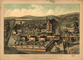
Bird's eye view of Confederate prison pen at Salisbury, N.C., taken in 1864.
$
17.95
–
$
47.95
Bird's eye view of Coronado Beach, San Diego Bay and city of San Diego, Cal. in distance
$
17.95
–
$
47.95
Bird's eye view of Dover, Strafford Co., New Hampshire 1877. A. Ruger del.
$
17.95
–
$
47.95
Bird's eye view of Fitzgerald, Georgia 1908.
$
17.95
–
$
47.95
Bird's eye view of Great Falls, Strafford Co., New Hampshire & Berwick, York Co., Maine 1877. A. Ruger del. C.H. Vogt & Co. Lith.
$
17.95
–
$
47.95
Bird's eye view of Healdsburg, Cal. Drawn by E. S. Glover. A.L. Bancroft & Co., lith.
$
17.95
–
$
47.95
Bird's eye view of Kalamazoo, Mich. 1883. Drawn by H. Wellge & A. F. Poole. Beck & Pauli, lithographers.
$
17.95
–
$
47.95
Bird's eye view of Laconia, Belknap County, N.H. 1883. Beck & Pauli, lithographers.
$
17.95
–
$
47.95
Bird's eye view of Lake Village, Belknap County, N.H. 1883. Beck & Pauli, lithographers.
$
17.95
–
$
47.95
Bird's eye view of Littleton, Grafton County, N.H. 1883. [Drawn by] A. Poole. Beck & Pauli, lithographers.
$
17.95
–
$
47.95
Bird's eye view of Macon, Ga.
$
17.95
–
$
47.95
Bird's eye view of Massillon, Stark County, Ohio 1870. Lithographed by Merchants Lith. Co.
$
17.95
–
$
47.95
Bird's eye view of New-York & Brooklyn drawn from nature & on stone by J. Bachman[n].
$
17.95
–
$
47.95
1
2
3
4
5
6
…
18
19
20
Load More
All products loaded.
Search Product or SKU
×
Home
All Products
Historic Maps
American Indian Maps
Birds Eye View Maps
Civil War Maps
Panoramic Maps
Railroad Maps
Revolutionary War Maps
State Maps
Historic Prints
Civil War Prints
Civil War Posters
Historic Portraits
Presidential Portraits
Contact Us
Cart
0
Cart
Close
Updating…
No products in the cart.
Continue shopping