-

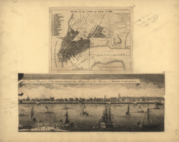
Plan of the city of New York , An exact prospect of Charlestown : the metropolis of the province of South Carolina
Price range: $39.95 through $69.95 -
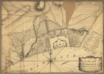
A plan of Pensacola and its environs in its present state, from an actual survey in 1778
Price range: $39.95 through $69.95 -
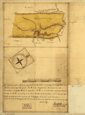
Map of the county of Frederick, 1769 Drawn by J Moffett
Price range: $39.95 through $69.95 -
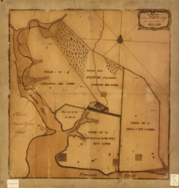
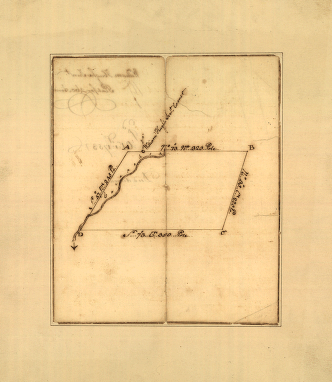
A plan of my farm on Little Huntg Creek & Potomk R G W
Price range: $39.95 through $69.95 -
Plat of a survey for William Hughes, Jr of 460 acres in Frederick County, Va on the Cacapon River
Price range: $39.95 through $69.95 -
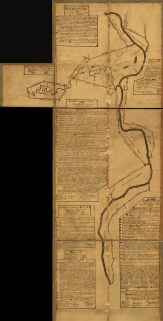
Eight survey tracts along the Kanawha River, WVa showing land granted to George Washington and others
Price range: $39.95 through $69.95 -
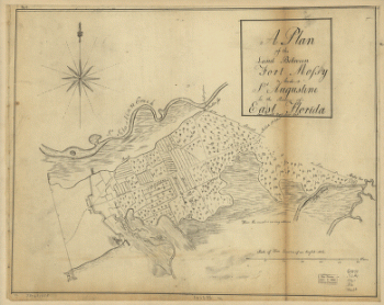
A plan of the land between Fort Mossy and St Augustine in the province of East Florida Sam Roworth, dept survr genl
Price range: $39.95 through $69.95 -
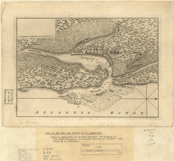
Plan of the town and harbour of St Augustine
Price range: $39.95 through $69.95 -
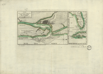
Plano de la ciudad y puerto de San Agustin de la Florida
Price range: $39.95 through $69.95 -
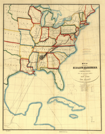
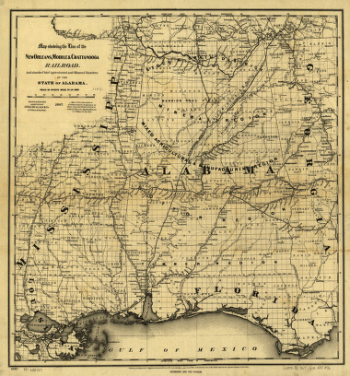
N.E. & S.W. Alabama Railroad
Price range: $39.95 through $69.95 -
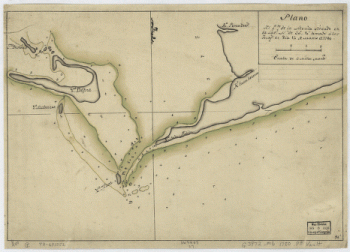
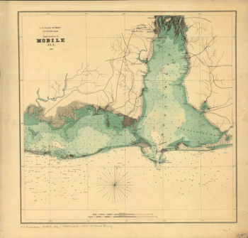
Plano del Pto. de la Movila situado en la latd. N. de 300 10' tomado á los Ings., el día 14 de marzo de 1780.
Price range: $39.95 through $69.95 -
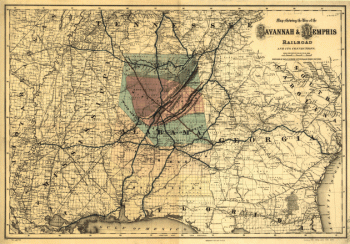
Map showing the line of the Savannah & Memphis Railroad and its connections.
Price range: $39.95 through $69.95 -
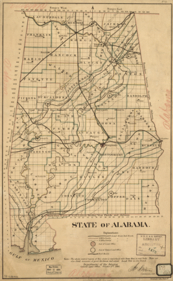
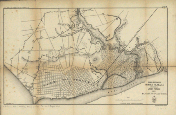
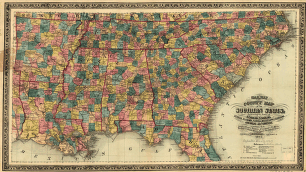
State of Alabama. October. 2nd. 1866.
Price range: $39.95 through $69.95 -
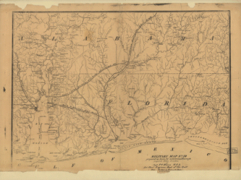
Military map no. 54, prepared as basis for additional surveys
Price range: $39.95 through $69.95 -
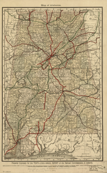
Alabama
Price range: $39.95 through $69.95 -
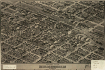
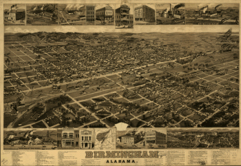
Birmingham, Alabama. H. Wellge, del. Beck & Pauli, litho.
Price range: $39.95 through $69.95 -
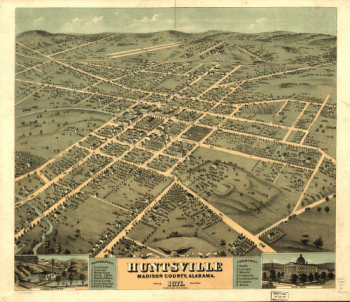
Bird's eye view of the city of Huntsville, Madison County, Alabama 1871.
Price range: $39.95 through $69.95 -
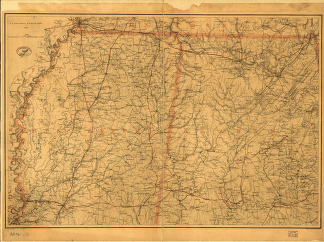
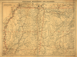
Northern Mississippi and Alabama
Price range: $39.95 through $69.95 -
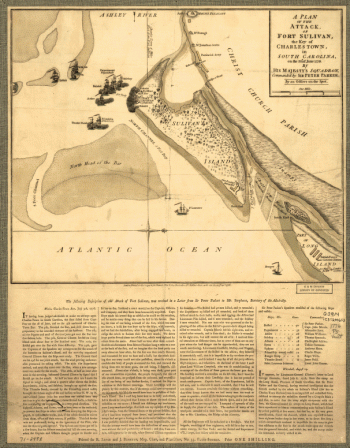
Plan of the battle of August 5, 1864. [Mobile Bay]
Price range: $39.95 through $69.95 -
Rebel defences, Mobile, Alabama, occupied by Union forces under Maj. Gen. E.R.S. Canby comdg
Price range: $39.95 through $69.95 -
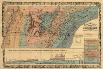
An outline geological map of Tennessee, including portions of Mississippi, Alabama, and Georgia.
Price range: $39.95 through $69.95 -
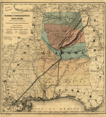
Map showing the line of the Alabama & Tennessee River Rail Road
Price range: $39.95 through $69.95 -
Approaches to Mobile, Ala. 1864.
Price range: $39.95 through $69.95 -
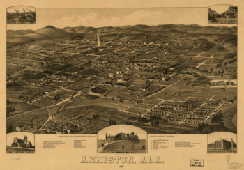
Anniston, Ala. 1887. Beck & Pauli Lith. Co.
Price range: $39.95 through $69.95 -
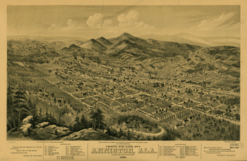
Bird's eye view of Anniston, Ala. 1888
Price range: $39.95 through $69.95 -
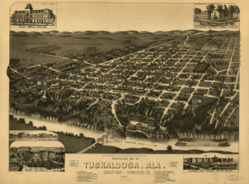
Perspective map of Tuskaloosa, Ala.
Price range: $39.95 through $69.95 -
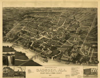
Perspective map of the city of Gadsden, Ala
Price range: $39.95 through $69.95 -
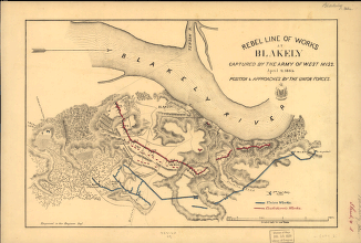
Rebel line of works at Blakely captured by the Army of West Miss., April 9, 1865
Price range: $39.95 through $69.95 -
Map showing the line of the New Orleans, Mobile & Chattanooga Railroad
Price range: $39.95 through $69.95 -
Railway and county map of the Southern States
Price range: $39.95 through $69.95 -
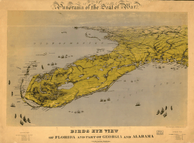
Birds eye view of Florida and part of Georgia and Alabama
Price range: $39.95 through $69.95 -
Map of the defences of the city of Mobile. [1862-64] Engraved in the Engineer Bureau, War Dept.
Price range: $39.95 through $69.95 -
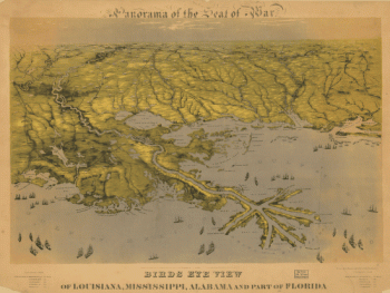
Birds eye view of Louisiana, Mississippi, Alabama and part of Florida
Price range: $39.95 through $69.95 -
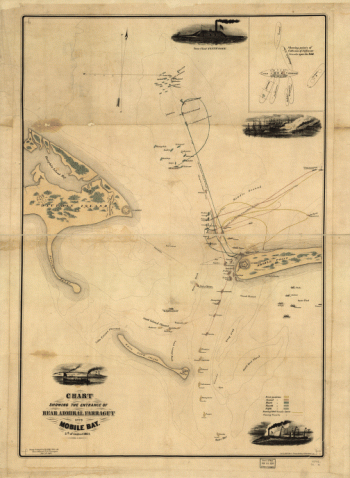
Chart showing the entrance of Rear Admiral Farragut into Mobile Bay. 5th of August 1864
Price range: $39.95 through $69.95 -
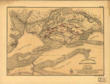
Siege operations at Spanish Fort, Mobile Bay, by the U.S. forces under Maj. Gen. Canby
Price range: $39.95 through $69.95 -
Business section of the city of Birmingham, Alabama.
Price range: $39.95 through $69.95 -
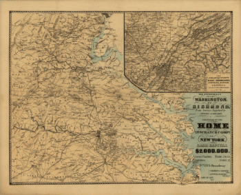
The approaches from Washington, to Richmond
Price range: $39.95 through $69.95 -
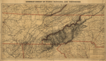
Mountain region of North Carolina and Tennessee
Price range: $39.95 through $69.95 -
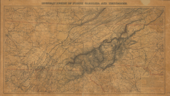
Mountain region of North Carolina and Tennessee
Price range: $39.95 through $69.95 -
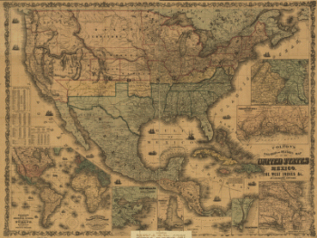
Colton's rail-road and military map of the United States, Mexico, the West Indies, &c.
Price range: $39.95 through $69.95 -
hern Mississippi and Alabama Drawn by A. Lindenkohl. H. Lindenkohl & Chas. G. Krebs, lith.
Price range: $39.95 through $69.95 -
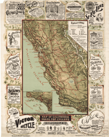
Map of California roads for cyclers.
Price range: $39.95 through $69.95 -
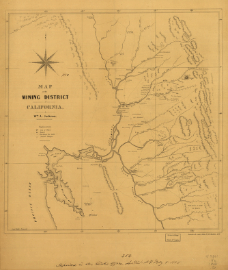
Map of the mining district of California.
Price range: $39.95 through $69.95 -
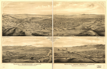
Birds eye view of Los Angeles, California. A.L. Bancroft & Co., lith.
Price range: $39.95 through $69.95 -
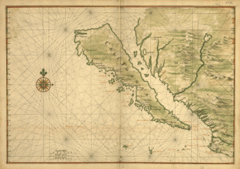
Map of California shown as an island
Price range: $39.95 through $69.95
![Plan of the battle of August 5, 1864. [Mobile Bay]](https://www.ushistoricalarchive.com/wp-content/uploads/nc/data/products/im/sm/al/b25-350x264.gif)
![Map of the defences of the city of Mobile. [1862-64] Engraved in the Engineer Bureau, War Dept.](https://www.ushistoricalarchive.com/wp-content/uploads/nc/data/products/im/sm/al/b43.gif)