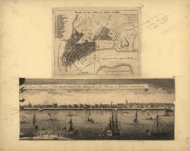
CREATED/PUBLISHED [London : s.n., 1762-1776] NOTES New York City map shows streets, wharves, ferries, principal buildings, and built-up area. Charleston view is panorama of waterfront and quays with principal buildings lettered for identification (no index present). Relief shown by hachures on New York City map. New York City map removed from London Magazine, Sept. 1776, Charleston view removed from London Magazine, 1762. New York City map includes index to points of interest.


![[Zehn Karten und Ansichten den Schlachtfelden des amerikanischen Unabhangigkeitskreiges in den Staaten Pennsylvanien und New York]](https://www.ushistoricalarchive.com/wp-content/uploads/nc/data/products/im/rw/south/b45-350x241.gif)
![[Zehn Karten und Ansichten den Schlachtfelden des amerikanischen Unabhangigkeitskreiges in den Staaten Pennsylvanien und New York]](https://www.ushistoricalarchive.com/wp-content/uploads/nc/data/products/im/rw/south/b49-350x246.gif)
