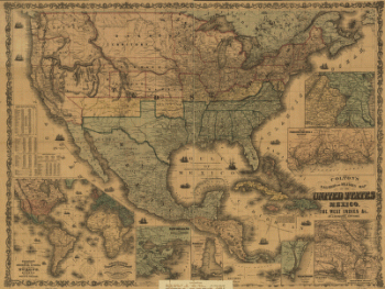
Compiled and engraved at the U.S. Coast Survey Office, from state maps, post office maps, local surveys, etc., with additions from campaign maps and information furnished by Capt. O. M. Poe, Chief Engineer, Military Division of the Mississippi and by Capt. W. E. Merrill, Chief Engineer, Department of the Cumberland. Drawn by A. Lindenkohl. CREATED/PUBLISHED [S.l., H. Lindenkohl & Chas. G. Krebs, lith.], 1864. NOTES Scale 1:633,600. General map indicating cities and towns, roads and railroads, rivers, and some relief by hachures. The map is overprinted in red to show state names and highlight state boundaries and railroads.
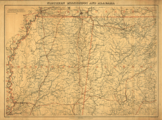
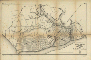
Northern Mississippi and Alabama
$17.95 – $47.95
SKU: smal24
Related products
-

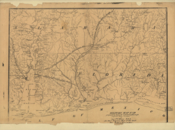
Military map no. 54, prepared as basis for additional surveys
$17.95 – $47.95 -
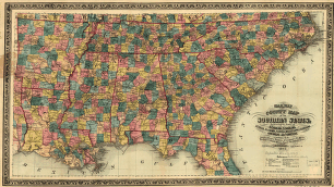
Railway and county map of the Southern States
$17.95 – $47.95