-

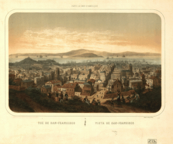
Vue de San-Francisco Vista de San-Francisco
Price range: $39.95 through $69.95 -
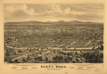
Bird's eye view of Santa Rosa, Sonoma County, Cal., 1876.
Price range: $39.95 through $69.95 -
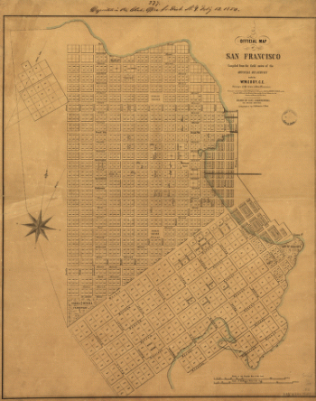
Official map of San Francisco.
Price range: $39.95 through $69.95 -
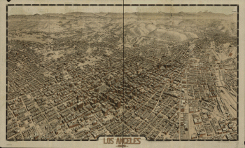
Los Angeles 1909.
Price range: $39.95 through $69.95 -
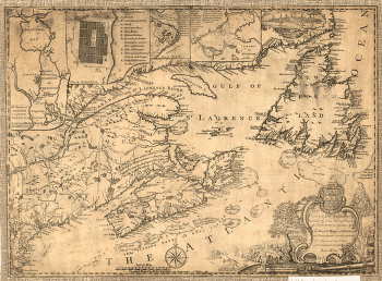
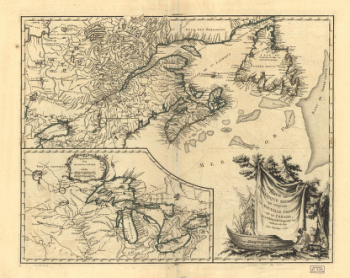
Province of Nova-Scotia and adjacent parts
Price range: $39.95 through $69.95 -
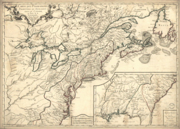
Carte des possessions françoises et angloises dans le Canada, et partie de la Louisiane, 1756
Price range: $39.95 through $69.95 -
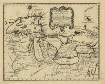
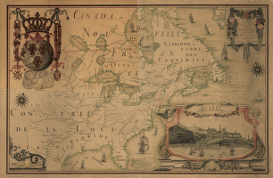
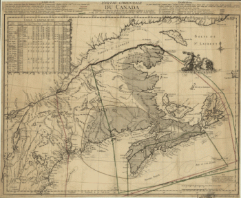
Partie occidentale de la Nouvelle France
Price range: $39.95 through $69.95 -
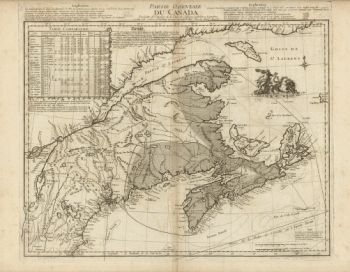
Partie orientale du Canada. Traduitte de l'anglois de la carte de Jefferys publiée à Londres en May 1755
Price range: $39.95 through $69.95 -
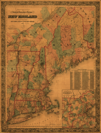
G. Woolworth Colton's railroad, township & distance map of New England with adjacent portions of New York, Canada & New Brunswick
Price range: $39.95 through $69.95 -
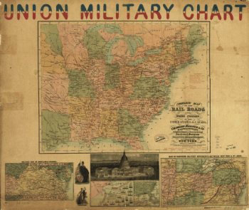
A correct map of the seat of war
Price range: $39.95 through $69.95 -
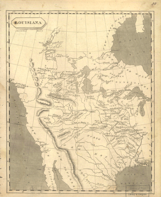
Louisiana
Price range: $39.95 through $69.95 -
Partie de l'Amérique septent? qui comprend la Nouvelle France ou le Canada
Price range: $39.95 through $69.95 -
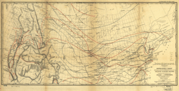
Isothermal chart of the region north of the 36th Parallel between the Atlantic & Pacific oceans
Price range: $39.95 through $69.95 -
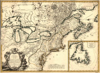
Carte du Canada et des Etats-Unis de l'Amérique Septentrionale
Price range: $39.95 through $69.95 -
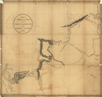
Mackenzie's track from Fort Chipewyan to the Pacific Ocean in 1793
Price range: $39.95 through $69.95 -
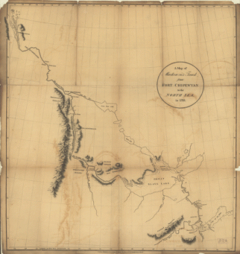
Mackenzie's track from Fort Chipewyan to the north sea in 1789
Price range: $39.95 through $69.95 -
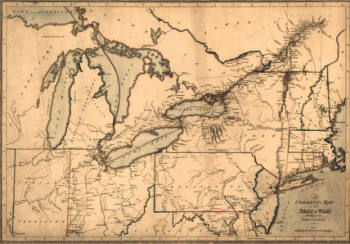
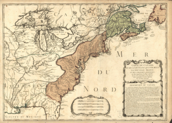
Canada and Louisiana
Price range: $39.95 through $69.95 -
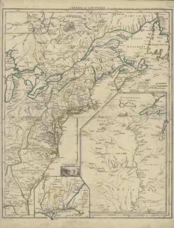
Canada et Louisiane, par le Sr. le Rouge ingénieur géographe du Roy.
Price range: $39.95 through $69.95 -
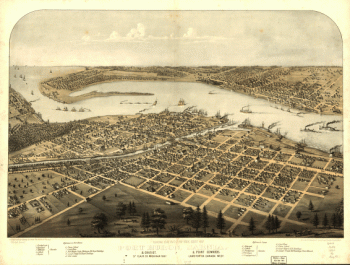
Birds eye view of the city of Port Huron, Sarnia & Gratiot, St. Clair Co., Michigan 1867
Price range: $39.95 through $69.95 -
Winnipeg
Price range: $39.95 through $69.95 -
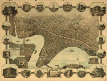
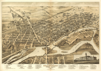
Bird's eye view of Brantford, province Ontario, Canada 1875
Price range: $39.95 through $69.95 -
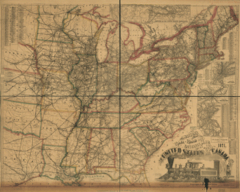
Watson's new rail-road and distance map of the United States and Canada, 1871
Price range: $39.95 through $69.95 -
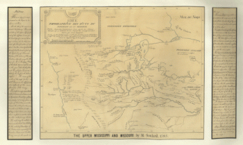
The upper Mississippi and Missouri
Price range: $39.95 through $69.95 -
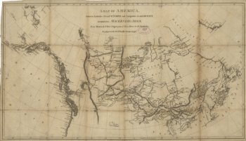
America between latitudes 40 and 70 north and longitudes 45 and 180 west
Price range: $39.95 through $69.95 -
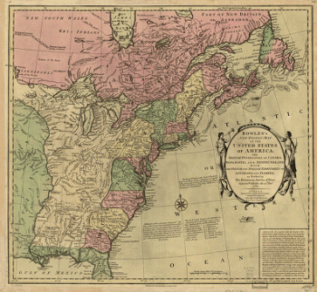
Bowles's new pocket map of the United States of America
Price range: $39.95 through $69.95 -
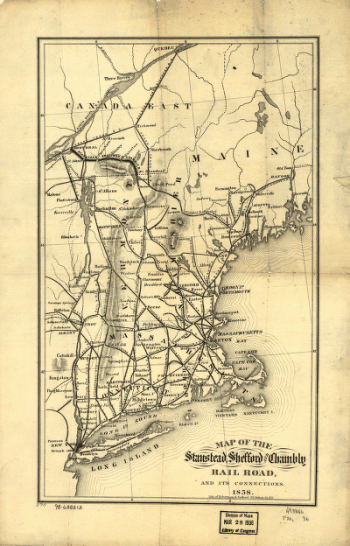
Map of the Stanstead, Shefford, and Chambly Rail Road, and its connections.
Price range: $39.95 through $69.95 -
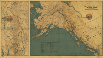
Map of Alaska, Yukon Territory and British Columbia
Price range: $39.95 through $69.95 -
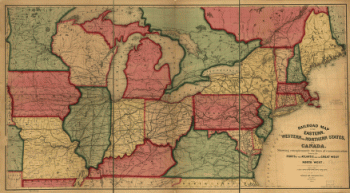
Railroad map of the eastern, western and northern states, and Canada
Price range: $39.95 through $69.95 -
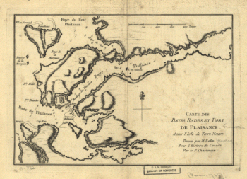
Carte des bayes, rades et port de Plaisance dans l'Isle de Terre-Neuve
Price range: $39.95 through $69.95 -
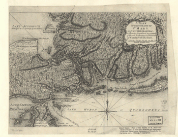
A Plan of the Straits of St. Mary, and Michilimakinac
Price range: $39.95 through $69.95 -
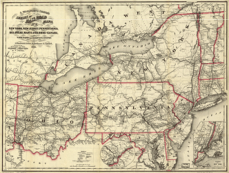
New York, New Jersey, Pennsylvania, Delaware, Maryland, Ohio and Canada, with parts of adjoining states
Price range: $39.95 through $69.95 -
Several routes proposed for the passage of gunboats to the Lakes via: Erie and Oswego Canal
Price range: $39.95 through $69.95 -
Carte de l'Amerique Septentrionnale
Price range: $39.95 through $69.95 -
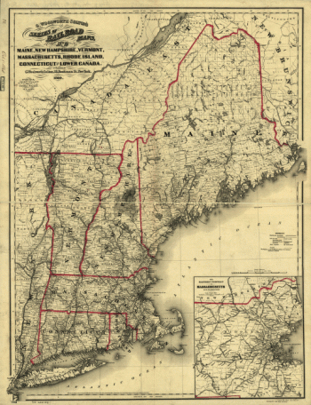
Maine, New Hampshire, Vermont, Massachusetts, Rhode Island, Connecticut and Lower Canada, 1860
Price range: $39.95 through $69.95 -
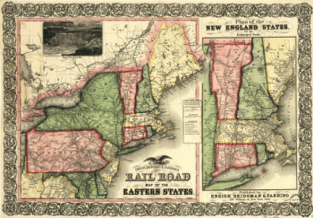
Ensign, Bridgman & Fanning's rail road map of the Eastern States
Price range: $39.95 through $69.95 -
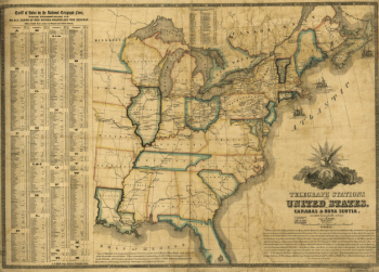
Telegraph stations in the United States, the Canadas & Nova Scotia
Price range: $39.95 through $69.95 -
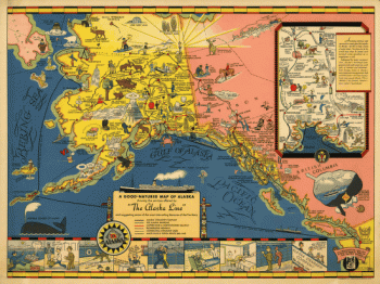
The Alaska Line
Price range: $39.95 through $69.95 -
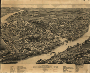
Bird's eye view of Sherbrooke, P.Q.
Price range: $39.95 through $69.95 -
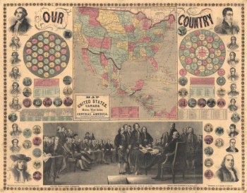
Map of the United States, Canada, Mexico, West Indies and Central America
Price range: $39.95 through $69.95 -
Complete map of the rail roads and water courses, in the United States & Canada
Price range: $39.95 through $69.95 -
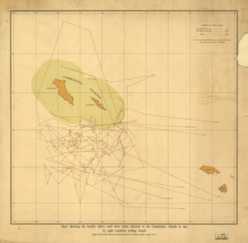
Chart showing the locality where seals were taken adjacent to the Commander Islands in 1892
Price range: $39.95 through $69.95 -
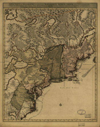
Nova tabula geographica complectens borealiorem Americæ partem
Price range: $39.95 through $69.95 -
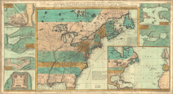
The English empire in North America
Price range: $39.95 through $69.95 -
Partie orientale du Canada, traduitte de l'anglois de la carte de Jefferys publiée a Londres en May 1755
Price range: $39.95 through $69.95 -
View of Victoria, Vancouver Island
Price range: $39.95 through $69.95 -
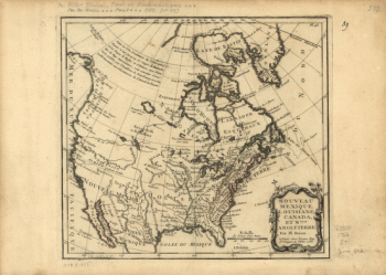
Nouveau Mexique, Louisiane, Canada, et Nlle. Angleterre. Par M. Brion.
Price range: $39.95 through $69.95 -
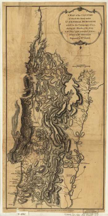
A Map of the Country in which the Army under Lt. Gen. Burgoyne acted in the Campaign of 1777
Price range: $39.95 through $69.95 -
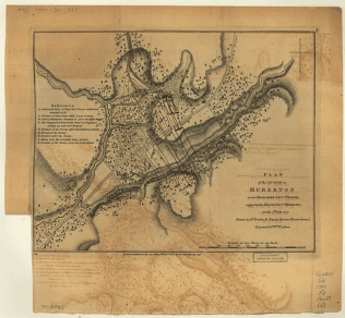
Plan of the action at Huberton under Brig. Gen. Frazer, 7th July 1777
Price range: $39.95 through $69.95