-

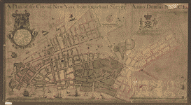
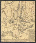
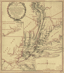
A plan of the city of New York from an actual survey
Price range: $39.95 through $69.95 -
A plan of the city of New-York & its environs to Greenwich
Price range: $39.95 through $69.95 -
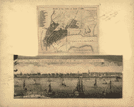
Plan of the city of New York
Price range: $39.95 through $69.95 -
A plan of the city and environs of New York in North America
Price range: $39.95 through $69.95 -
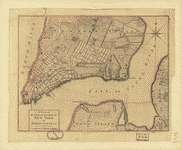
Plan of the city of New York
Price range: $39.95 through $69.95 -
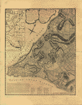
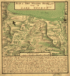
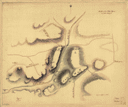
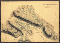
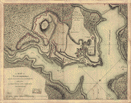
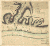
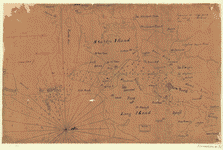
Plan of Fort William Henry and camp at Lake George
Price range: $39.95 through $69.95 -
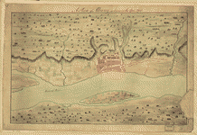
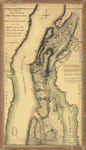
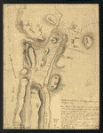
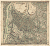
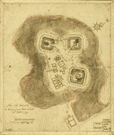
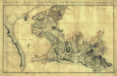
A Plan of Albany, as it was in the year 1758
Price range: $39.95 through $69.95 -
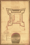
A plan of Fort George at the city of New-York
Price range: $39.95 through $69.95 -
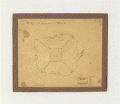
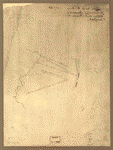
Designs for fortifying Governors Island near New York
Price range: $39.95 through $69.95 -
Design for Governor's Island
Price range: $39.95 through $69.95 -
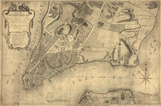
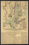
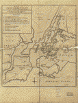
A plan of New York Island, with part of Long Island, Staten Island & east New Jersey
Price range: $39.95 through $69.95 -
A plan of New York Island, with part of Long Island, Staten Island & east New Jersey
Price range: $39.95 through $69.95 -
The seat of action, between the British and American forces
Price range: $39.95 through $69.95 -
Plan of the attack the rebels on Long Island
Price range: $39.95 through $69.95 -
Plan of the attack on the provincial army on Long Island, August 27th 1776
Price range: $39.95 through $69.95 -
Attaque de l'armee des provinciaux dans Long Island du 27 aoust 1776
Price range: $39.95 through $69.95 -
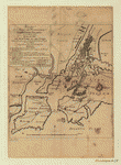
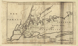
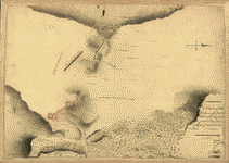
Sketch of the country illustrating the late engagement in Long Island
Price range: $39.95 through $69.95 -
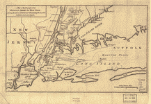
Map of the progress of His Majesty's armies in New York
Price range: $39.95 through $69.95 -
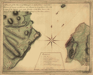
A plan of the Narrows of Hells-gate in the East River
Price range: $39.95 through $69.95 -
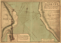
Plan of The Narrows
Price range: $39.95 through $69.95 -
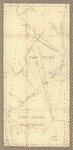
The White Plains
Price range: $39.95 through $69.95 -
A plan of the attack of Fort Washington
Price range: $39.95 through $69.95 -
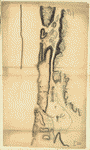
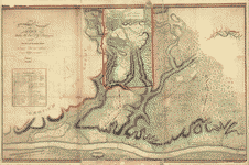
Northern part of New York Island
Price range: $39.95 through $69.95 -
Sketch of the Hessian attack on Fort Washington
Price range: $39.95 through $69.95 -
Sketch of the Heights of Kingsbridge 1777
Price range: $39.95 through $69.95 -
Disposition of British troops, with fortifications north of Fort Knipehausen, ie Fort Washington to Fort Independence
Price range: $39.95 through $69.95 -
New York Island – Military and unfinished
Price range: $39.95 through $69.95 -
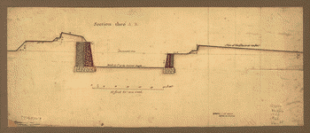
A Plan of the works on Spikendevil Hill with the ground in front
Price range: $39.95 through $69.95 -
A Map of Ticonderoga
Price range: $39.95 through $69.95 -
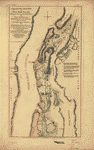
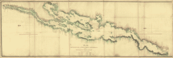
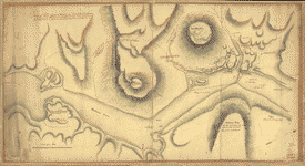
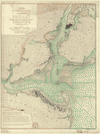
Lake Champlain from Fort St John's to Ticonderoga
Price range: $39.95 through $69.95 -
Position of the detachment under Lieut't Col Baum
Price range: $39.95 through $69.95 -
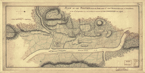
Plan of the position which the army under Lt Genl Burgoyne took at Saratoga
Price range: $39.95 through $69.95 -
Position of the army on the 8th Octbr 1777
Price range: $39.95 through $69.95 -
Plan of the encampment and position of the army under His Excelly Lt General Burgoyne at Braemus Heights
Price range: $39.95 through $69.95 -
The encampment & position of the army under His Excy Lt Gl: Burgoyne at Swords's and Freeman's Farms
Price range: $39.95 through $69.95 -
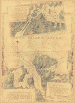
A plan of the Forts Montgomery & Clinton
Price range: $39.95 through $69.95 -
Sketch of Forts Clinton & Montgomery, stormed the 6th Oct 1777
Price range: $39.95 through $69.95 -
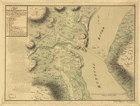
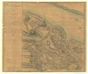
Plan of the redoubts at Richmond on Staten Island, 30th October 1779
Price range: $39.95 through $69.95 -
Nord de l'Ile de New-York
Price range: $39.95 through $69.95 -
Reconnoissance de King's bridge
Price range: $39.95 through $69.95 -
Environs de New-York, de Long-Island, etc
Price range: $39.95 through $69.95 -
Position des Armees ameriquaine et francoise a Kings-ferry
Price range: $39.95 through $69.95 -
Carte de l'entree de la rivière d'Hudson
Price range: $39.95 through $69.95 -
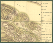
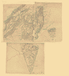
Oyster Bay and Huntington Bay
Price range: $39.95 through $69.95 -
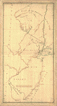
The State of New Jersey
Price range: $39.95 through $69.95 -
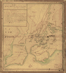
New York & New Jersey
Price range: $39.95 through $69.95 -
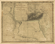
Lines run in the Jersies for determining boundaries between that Province & New York
Price range: $39.95 through $69.95 -
Northern New Jersey – 3 Maps
Price range: $39.95 through $69.95