-

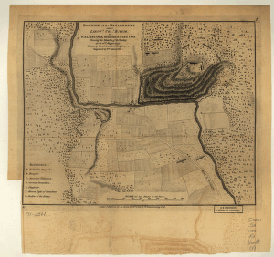
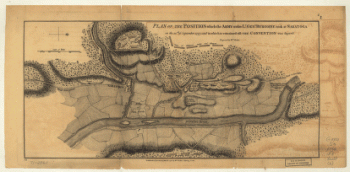
Position of the detachment under Lt. Col. Baum at Walmscock near Bennington, 16th Aug 1777
Price range: $39.95 through $69.95 -
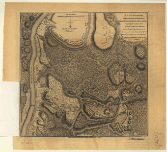
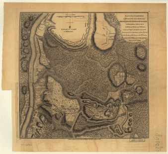
Plan of the encampment and position of the army under Lt. Gen. Burgoyne, at Swords House, 17th Sept 1777
Price range: $39.95 through $69.95 -
Plan of the encampment and position of the army under Lt. Gen. Burgoyne, at Swords House, 19th Sept 1777
Price range: $39.95 through $69.95 -
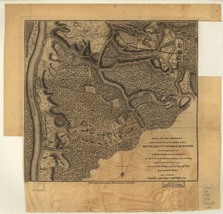
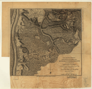
Plan of the encampment and position of the army under Lt. Gen. Burgoyne, at Braemus Heights, 20th Sept, 7th Oct 1777
Price range: $39.95 through $69.95 -
Plan of the encampment and position of the army under Lt. Gen. Burgoyne, at Braemus Heights, 8th Oct 1777
Price range: $39.95 through $69.95 -
Plan of the encampment and position of the army under Lt. Gen. Burgoyne, at Saratoga, 10th Sept 1777
Price range: $39.95 through $69.95 -
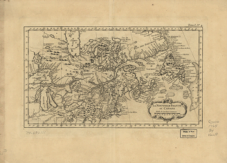
La Nouvelle France où Canada
Price range: $39.95 through $69.95 -
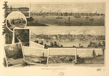
Victoria, B.C. and vicinity 1884. By L. Samuel. Lithographed by the West Shore
Price range: $39.95 through $69.95 -
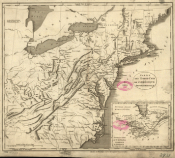
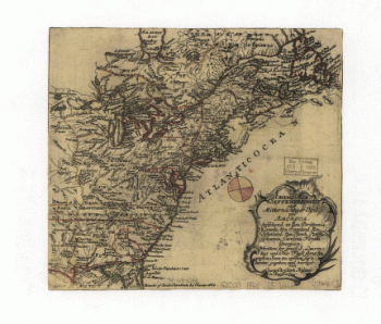
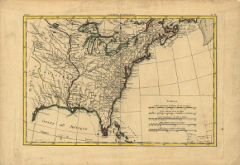
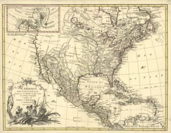
Partie des États-Unis de l'Amérique septentrionale
Price range: $39.95 through $69.95 -
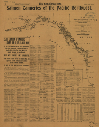
Salmon Canneries of the Pacific Northwest
Price range: $39.95 through $69.95 -
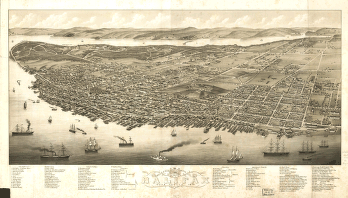
Panoramic view of the city of Halifax, Nova Scotia 1879
Price range: $39.95 through $69.95 -
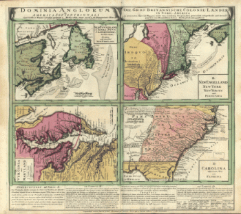
Dominia Anglorum in America Septentrionali. Specialibus mappis Londini primum a Mollio edita, nunc recusa ab Hommanianis Hered.
Price range: $39.95 through $69.95 -
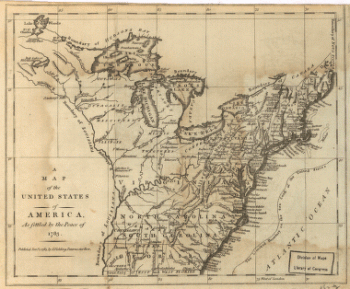
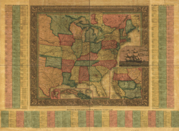
United States of America, as settled by the peace of 1783.
Price range: $39.95 through $69.95 -
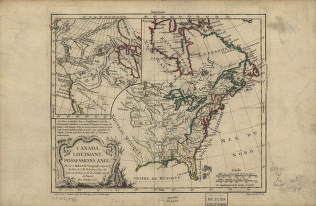
Canada and Louisiane
Price range: $39.95 through $69.95 -
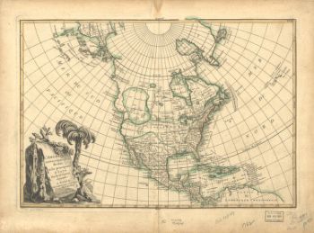
America septentrionalis oder Mitternächtiger Theil von America
Price range: $39.95 through $69.95 -
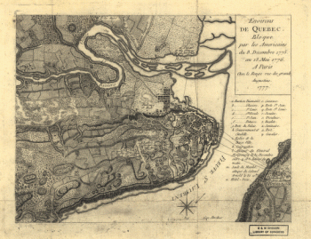
Environs de Quebec
Price range: $39.95 through $69.95 -
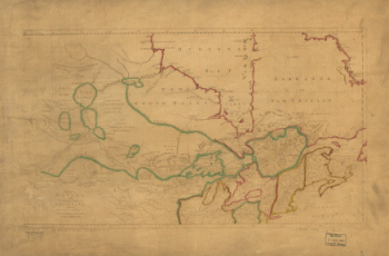
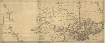
Canada and the north part of Louisiana with the adjacent countrys
Price range: $39.95 through $69.95 -
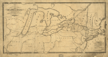
The most direct commercial route from the Atlantic via L. Ontario, to the province of Upper Canada
Price range: $39.95 through $69.95 -
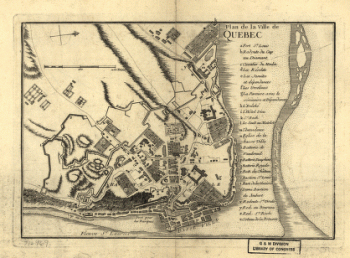
Plan de la ville de Quebec
Price range: $39.95 through $69.95 -
Canada IIe. feuille, XXXV, B 32
Price range: $39.95 through $69.95 -
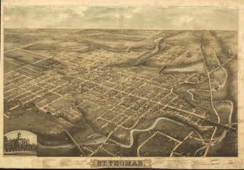
St. Thomas
Price range: $39.95 through $69.95 -
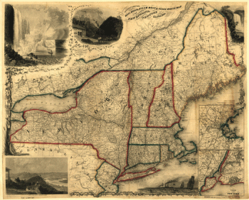
Sherman & Smith's railroad, steam boat & stage route map of New England, New-York and Canada
Price range: $39.95 through $69.95 -
L'Amérique septentrionale, dressée sur les mémoires le plus récens des meilleurs géographes & publée par Cóvens & Mortier
Price range: $39.95 through $69.95 -
L'Amérique septentrionale divisée en ses principaux états par le Sr. Janvier, géographe. Morillier, invenit. Berthault, sculpcit.
Price range: $39.95 through $69.95 -
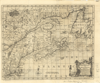
New England and Nova Scotia
Price range: $39.95 through $69.95 -
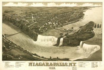
Niagara-Falls, N.Y. 1882
Price range: $39.95 through $69.95 -
Williams' commercial map of the United States and Canada with railroads, routes and distances
Price range: $39.95 through $69.95 -
Canada and the north part of Louisiana with the adjacent countrys
Price range: $39.95 through $69.95 -
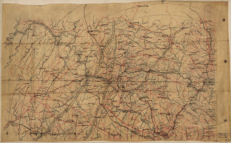
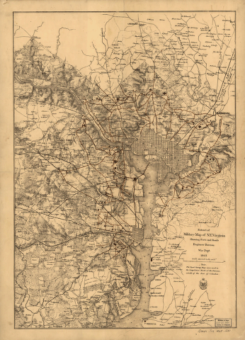
Extract of military map of N.E. Virginia showing forts and roads.
Price range: $39.95 through $69.95 -
Catalogue of points of historic interest : [Washington D.C. and metropolitan area]
Price range: $39.95 through $69.95 -
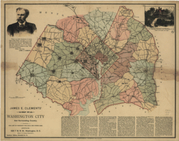
James E. Clements' map of Washington City and surrounding country.
Price range: $39.95 through $69.95 -
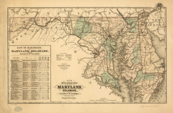
Railroad map of the state of Maryland, Delaware, and the District of Columbia
Price range: $39.95 through $69.95 -
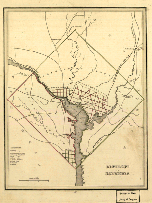
District of Columbia.
Price range: $39.95 through $69.95 -
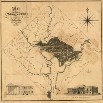
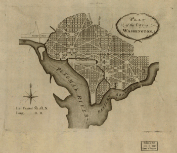
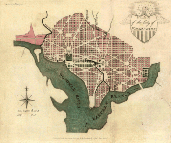
Plan of the city of Washington and territory of Columbia / engraved by W. & D. Lizars, Edin'r.
Price range: $39.95 through $69.95 -
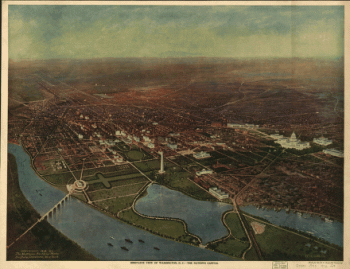
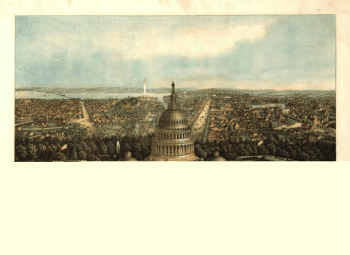
Bird's-eye view of Washington, D.C.–the nation's capital
Price range: $39.95 through $69.95 -
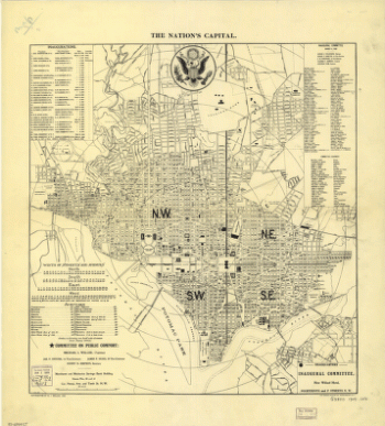
The nation's capital : Washington D.C.
Price range: $39.95 through $69.95 -
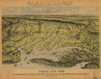
Birds eye view of Virginia, Maryland, Delaware and the District of Columbia
Price range: $39.95 through $69.95 -
Washington, the beautiful capital of the nation
Price range: $39.95 through $69.95 -
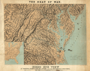
Panorama of the seat of war. Birds eye view of Virginia, Maryland, Delaware, and the District of Columbia
Price range: $39.95 through $69.95 -
View of Washington City
Price range: $39.95 through $69.95 -
Virginia and Maryland
Price range: $39.95 through $69.95 -
Plan of the city of Washington
Price range: $39.95 through $69.95 -
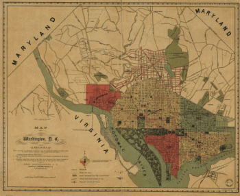
Washington, D.C., and environs
Price range: $39.95 through $69.95 -
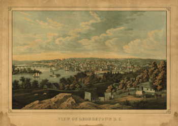
Georgetown D.C.
Price range: $39.95 through $69.95 -
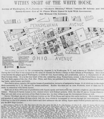
Within sight of the White House : section of Washington, D.C.
Price range: $39.95 through $69.95 -
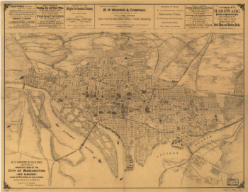
B.H. Warner & Co.'s Map
Price range: $39.95 through $69.95 -
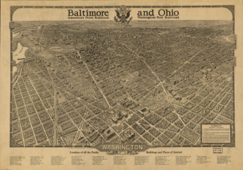
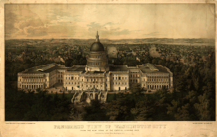
Panoramic view of Washington City
Price range: $39.95 through $69.95 -
Plan of the city of Washington.
Price range: $39.95 through $69.95
![Catalogue of points of historic interest : [Washington D.C. and metropolitan area]](https://www.ushistoricalarchive.com/wp-content/uploads/nc/data/products/im/sm/dc/b14-350x247.gif)