-

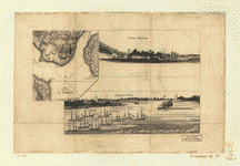
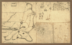
Plan d'Amboy
Price range: $39.95 through $69.95 -
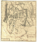
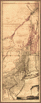
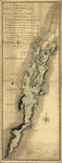
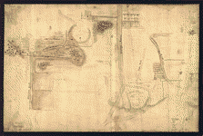
A sketch of the northern parts of New Jersey
Price range: $39.95 through $69.95 -
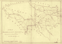
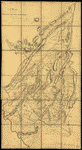
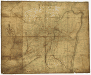
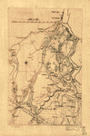
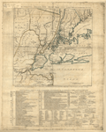
Somerset County
Price range: $39.95 through $69.95 -
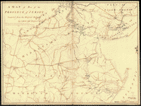
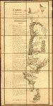
A map of part of the province of Jersey
Price range: $39.95 through $69.95 -
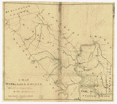
Middlesex County
Price range: $39.95 through $69.95 -
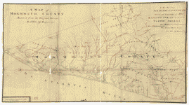
Monmouth County
Price range: $39.95 through $69.95 -
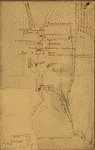
Sketch of Haddonfield
Price range: $39.95 through $69.95 -
Sketch of Haddonfield, March 1778
Price range: $39.95 through $69.95 -
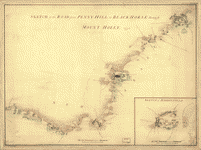
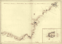
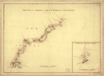
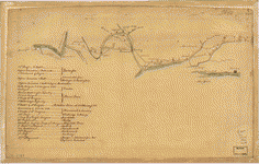
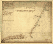
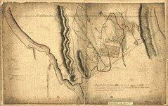
Sketch of the road from Black Horse to Crosswick
Price range: $39.95 through $69.95 -
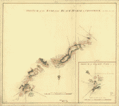
Sketch of the road from Black Horse to Crosswick
Price range: $39.95 through $69.95 -
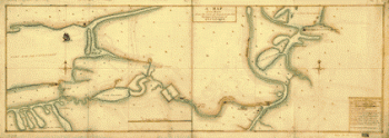
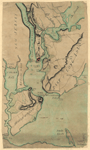
Plan of part of the River Delaware from Chester to Philadelphia
Price range: $39.95 through $69.95 -
Carte de l'affaire de Montmouth
Price range: $39.95 through $69.95 -
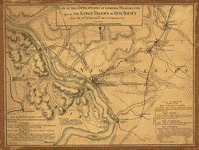
Plan of the operations of General Washington against the King's troops in New Jersey
Price range: $39.95 through $69.95 -
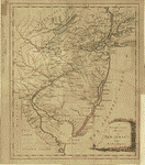
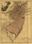
A new and accurate map of New Jersey, from the best authorities
Price range: $39.95 through $69.95 -
Plan of Princeton, Dec 31, 1776
Price range: $39.95 through $69.95 -
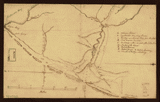
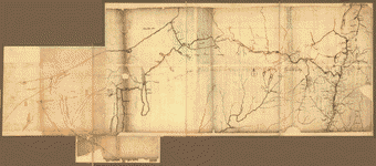
British outposts between Burlington and New Bridge, New Jersey
Price range: $39.95 through $69.95 -
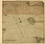
Map of the coast of New Jersey from Barnegat Inlet to Cape May
Price range: $39.95 through $69.95 -
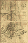
The Province of New Jersey, divided into East and West, commonly called the Jerseys
Price range: $39.95 through $69.95 -
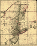
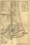
The provinces of New York and New Jersey
Price range: $39.95 through $69.95 -
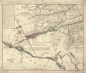
Northern Department of North-America
Price range: $39.95 through $69.95 -
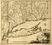
Connecticut and parts adjacent
Price range: $39.95 through $69.95 -
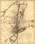
The provinces of New York, and New Jersey
Price range: $39.95 through $69.95 -
The provinces of New York, and New Jersey
Price range: $39.95 through $69.95 -
The provinces of New York, and New Jersey
Price range: $39.95 through $69.95 -
The Province of New York
Price range: $39.95 through $69.95 -
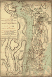
A map of the Province of New-York
Price range: $39.95 through $69.95 -
A map containing part of the Provinces of New York and New Jersey
Price range: $39.95 through $69.95 -
Operations of the King's army under the command of General Sr William Howe
Price range: $39.95 through $69.95 -
Operations of His Majesty's fleet and army under the command of Vice Admiral the Rt Hble Lord Viscount Howe and Genl Sr Wm Howe
Price range: $39.95 through $69.95 -
A map of the Province of New York
Price range: $39.95 through $69.95 -
Province de New-York en 4 feuilles
Price range: $39.95 through $69.95 -
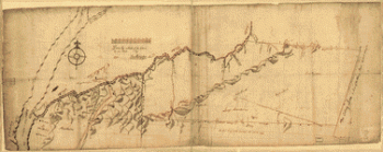
The Hudsons River
Price range: $39.95 through $69.95 -
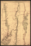
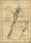
Lake Champlain
Price range: $39.95 through $69.95 -
Lake Champlain including Crown Point and St Iohn's
Price range: $39.95 through $69.95 -
A draught of Lake George, and part of Hudson's River taken September 1756
Price range: $39.95 through $69.95 -
The Northern parts of New York
Price range: $39.95 through $69.95 -
New York from the Hudson River west to the Unadilla Branch of the Susquehanna River
Price range: $39.95 through $69.95 -
A Map of the route from the city of Albany to the Fort Osswego on the Lake of Cataroque
Price range: $39.95 through $69.95 -
NW parts of New York, no 156
Price range: $39.95 through $69.95 -
The lands disputed by Philipse Patent against Beekmans & Rambaults
Price range: $39.95 through $69.95 -
Map showing the Bowery Lane area of Manhattan
Price range: $39.95 through $69.95 -
Plan of Governor's, Kennedy's, and Brown's Islands
Price range: $39.95 through $69.95 -
Map of that part of Orange County lying to the north of the mountains of the highlands
Price range: $39.95 through $69.95 -
Map of Orange and Rockland counties area of New York
Price range: $39.95 through $69.95 -
Old map of Brooklyn and greater part of King's County, Long Island
Price range: $39.95 through $69.95 -
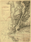
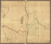
The country twenty five miles round New York
Price range: $39.95 through $69.95 -
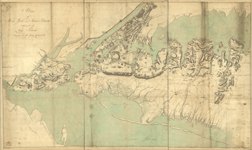
Plan of New York and Staten Islands with part of Long Island
Price range: $39.95 through $69.95 -
Plan of New York and Staten Islands with part of Long Island
Price range: $39.95 through $69.95