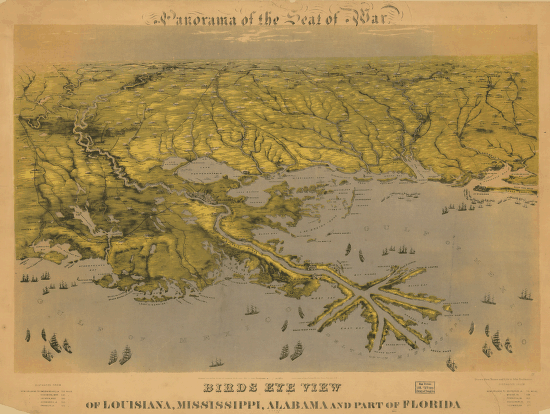
Drawn from nature and lith. by John Bachmann. CREATED/PUBLISHED [New York] c1861. NOTES Scale not given. Reference: LC Civil War Maps (2nd ed.), 1.7 At top of map: Panorama of the seat of war. Table of distances from New Orleans in lower margin. View of the Gulf coast centered on the Mississippi River delta, showing cities and towns, roads, railroads, rivers, and forts.


![Plan of the battle of August 5, 1864. [Mobile Bay]](https://www.ushistoricalarchive.com/wp-content/uploads/nc/data/products/im/sm/al/b25-350x264.gif)
