Home
All Products
Historic Maps
American Indian Maps
Birds Eye View Maps
Civil War Maps
Panoramic Maps
Railroad Maps
Revolutionary War Maps
State Maps
Historic Prints
Civil War Prints
Civil War Posters
Historic Portraits
Presidential Portraits
Contact Us
0
0
Search Product or SKU
×
press
Enter
to search
Showing all results:
No products found.
State Maps
Search
Search Product or SKU
×
Sort By
Default
Price: Low to High
Price: High to Low
Alphabetical
SKU
Categories
All
American Indian Maps
American Indian Photos
Birds Eye View Maps
CD Collections
Civil War Maps
Civil War Posters
Civil War Prints
Panoramic Maps
Photo-chromes
Presidential Portraits
Railroad Maps
Revolutionary War Maps
St. Augustine
State Maps
Alabama
California
Canada
Georgia
Louisiana
Michigan
New Hampshire
New Jersey
New York
New York City
North Carolina
Ohio
South Carolina
Tennessee
Texas
Washington DC
Showing
“State Maps”
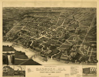
Perspective map of the city of Gadsden, Ala
$
17.95
–
$
47.95
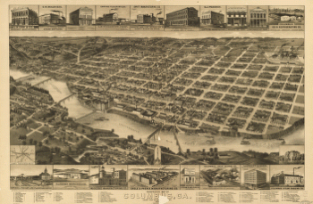
Perspective map of Columbus, Ga.
$
17.95
–
$
47.95
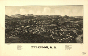
Penacook, N.H. Pub. & drawn by L. R. Burleigh.
$
17.95
–
$
47.95
Partie orientale du Canada. Traduitte de l'anglois de la carte de Jefferys publiée à Londres en May 1755
$
17.95
–
$
47.95
Partie orientale du Canada, traduitte de l'anglois de la carte de Jefferys publiée a Londres en May 1755
$
17.95
–
$
47.95
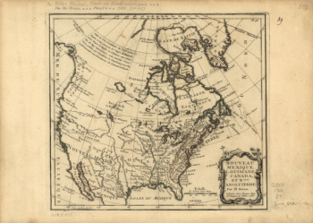
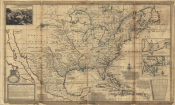
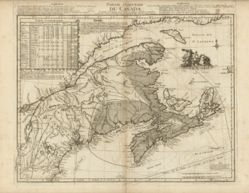
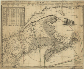
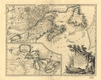
Partie occidentale de la Nouvelle France
$
17.95
–
$
47.95
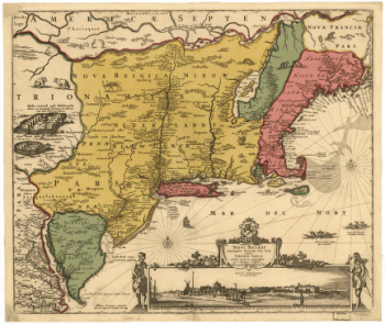
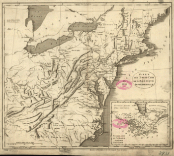
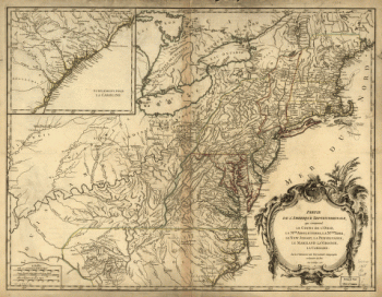
Partie des États-Unis de l'Amérique septentrionale
$
17.95
–
$
47.95
Partie de l'Amérique septentrionale, qui comprend le cours de l'Ohio, la Nlle. Angleterre, la Nlle York, le New Jersey, la Pensylvanie, le Maryland, la Virginie, la Caroline
$
17.95
–
$
47.95
Partie de l'Amérique septent? qui comprend la Nouvelle France ou le Canada
$
17.95
–
$
47.95
Part of U.S. Mil. Reservation, West Point, N.Y. / drawn by Cadet Chas. De L. Hine.
$
17.95
–
$
47.95
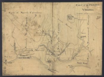
Part of the Province of Virginia.
$
17.95
–
$
47.95
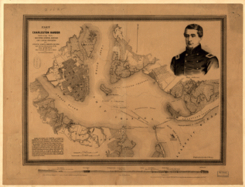
Part of South Carolina and Georgia
$
17.95
–
$
47.95
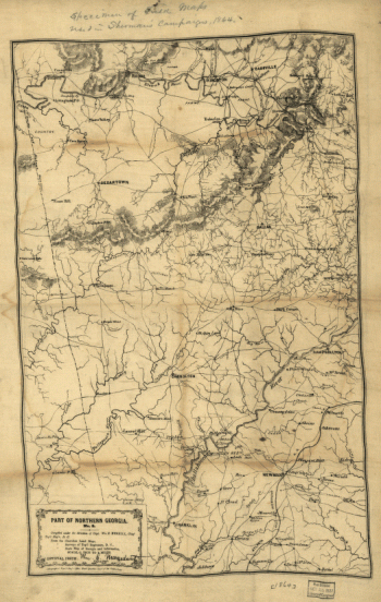
Part of northern Georgia : no. 2
$
17.95
–
$
47.95
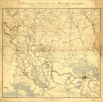
Part of Louisiana and Mississippi
$
17.95
–
$
47.95
Part of Long Island; and the coast eastward to the shoals of Nantucket.
$
17.95
–
$
47.95
Part of Charleston Harbor, embracing forts Moultrie, Sumter, Johnson, and Castle Pinckney, also Sullivan, James & Morris islands
$
17.95
–
$
47.95
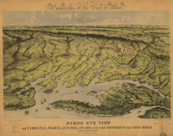
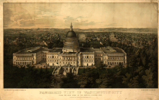
Panoramic view of Washington City
$
17.95
–
$
47.95
Panoramic view of the city of Youngstown, county seat of Mahoning Co., Ohio 1882
$
17.95
–
$
47.95
Panoramic view of the city of Youngstown, county seat of Mahoning Co., Ohio
$
17.95
–
$
47.95
Panoramic view of the city of Ravenna, county seat of Portage Co., Ohio 1882.
$
17.95
–
$
47.95
Panoramic view of the city of Niles, Trumbull Co., Ohio 1882. Beck & Pauli Lith.
$
17.95
–
$
47.95
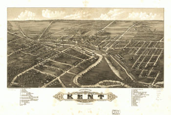
Panoramic view of the city of Kent, Portage County, Ohio 1882.
$
17.95
–
$
47.95
Panoramic view of the city of Jackson, Michigan 1881. [By] A. Ruger. Beck & Pauli Lith.
$
17.95
–
$
47.95
Panoramic view of the city of Halifax, Nova Scotia 1879
$
17.95
–
$
47.95
Panoramic view of the city of Ann Arbor, Washtenaw Co., Michigan 1880. Beck & Pauli Lith.
$
17.95
–
$
47.95
Panoramic view of the city of Akron, Summit County, Ohio 1882. Beck & Pauli, lithographers.
$
17.95
–
$
47.95
Panoramic view of Quitman, Ga. county-seat of Brooks-County 1885. Beck & Pauli, lith.
$
17.95
–
$
47.95
Panoramic view of Mt. Clemens 1881, Macomb Co., Mich. Beck & Pauli, lith.
$
17.95
–
$
47.95
Panorama of the seat of war. Birds eye view of Virginia, Maryland, Delaware, and the District of Columbia
$
17.95
–
$
47.95
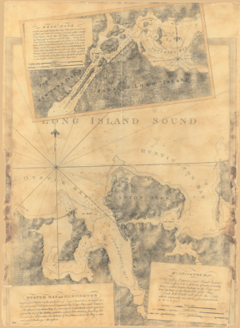
Oyster Bay and Huntington. Huntington Bay.
$
17.95
–
$
47.95
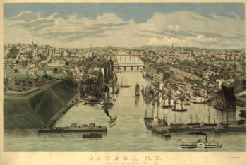
Oswego, N.Y. / Lewis Bradley del. ; on stone by D.W. Moody.
$
17.95
–
$
47.95
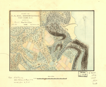
Original maps of Forts Henry & Donelson and vicinity
$
17.95
–
$
47.95
oramic view of Valdosta, Ga., county-seat of Lowndes-County. Beck & Pauli, litho.
$
17.95
–
$
47.95
Operations of the King's army under the command of General Sir William Howe, K.B. in New York and east New Jersey
$
17.95
–
$
47.95
Operations of General Washington, against the Kings troops in New Jersey, from the 26th, of December, 1776, to the 3d. January 1777
$
17.95
–
$
47.95
Old map of Brooklyn and greater part of King's County, Long Island.
$
17.95
–
$
47.95
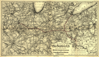
Ohio Southern railroad and its connections
$
17.95
–
$
47.95
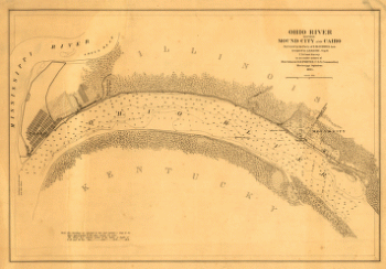
Ohio River between Mound City and Cairo
$
17.95
–
$
47.95
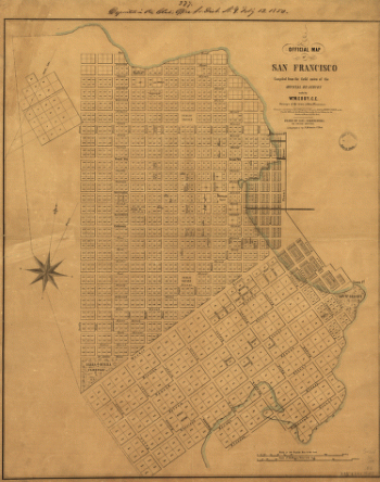
Official map of San Francisco.
$
17.95
–
$
47.95
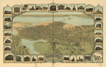
Oakland, California, 1900. Mutual L. & Lith. Co.
$
17.95
–
$
47.95
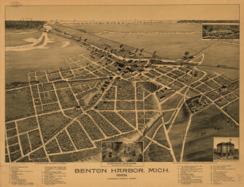
nton Harbor, Mich. 1889.
$
17.95
–
$
47.95
Novi Belgii Novæque Angliæ : nec non partis Virginiæ tabula multis in locis emendata / per Nicolaum Visscher nunc apud Petr. Schenk Iun.
$
17.95
–
$
47.95
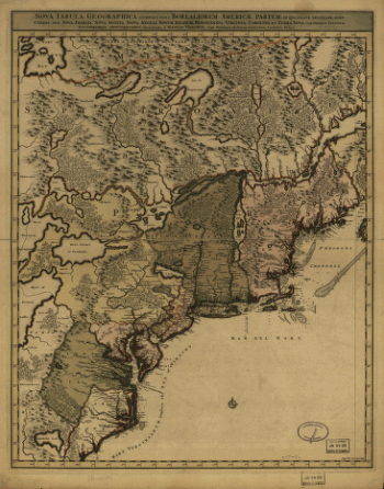
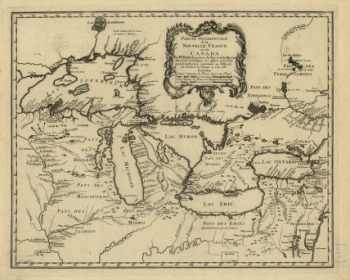
Nova tabula geographica complectens borealiorem Americæ partem
$
17.95
–
$
47.95
Nouveau Mexique, Louisiane, Canada, et Nlle. Angleterre. Par M. Brion.
$
17.95
–
$
47.95
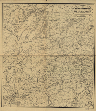
Northwestern Georgia
$
17.95
–
$
47.95
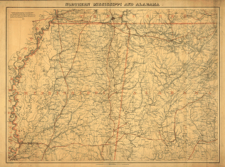
Northern Mississippi and Alabama
$
17.95
–
$
47.95
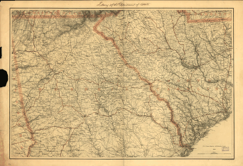
Northern Georgia and western and central South Carolina
$
17.95
–
$
47.95
North parts of America claimed by France (Louisiana, Mississipi, Canada, and New France)
$
17.95
–
$
47.95
1
2
3
4
5
6
7
8
9
10
…
18
19
20
Load More
All products loaded.
Search Product or SKU
×
Home
All Products
Historic Maps
American Indian Maps
Birds Eye View Maps
Civil War Maps
Panoramic Maps
Railroad Maps
Revolutionary War Maps
State Maps
Historic Prints
Civil War Prints
Civil War Posters
Historic Portraits
Presidential Portraits
Contact Us
Cart
0
Cart
Close
Updating…
No products in the cart.
Continue shopping