-

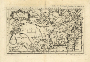
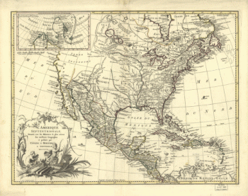
La Louisiane et pays voisins.
Price range: $39.95 through $69.95 -
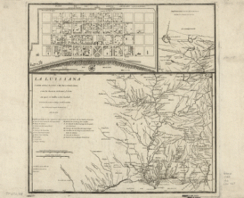
La Luisiana cedida al Rei N. S. por S. M. Christianisima
Price range: $39.95 through $69.95 -
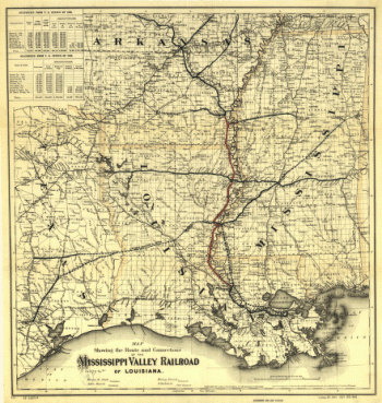
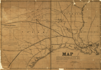
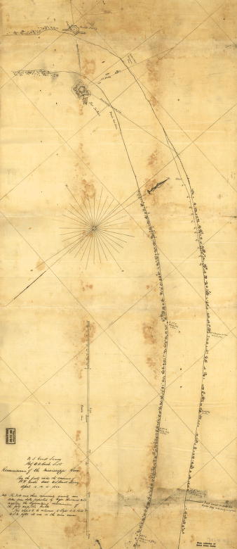
Route and connections of the Mississippi Valley Railroad of Louisiana
Price range: $39.95 through $69.95 -
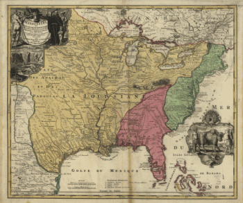
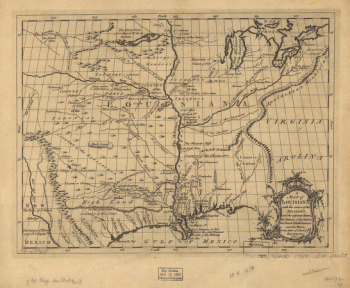
Amplissima regionis Mississipi seu provinciæ Ludovicianæ â R.P.
Price range: $39.95 through $69.95 -
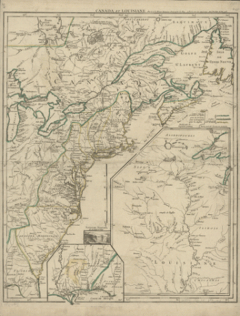
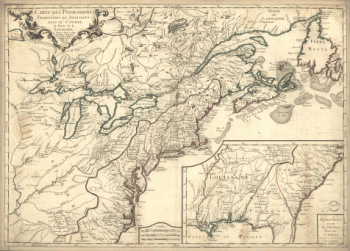
Canada et Louisiane, par le Sr. le Rouge ingénieur géographe du Roy.
Price range: $39.95 through $69.95 -
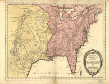
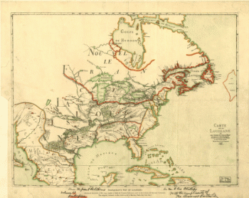
Carte de la Louisiane et des pays voisins dédiée à M. Rouillé sécretaire d'État, ayant le Département de la marine
Price range: $39.95 through $69.95 -
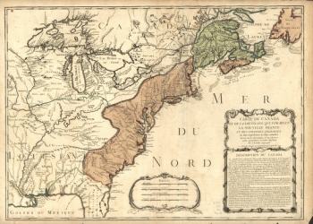
Carte du Canada et de la Louisiane qui forment la Nouvelle France et des colonies angloises ou sont representez les pays contestez.
Price range: $39.95 through $69.95 -
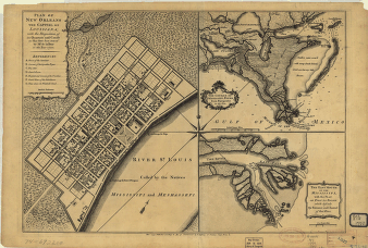
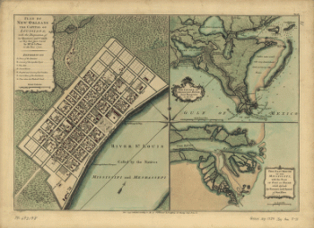
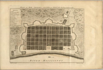
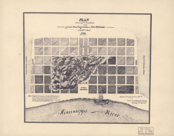
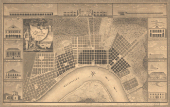
Plan of New Orleans the capital of Louisiana
Price range: $39.95 through $69.95 -
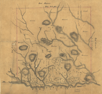
Map of Las Ormigas Grant, Sabine and DeSoto Parishes, Louisiana
Price range: $39.95 through $69.95 -
Carte des possessions françoises et angloises dans le Canada, et partie de la Louisiane
Price range: $39.95 through $69.95 -
Sketch of the two breakwaters above Alexandria in the Red River
Price range: $39.95 through $69.95 -
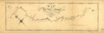
Map of the Red River in Louisiana
Price range: $39.95 through $69.95 -
Plan of New Orleans the capital of Louisiana
Price range: $39.95 through $69.95 -
Map exhibiting the fixed location of the main trunk of the New-Orleans, Opelousas & Great Western Railroad of Louisiana
Price range: $39.95 through $69.95 -
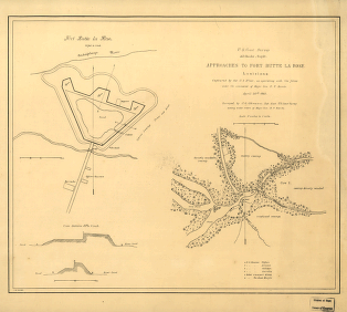
Approaches to Fort Butte La Rose, Louisiana
Price range: $39.95 through $69.95 -
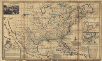
North parts of America claimed by France (Louisiana, Mississipi, Canada, and New France)
Price range: $39.95 through $69.95 -
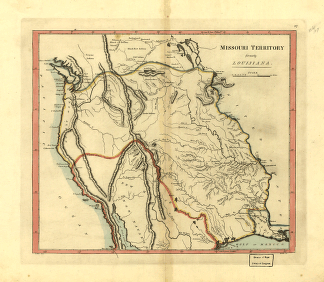
Missouri territory formerly Louisiana.
Price range: $39.95 through $69.95 -
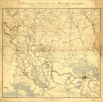
Part of Louisiana and Mississippi
Price range: $39.95 through $69.95 -
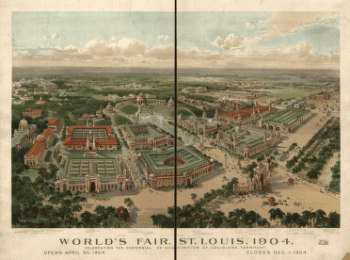
World's Fair, St Louis, 1904
Price range: $39.95 through $69.95 -
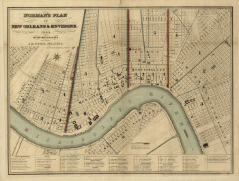
Norman's plan of New Orleans & environs, 1845
Price range: $39.95 through $69.95 -
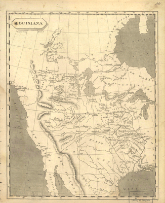
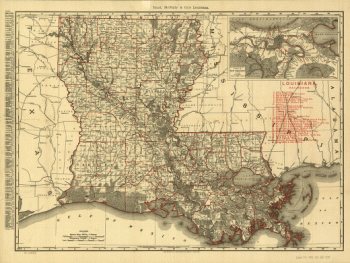
Louisiana
Price range: $39.95 through $69.95 -
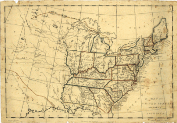
United States and part of Louisiana
Price range: $39.95 through $69.95 -
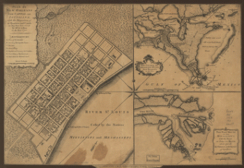
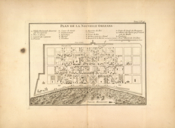
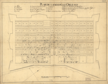
Plan de la Nouvelle Orleans
Price range: $39.95 through $69.95 -
United States including Louisiana
Price range: $39.95 through $69.95 -
Plan of New Orleans
Price range: $39.95 through $69.95 -
Louisiana from 1896
Price range: $39.95 through $69.95 -
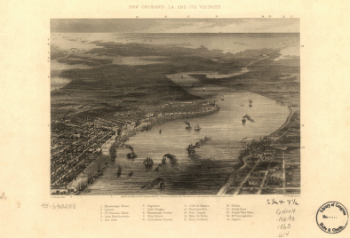
New Orleans, La. and its vicinity. J. Wells, del. W. Ridgway, sc.
Price range: $39.95 through $69.95 -
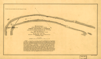
Reconnoissance of the Mississippi River below Forts Jackson and St. Philip
Price range: $39.95 through $69.95 -
Boundaries of the great conflagration of New Orleans on the 21st of March 1788
Price range: $39.95 through $69.95 -
L'Amérique septentrionale, dressée sur les mémoires le plus récens des meilleurs géographes, & publiée par Cóvens & Mortier.
Price range: $39.95 through $69.95 -
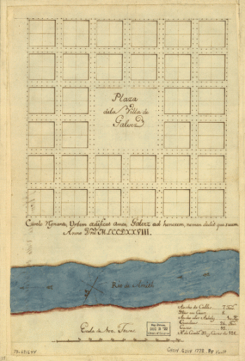
Plaza de la villa de Galvez.
Price range: $39.95 through $69.95 -
Plan of the city and suburbs of New Orleans
Price range: $39.95 through $69.95 -
Franquelin's map of Louisiana.
Price range: $39.95 through $69.95 -
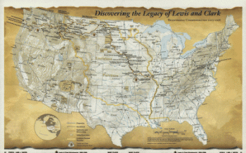
Discovering the legacy of Lewis and Clark : bicentennial commemoration 2003-2006
Price range: $39.95 through $69.95 -
Plan de la Nouvelle Orleans / Anonymous.
Price range: $39.95 through $69.95 -
Louisiana
Price range: $39.95 through $69.95 -
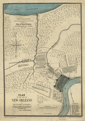
Plan of the City of New Orleans and adjacent plantations
Price range: $39.95 through $69.95 -
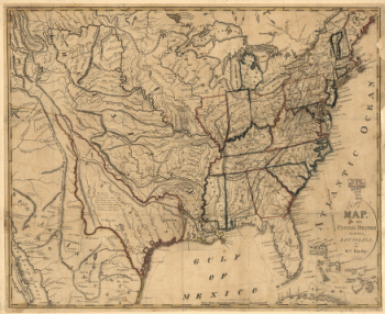
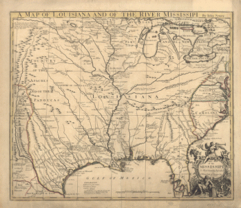
A map of Louisiana and of the river Mississipi
Price range: $39.95 through $69.95 -
Port Hudson
Price range: $39.95 through $69.95 -
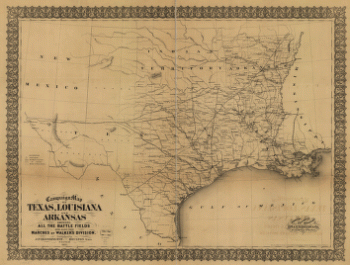
Campaign map of Texas, Louisiana and Arkansas
Price range: $39.95 through $69.95 -
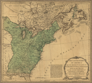
The United States of America with the British possessions of Canada, Nova Scotia, & of Newfoundland
Price range: $39.95 through $69.95 -
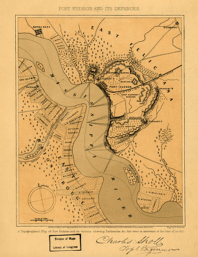
Port Hudson and its defences
Price range: $39.95 through $69.95 -
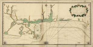
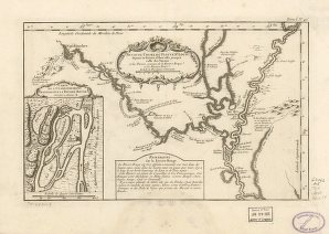
Suite du cours du fleuve
Price range: $39.95 through $69.95 -
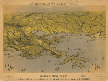
Birds eye view of Louisiana, Mississippi, Alabama and part of Florida
Price range: $39.95 through $69.95 -
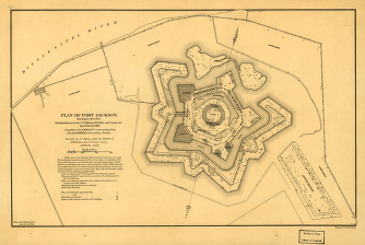
Plan of Fort Jackson
Price range: $39.95 through $69.95 -
Reconnoissance of the Mississippi River below Forts Jackson and St. Philip
Price range: $39.95 through $69.95