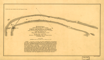
Made previous to the reduction by the U.S. Fleet, under the command of flag officer D.G. Farragut, U.S.N. / by the party under the direction of F.H. Gerdes, Asst., U.S. Coast Survey, A.D. Bache, supdt. United States Coast Survey. CREATED/PUBLISHED [1862?] NOTES At head of title: U.S. Coast Survey. Prof. A. D. Bache, Supt. Stamped in lower right corner: From collection of David Dixon Porter. Covering the environs of forts St. Philip and Jackson, Louisiana. 'Note: The forts and their immediate vicinity were taken from data furnished by Major Barnard, U.S.E., excepting the trigonometrical determinations of the forts and the hulks. This chart to be returned to Capt. D. D. Porter, U.S.N., after its use in the river ceases.'
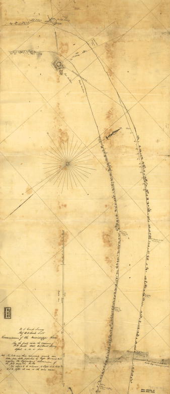
Reconnoissance of the Mississippi River below Forts Jackson and St. Philip
Price range: $39.95 through $69.95
SKU: smla51
Related products
-

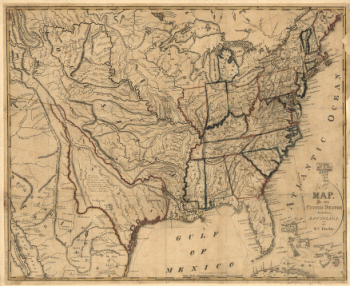
United States including Louisiana
Price range: $39.95 through $69.95 -
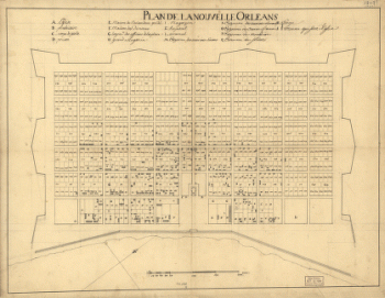
Plan de la Nouvelle Orleans / Anonymous.
Price range: $39.95 through $69.95 -
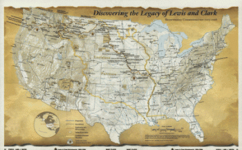
Discovering the legacy of Lewis and Clark : bicentennial commemoration 2003-2006
Price range: $39.95 through $69.95 -
Reconnoissance of the Mississippi River below Forts Jackson and St. Philip
Price range: $39.95 through $69.95