-

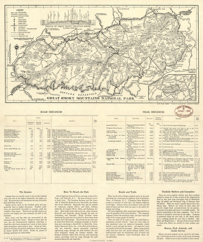
Great Smoky Mountains National Park, North Carolina/Tennessee
Price range: $39.95 through $69.95 -
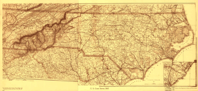
North Carolina Drawn by A. Lindenkohl
Price range: $39.95 through $69.95 -
Great Smoky Mountains National Park, North Carolina/Tennessee
Price range: $39.95 through $69.95 -
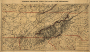
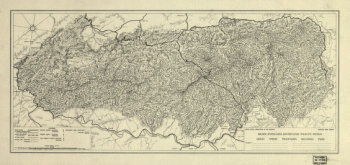
Mountain region of North Carolina and Tennessee
Price range: $39.95 through $69.95 -
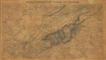
Mountain region of North Carolina and Tennessee.
Price range: $39.95 through $69.95 -
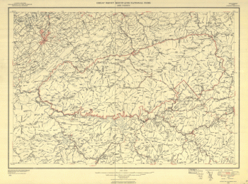
Great Smoky Mountains National Park and vicinity
Price range: $39.95 through $69.95 -
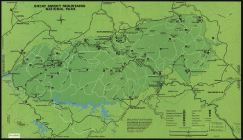
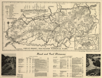
Great Smoky Mountains National Park
Price range: $39.95 through $69.95 -
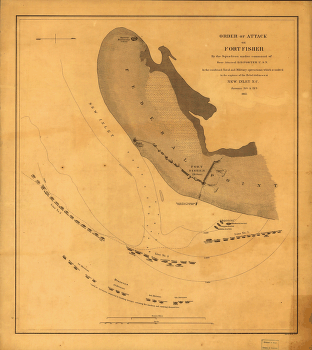
Fort Fisher, defensive work protecting the entrance to the port of Wilmington, North Carolina, captured by the Federals, Jan. 15, 1865
Price range: $39.95 through $69.95 -
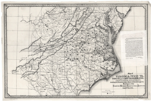
Map of Virginia and West Va., North & part of South Carolina, Maryland & Delaware
Price range: $39.95 through $69.95 -
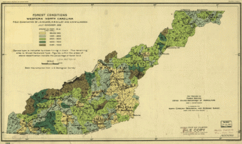
Forest conditions of western North Carolina.
Price range: $39.95 through $69.95 -
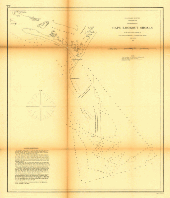
Reconnoissance of Cape Lookout shoals by the party
Price range: $39.95 through $69.95 -
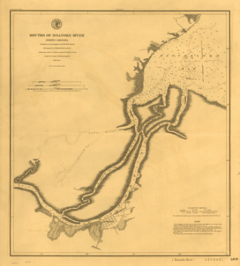
Mouths of Roanoke River, North Carolina
Price range: $39.95 through $69.95 -
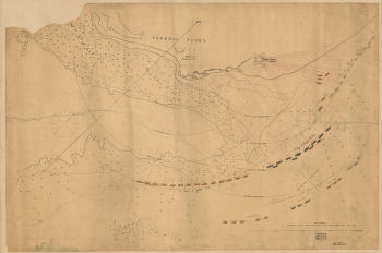
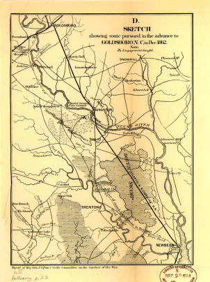
Sketch showing route pursued in the advance to Goldsboro, N.C., in Dec. 1862
Price range: $39.95 through $69.95 -
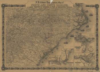
J. H. Colton's topographical map of North and South Carolina
Price range: $39.95 through $69.95 -
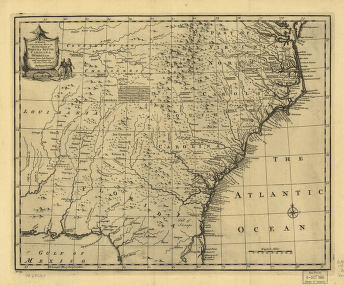
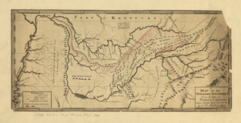
A map of the Tennessee government, formerly part of North Carolina.
Price range: $39.95 through $69.95 -
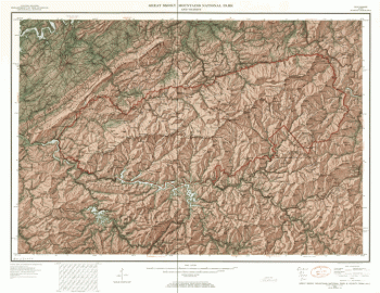
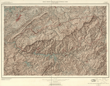
Great Smoky Mountains National Park.
Price range: $39.95 through $69.95 -
Great Smoky Mountains National Park.
Price range: $39.95 through $69.95 -
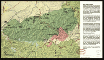
Great Smoky Mountains National Park and vicinity.
Price range: $39.95 through $69.95 -
Great Smoky Mountains National Park.
Price range: $39.95 through $69.95 -
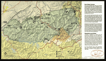
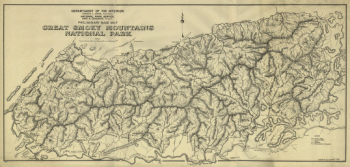
Preliminary base map, Great Smoky Mountains National Park.
Price range: $39.95 through $69.95 -
Great Smoky Mountains National Park and vicinity.
Price range: $39.95 through $69.95 -
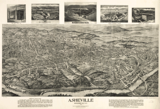
Asheville, Buncombe Co. N.C. 1912.
Price range: $39.95 through $69.95 -
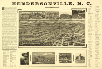
Hendersonville, N.C. 1913.
Price range: $39.95 through $69.95 -
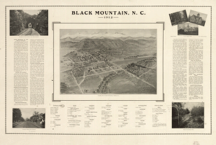
Black Mountain, N.C. 1912.
Price range: $39.95 through $69.95 -
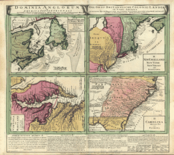
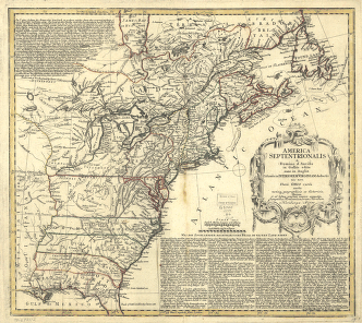
Dominia Anglorum in America Septentrionali. Specialibus mappis Londini primum a Mollio edita, nunc recusa ab Hommanianis Hered.
Price range: $39.95 through $69.95 -
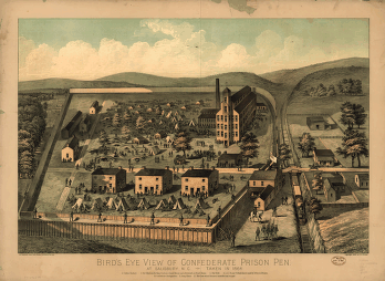
Bird's eye view of Confederate prison pen at Salisbury, N.C., taken in 1864.
Price range: $39.95 through $69.95 -
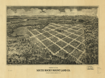
Property of the South Rocky Mount Land Co. at South Rocky Mount, N.C.
Price range: $39.95 through $69.95 -
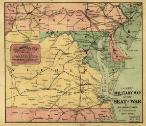
A new military map of the seat of war by J.H. Higginson.
Price range: $39.95 through $69.95 -
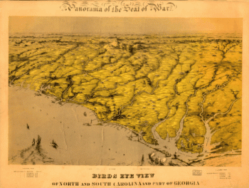
Birds eye view of North and South Carolina and part of Georgia.
Price range: $39.95 through $69.95 -
Attack on Fort Fisher
Price range: $39.95 through $69.95 -
America Septentrionalis a Domino d'Anville in Galliis edita nunc in Anglia
Price range: $39.95 through $69.95 -
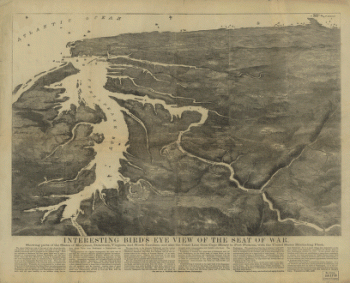
Interesting Bird's eye view of the seat of war
Price range: $39.95 through $69.95 -
Western border states
Price range: $39.95 through $69.95 -
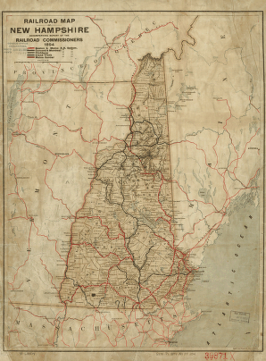
Railroad map of New Hampshire accompanying report of the railroad commissioners, 1894.
Price range: $39.95 through $69.95 -
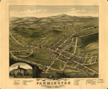
Bird's eye view of the village of Farmington, Stafford County, New Hampshire 1877.
Price range: $39.95 through $69.95 -
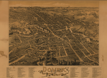
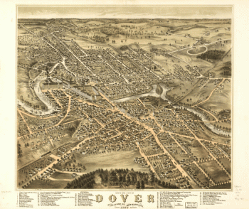
Dover, Stafford County, New Hampshire 1888.
Price range: $39.95 through $69.95 -
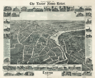
Exeter, New Hampshire, 1896. Compliments of the Exeter News-letter.
Price range: $39.95 through $69.95 -
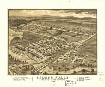
Salmon Falls, Strafford Co., New Hampshire 1877.
Price range: $39.95 through $69.95 -
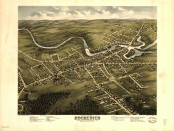
Bird's eye view of Dover, Strafford Co., New Hampshire 1877. A. Ruger del.
Price range: $39.95 through $69.95 -
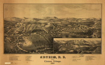
Antrim, N.H. and Clinton Village.
Price range: $39.95 through $69.95 -
Franklin and Franklin Falls, N.H., Merrimack County, 1884. [Drawn by] H. Wellge.
Price range: $39.95 through $69.95 -
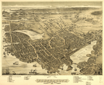
Bird's eye view of Portsmouth, Rockingham Co., New Hampshire 1877. A. Ruger del. D. Bremner & Co. Lith.
Price range: $39.95 through $69.95 -
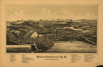
Wolfeborough, N.H., Lake Winnipesaukee. Drawn & published by Geo. E. Norris. Burleigh Lith. Est.
Price range: $39.95 through $69.95 -
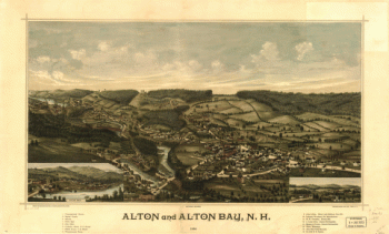
Alton and Alton Bay, N.H. 1888. Drawn & published by Geo. E. Norris. The Burleigh Lith. Est.
Price range: $39.95 through $69.95 -
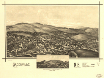
Greenville, N.H. 1886. Burleigh Lith. Establishment.
Price range: $39.95 through $69.95 -
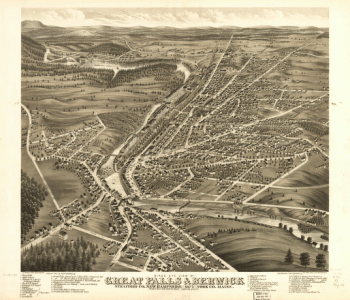
Bird's eye view of Great Falls, Strafford Co., New Hampshire & Berwick, York Co., Maine 1877. A. Ruger del. C.H. Vogt & Co. Lith.
Price range: $39.95 through $69.95

![Franklin and Franklin Falls, N.H., Merrimack County, 1884. [Drawn by] H. Wellge.](https://www.ushistoricalarchive.com/wp-content/uploads/nc/data/products/im/sm/nh/b21-350x263.gif)