-
![Calumet, Hecla & Red Jacket, Mich. : 1881 / [signed] H. Wellge, Milw. ; Beck & Pauli, lith., Milwaukee, Wis.](https://www.ushistoricalarchive.com/wp-content/themes/savoy/assets/img/placeholder.png)
Calumet, Hecla & Red Jacket, Mich. : 1881 / [signed] H. Wellge, Milw. ; Beck & Pauli, lith., Milwaukee, Wis.
Price range: $39.95 through $69.95 -
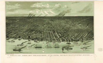
Birds eye view–showing about three miles square–of the central portion of the city of Detroit, Michigan. Calvert Lith Co.
Price range: $39.95 through $69.95 -
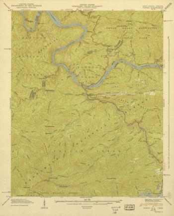
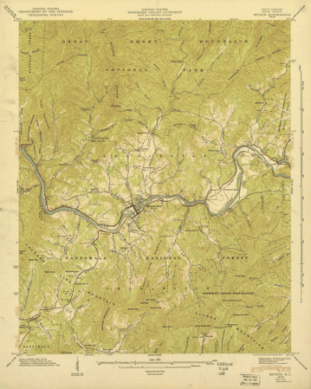
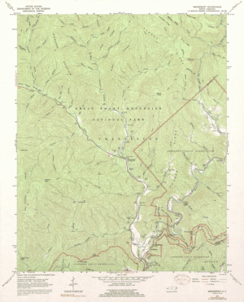
North Carolina. – Tapoco
Price range: $39.95 through $69.95 -
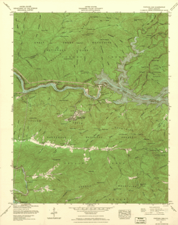
North Carolina. – Fontana Dam
Price range: $39.95 through $69.95 -
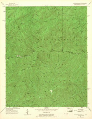
North Carolina. – Thunderhead Mountain
Price range: $39.95 through $69.95 -
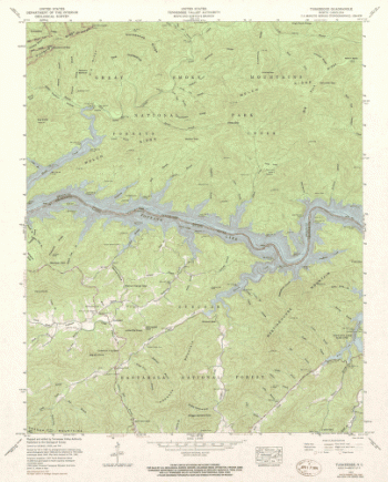
North Carolina. – Tuskeegee
Price range: $39.95 through $69.95 -
North Carolina. – Bryson
Price range: $39.95 through $69.95 -
North Carolina. – Clingmans Dome
Price range: $39.95 through $69.95 -
North Carolina. – Smokemont
Price range: $39.95 through $69.95 -
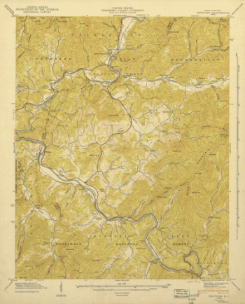
North Carolina. – Whittier
Price range: $39.95 through $69.95 -
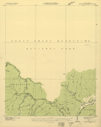
North Carolina. – Bunches Bald
Price range: $39.95 through $69.95 -
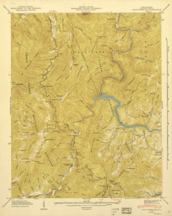
North Carolina. – Cove Creek
Price range: $39.95 through $69.95 -
The war in North Carolina. Map of the entrance to Beaufort harbor, N.C. showing the position of Fort Macon, etc.
Price range: $39.95 through $69.95 -
North Carolina. – Luftee Knob
Price range: $39.95 through $69.95 -
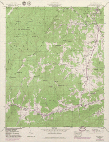
North Carolina. – Dellwood
Price range: $39.95 through $69.95 -
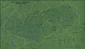
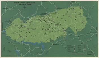
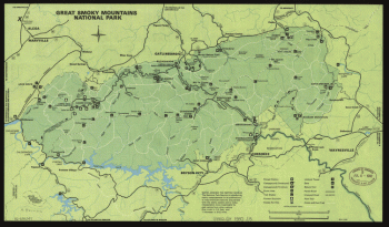
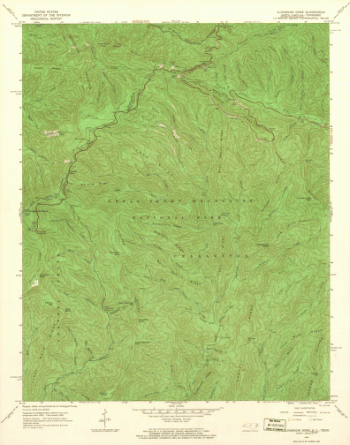
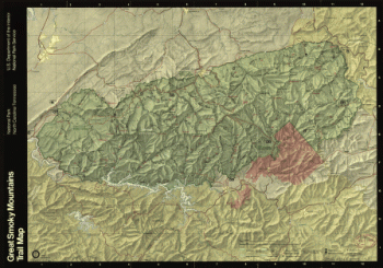
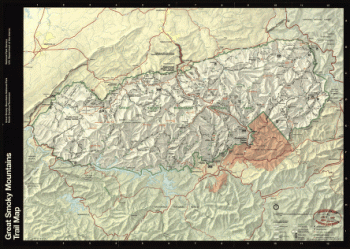
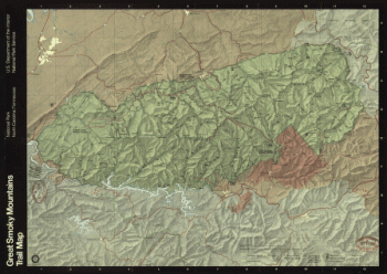
Great Smoky Mountains National Park, North Carolina/Tennessee, trail map / U.S. Department of the Interior, National Park Service.
Price range: $39.95 through $69.95 -
North Carolina coast line. Showing every inlet, sound & bay of special interest, from Fortress Monroe to South Carolina.
Price range: $39.95 through $69.95 -
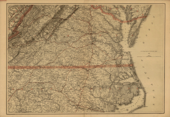
Southern Virginia and northern North Carolina
Price range: $39.95 through $69.95 -
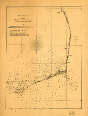
Sketch of the coast of North Carolina from Oregon Inlet to Ocracoke Inlet.
Price range: $39.95 through $69.95 -
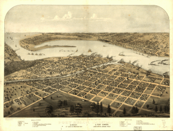
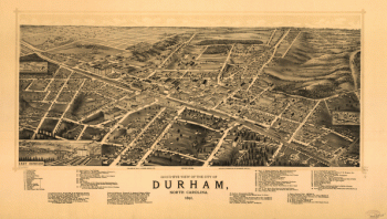
Bird's-eye view of the city of Durham, North Carolina 1891.
Price range: $39.95 through $69.95 -
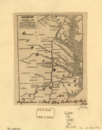
Railroads in Virginia and part of North Carolina, drawn and engraved for Doggett's Railroad Guide & Gazetteer.
Price range: $39.95 through $69.95 -
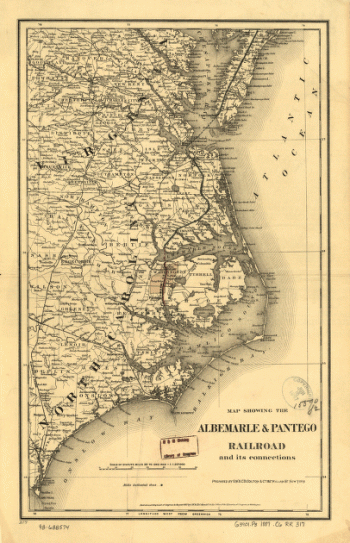
Map showing the Albemarle & Pantego Railroad and its connections.
Price range: $39.95 through $69.95 -
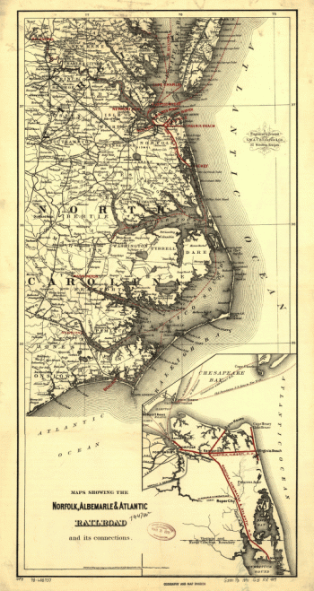
Maps showing the Norfolk, Albermarle & Atlantic Railroad and its connections.
Price range: $39.95 through $69.95 -
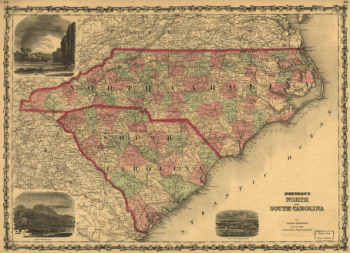
Johnson's North and South Carolina.
Price range: $39.95 through $69.95 -
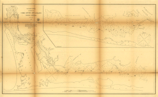
Core Sound and Straits, North Carolina.
Price range: $39.95 through $69.95 -
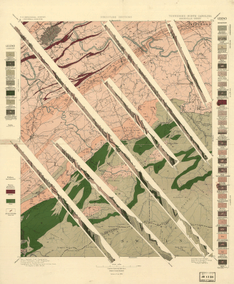
Tennessee-North Carolina.
Price range: $39.95 through $69.95 -
Great Smoky Mountains National Park, North Carolina/Tennessee, trail map
Price range: $39.95 through $69.95 -
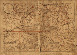
Map of the seat of war in Virginia.
Price range: $39.95 through $69.95 -
Great Smoky Mountains National Park, North Carolina-Tennessee, trail map
Price range: $39.95 through $69.95 -
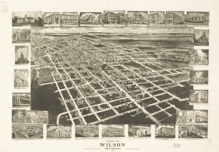
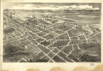
Birds eye view of Wilson, North Carolina 1908.
Price range: $39.95 through $69.95 -
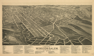
Bird's-eye view of the twin cities, Winston-Salem, North Carolina 1891.
Price range: $39.95 through $69.95 -
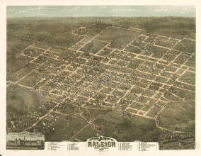
Bird's eye view of the city of Raleigh, North Carolina 1872.
Price range: $39.95 through $69.95 -
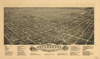
Bird's eye view of the city of Greensboro, North Carolina. 1891.
Price range: $39.95 through $69.95 -
Bird's-eye-view of Statesville, North Carolina,
Price range: $39.95 through $69.95 -
Bird's-eye-view of Hickory, North Carolina.
Price range: $39.95 through $69.95 -
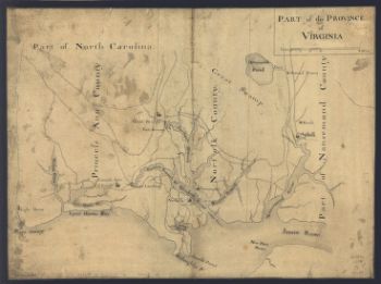
Part of the Province of Virginia.
Price range: $39.95 through $69.95 -
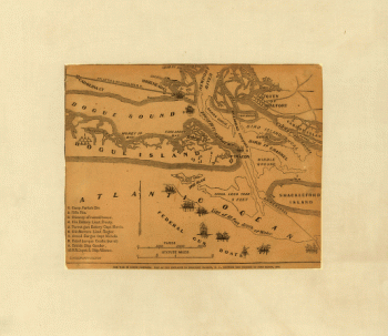
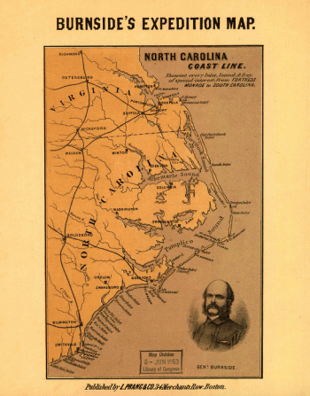
Sketch showing route of the Burnside expedition [to Roanoke Island, N.C., February 6, 1862]
Price range: $39.95 through $69.95 -
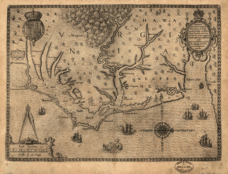
Americæ pars, nunc Virginia dicta : primum ab Anglis inuenta
Price range: $39.95 through $69.95 -
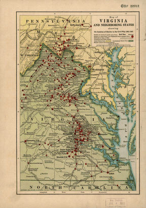
Map of Virginia and neighboring states showing the location of battles in the Civil War 1861-1865.
Price range: $39.95 through $69.95 -
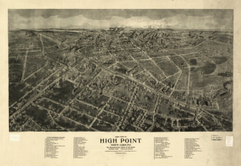
Aero view of High Point, North Carolina by J. J. Farris.
Price range: $39.95 through $69.95 -
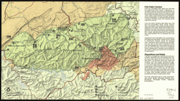
Great Smoky Mountains National Park. 1971.
Price range: $39.95 through $69.95 -
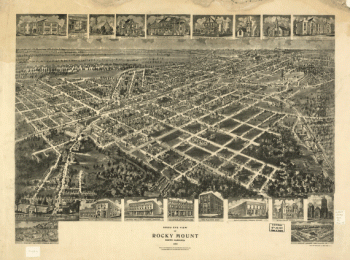
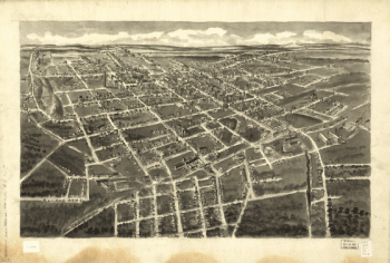
Bird's eye view of Rocky Mount, North Carolina 1907.
Price range: $39.95 through $69.95 -
Great Smoky Mountains National Park. 1971.
Price range: $39.95 through $69.95 -
Great Smoky Mountains National Park, North Carolina/Tennessee
Price range: $39.95 through $69.95 -
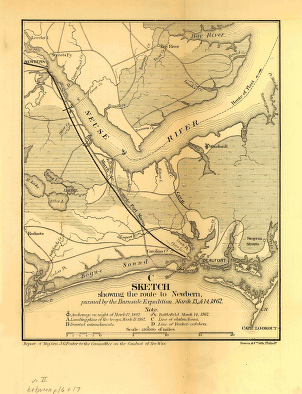
Sketch showing the route to Newbern, pursued by the Burnside expedition, March 13 & 14, 1862
Price range: $39.95 through $69.95 -
Great Smoky Mountains National Park
Price range: $39.95 through $69.95 -
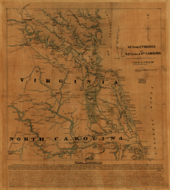
S.E. portion of Virginia and N.E. portion of N'th Carolina
Price range: $39.95 through $69.95
![Calumet, Hecla & Red Jacket, Mich. : 1881 / [signed] H. Wellge, Milw. ; Beck & Pauli, lith., Milwaukee, Wis.](https://www.ushistoricalarchive.com/wp-content/uploads/nc/data/products/im/sm/mi/b7-350x213.gif)

![Sketch showing route of the Burnside expedition [to Roanoke Island, N.C., February 6, 1862]](https://www.ushistoricalarchive.com/wp-content/uploads/nc/data/products/im/sm/nc/b46-350x765.gif)