-

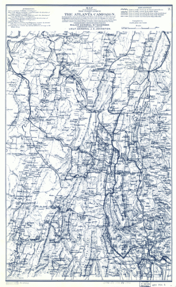
Map illustrating the first epoch of the Atlanta Campaign
Price range: $39.95 through $69.95 -
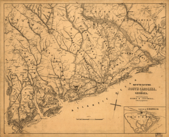
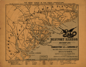
Beaufort Harbor and coast line between Charleston, S.C. and Savanna Ga.
Price range: $39.95 through $69.95 -
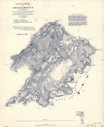
Battle field of Chickamauga, Georgia
Price range: $39.95 through $69.95 -
Pine Mountain, Lost Mountain, Kenesaw Mountain, and Little Kenesaw Mountain
Price range: $39.95 through $69.95 -
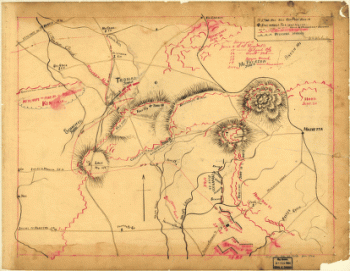
Chickamauga battle-field
Price range: $39.95 through $69.95 -
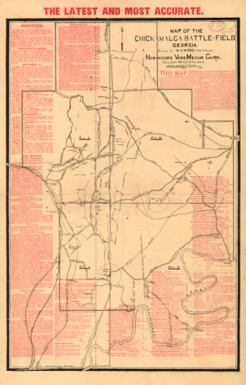
Chickamauga and Chattanooga National Military Park, Ga. (Chickamauga Battlefield).
Price range: $39.95 through $69.95 -
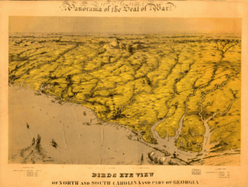
Birds eye view of North and South Carolina and part of Georgia.
Price range: $39.95 through $69.95 -
Fort McAllister, Dec. 1864
Price range: $39.95 through $69.95 -
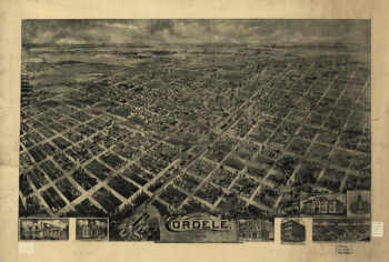
Birds eye view Cordele, Georgia 1908. Drawn by A. E. Downs.
Price range: $39.95 through $69.95 -
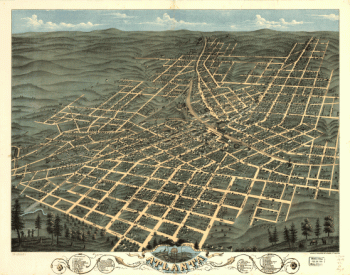
Birds eye view of the city of Atlanta, the capitol of Georgia 1871. Drawn & published by A. Ruger.
Price range: $39.95 through $69.95 -
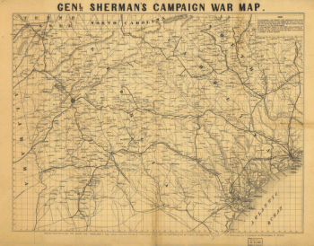
Genl. Sherman's campaign war map.
Price range: $39.95 through $69.95 -
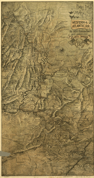
Birds-eye map of the Western and Atlantic R.R., the great Kennesaw route
Price range: $39.95 through $69.95 -
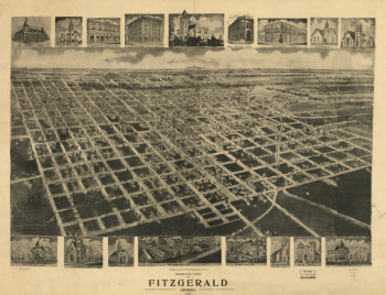
Bird's eye view of Fitzgerald, Georgia 1908.
Price range: $39.95 through $69.95 -
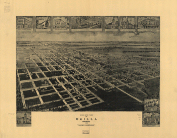
Birds eye view of Ocilla, Georgia 1908.
Price range: $39.95 through $69.95 -
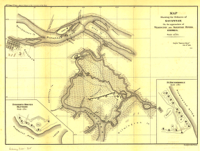
Defences of Savannah
Price range: $39.95 through $69.95 -
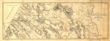
The country embracing the various routes surveyed for the Western & Atlantic Rail Road of Georgia
Price range: $39.95 through $69.95 -
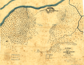
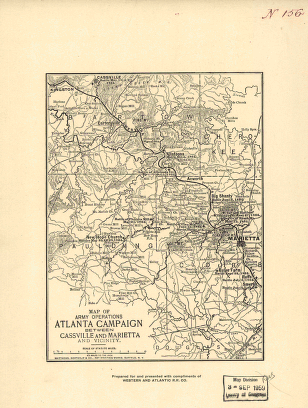
Map of army operations Atlanta campaign between Cassville and Mariette and vicinity
Price range: $39.95 through $69.95 -
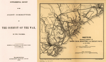
Sketch showing position of Boyd's Neck, Honey Hill, and Devaux' Neck
Price range: $39.95 through $69.95 -
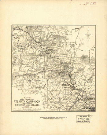
Map of army operations Atlanta campaign between Kingston and Atlanta
Price range: $39.95 through $69.95 -
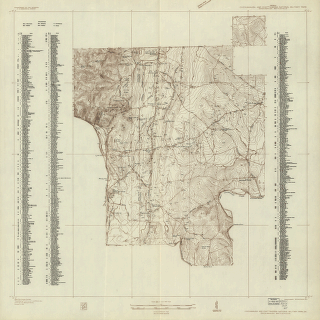
Map of the Atlanta campaign. [May-Sept. 1864].
Price range: $39.95 through $69.95 -
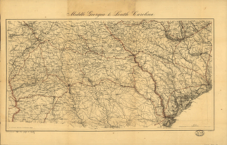
Middle Georgia & South Carolina / U.S. Coast Survey
Price range: $39.95 through $69.95 -
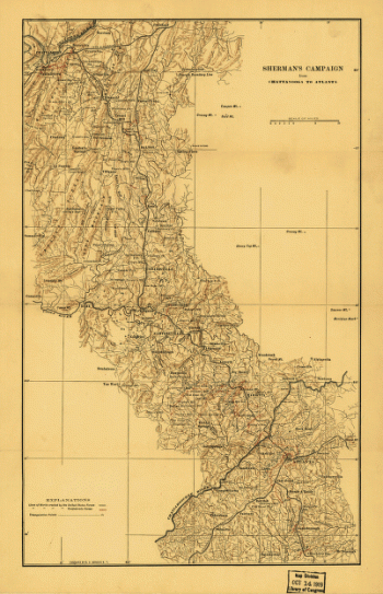
Sherman's campaign from Chattanooga to Atlanta from 1864
Price range: $39.95 through $69.95 -
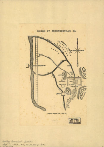
Prison at Andersonville, Ga.
Price range: $39.95 through $69.95 -
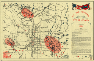
Civil War Centennial, city of Atlanta
Price range: $39.95 through $69.95 -
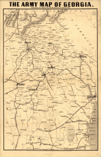
Army map of Georgia
Price range: $39.95 through $69.95 -
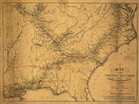
A map of the Georgia Rail Road and the several lines of railroad connecting with it, Febr. 1839.
Price range: $39.95 through $69.95 -
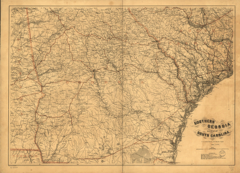
Southern Georgia and part of South Carolina / U.S. Coast Survey, A.D. Bache
Price range: $39.95 through $69.95 -
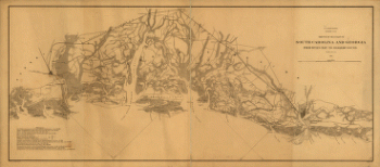
Sketch of sea coast of South Carolina and Georgia from Bull's Bay to Ossabaw Sound
Price range: $39.95 through $69.95 -
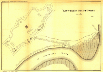
'Causten's Bluff' fort
Price range: $39.95 through $69.95 -
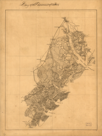
The environs of Savannah, Georgia
Price range: $39.95 through $69.95 -
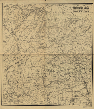
Northwestern Georgia
Price range: $39.95 through $69.95 -
Indexed railroad and county map of Georgia.
Price range: $39.95 through $69.95 -
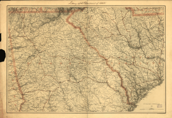
Northern Georgia and western and central South Carolina
Price range: $39.95 through $69.95 -
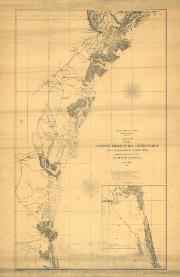
Sketch of the Atlantic coast of the United States from Savannah River to St. Mary's River
Price range: $39.95 through $69.95 -
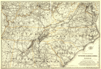
Proposed Tennessee, Alabama, and Georgia Railroad
Price range: $39.95 through $69.95 -
Line of the Virginia, Tennessee, & Georgia Air
Price range: $39.95 through $69.95 -
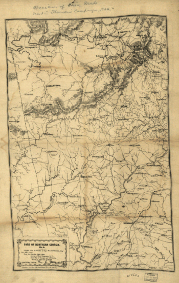
Part of northern Georgia : no. 2
Price range: $39.95 through $69.95 -
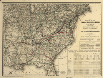
The Virginia, Tennessee, and Georgia Air Line
Price range: $39.95 through $69.95 -
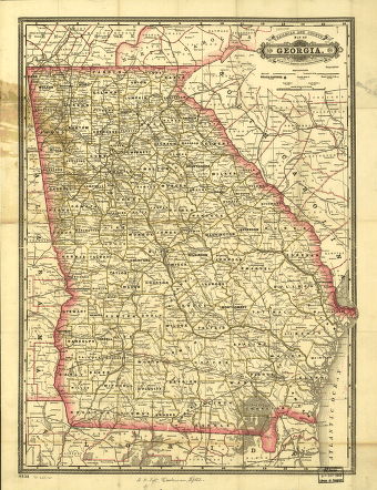
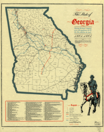
The State of Georgia
Price range: $39.95 through $69.95 -
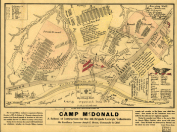
Camp McDonald
Price range: $39.95 through $69.95 -
Map of the seat of war, in South Carolina, and Georgia
Price range: $39.95 through $69.95 -
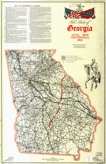
The State of Georgia, Civil War Centennial, 1864
Price range: $39.95 through $69.95 -
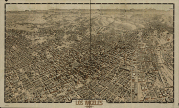
Los Angeles 1909.
Price range: $39.95 through $69.95 -
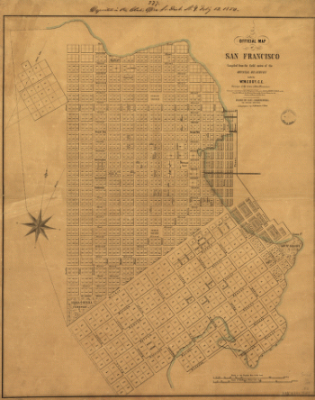
Official map of San Francisco.
Price range: $39.95 through $69.95 -
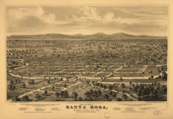
Bird's eye view of Santa Rosa, Sonoma County, Cal., 1876.
Price range: $39.95 through $69.95 -
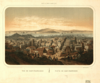
Vue de San-Francisco Vista de San-Francisco
Price range: $39.95 through $69.95 -
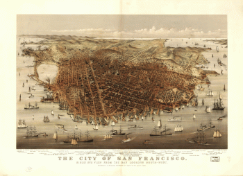
The city of San Francisco. Birds eye view from the bay looking south-west.
Price range: $39.95 through $69.95 -
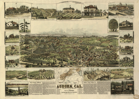
Auburn, Cal.
Price range: $39.95 through $69.95
![Map of the Atlanta campaign. [May-Sept. 1864].](https://www.ushistoricalarchive.com/wp-content/uploads/nc/data/products/im/sm/ga/b29.gif)