-
![[Zehn Karten und Ansichten den Schlachtfelden des amerikanischen Unabhangigkeitskreiges in den Staaten Pennsylvanien und New York]](https://www.ushistoricalarchive.com/wp-content/themes/savoy/assets/img/placeholder.png)
[Zehn Karten und Ansichten den Schlachtfelden des amerikanischen Unabhangigkeitskreiges in den Staaten Pennsylvanien und New York]
Price range: $39.95 through $69.95 -
[Zehn Karten und Ansichten den Schlachtfelden des amerikanischen Unabhangigkeitskreiges in den Staaten Pennsylvanien und New York]
Price range: $39.95 through $69.95 -
[Zehn Karten und Ansichten den Schlachtfelden des amerikanischen Unabhangigkeitskreiges in den Staaten Pennsylvanien und New York]
Price range: $39.95 through $69.95 -
[Zehn Karten und Ansichten den Schlachtfelden des amerikanischen Unabhangigkeitskreiges in den Staaten Pennsylvanien und New York]
Price range: $39.95 through $69.95 -
[Zehn Karten und Ansichten den Schlachtfelden des amerikanischen Unabhangigkeitskreiges in den Staaten Pennsylvanien und New York]
Price range: $39.95 through $69.95 -
[Zehn Karten und Ansichten den Schlachtfelden des amerikanischen Unabhangigkeitskreiges in den Staaten Pennsylvanien und New York]
Price range: $39.95 through $69.95 -
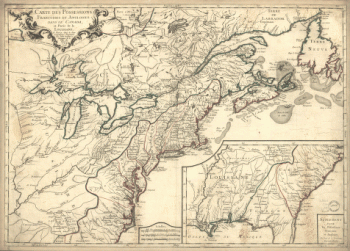
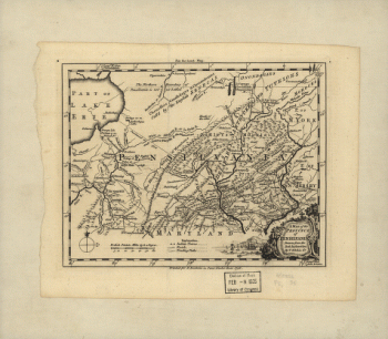
A map of the province of Pensilvania / drawn from the best authorities by T Kitchin gr
Price range: $39.95 through $69.95 -
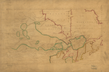
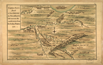
Captain Snow's scetch of the country by himself, and the best accounts he could receive from the Indian traders
Price range: $39.95 through $69.95 -
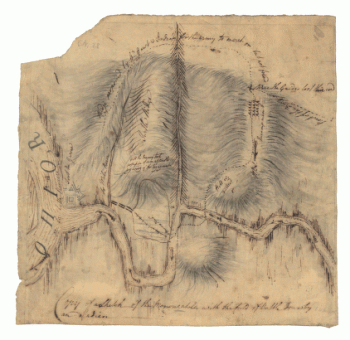
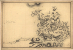
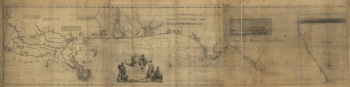
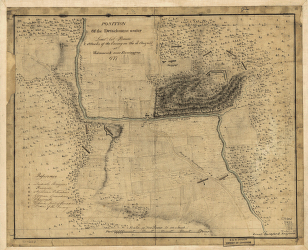
British camp at Trudruffrin from [sic] with the attack made by Major General Grey against the rebels near White Horse Tavern
Price range: $39.95 through $69.95 -
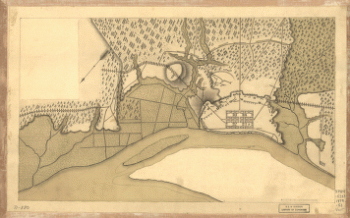
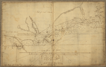
Plan of part of western front
Price range: $39.95 through $69.95 -
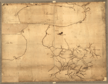
Copy of a sketch of the Monongahela, with the field of battle, done by an Indian
Price range: $39.95 through $69.95 -
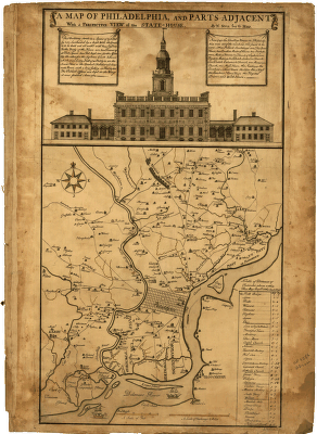
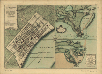
A map of Philadelphia and parts adjacent : with a perspective view of the State-House / by N Scull and G Heap , L Hebert sculpt
Price range: $39.95 through $69.95 -
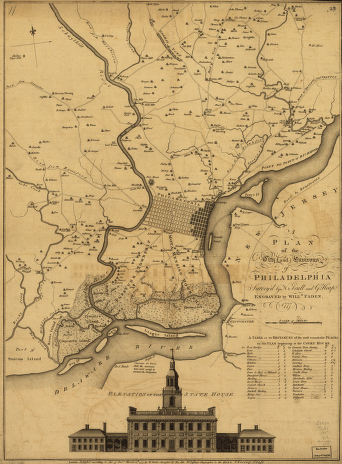
A plan of the city and environs of Philadelphia, survey'd by N Scull and G Heap Engraved by Will Faden
Price range: $39.95 through $69.95 -
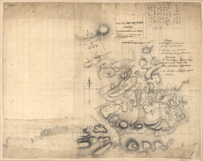
Battle of Brandywine, 11th Septr 1777, in which the rebels were defeated by the Army under the command of Genl Sir Willm Howe
Price range: $39.95 through $69.95 -
Battle of Brandywine, 11 Septr 1777
Price range: $39.95 through $69.95 -
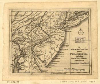
A Map of the country round Philadelphia including part of New Jersey, New York, Staten Island, & Long Island
Price range: $39.95 through $69.95 -
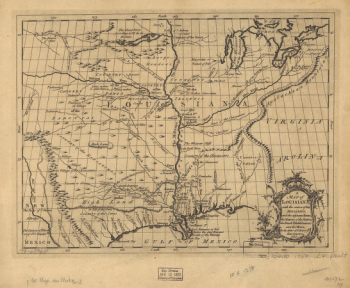
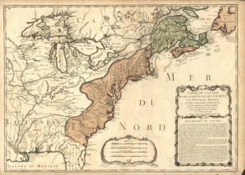
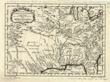
Carte des possessions francoises et angloises dans le Canada, et partie de la Louisiane, 1756 L Thevenard fil sculp
Price range: $39.95 through $69.95 -
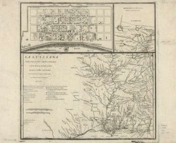
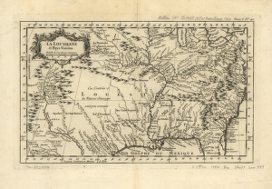
La Louisiane et pays voisins
Price range: $39.95 through $69.95 -
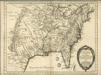
Carte de la Louisiane et pays voisins, pour servir a l'Histoire generale des voyages Par M B, ing de la marine
Price range: $39.95 through $69.95 -
Carte du Canada et de la Louisiane qui forment la Nouvelle France et des colonies angloises ou sont representez les pays contestez
Price range: $39.95 through $69.95 -
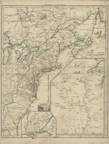
Canada et Louisiane, par le Sr le Rouge ingenieur geographe du Roy
Price range: $39.95 through $69.95 -
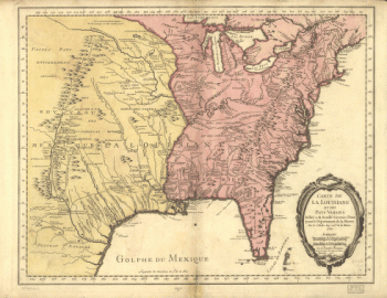
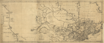
A map of Canada and the north part of Louisiana with the adjacent countrys By Thos Jefferys, geographer to His Majesty, 1762
Price range: $39.95 through $69.95 -
A map of Canada and the north part of Louisiana with the adjacent countrys By Thos Jefferys, geographer to His Majesty, 1762
Price range: $39.95 through $69.95 -
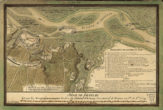
Siège de Savannah fait par les troupes francoises aux ordres du general d'Estaing vice-amiral de France, en 7bre, et 8bre 1779
Price range: $39.95 through $69.95 -
Savannah and its environs
Price range: $39.95 through $69.95 -
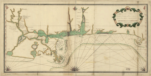
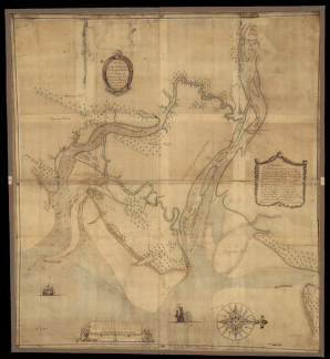
A plan of the inlets & rivers of Savannah & Warsaw in the Province of Georgia
Price range: $39.95 through $69.95 -
Map of West Florida B Romans, inv delin & in AEre incidit
Price range: $39.95 through $69.95 -
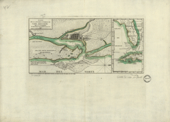
Plano de la ciudad y puerto de San Agustin de la Florida
Price range: $39.95 through $69.95 -
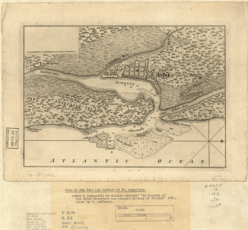
Plan of the town and harbour of St Augustine
Price range: $39.95 through $69.95 -
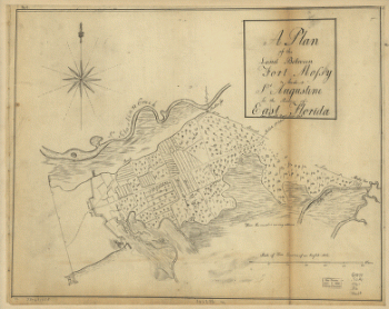
A plan of the land between Fort Mossy and St Augustine in the province of East Florida Sam Roworth, dept survr genl
Price range: $39.95 through $69.95 -
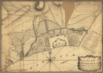
A plan of Pensacola and its environs in its present state, from an actual survey in 1778
Price range: $39.95 through $69.95 -
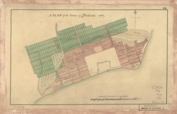
A Plan of the town of Pensacola, 1767
Price range: $39.95 through $69.95 -
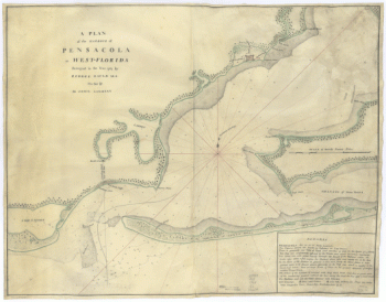
A plan of the harbour of Pensacola in West-Florida Surveyed in the year 1764 by George Gauld, MA The bar by Sir John Lindsay
Price range: $39.95 through $69.95 -
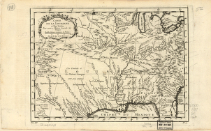
Carte de la Florida, de la Louisiane, et pays voisins : pour servir a l'Histoire generale des voyages / par M B, ing de la marine, 1757
Price range: $39.95 through $69.95 -
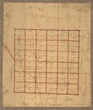
The Above is a plan of the town of Cabot, State of Vermont
Price range: $39.95 through $69.95 -
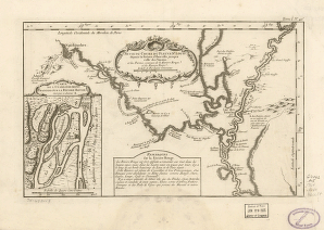
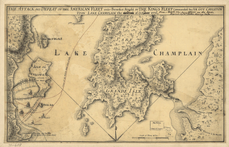
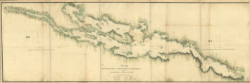
Plan, Lake Champlain from Fort St John's to Ticonderoga, with the soundings, rocks, shoals, and sands, surveyed in the years 1778, 1779
Price range: $39.95 through $69.95 -
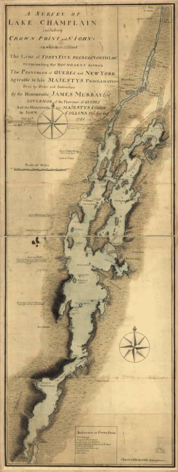
A survey of Lake Champlain
Price range: $39.95 through $69.95
![[Zehn Karten und Ansichten den Schlachtfelden des amerikanischen Unabhangigkeitskreiges in den Staaten Pennsylvanien und New York]](https://www.ushistoricalarchive.com/wp-content/uploads/nc/data/products/im/rw/south/b49-350x246.gif)
![[Zehn Karten und Ansichten den Schlachtfelden des amerikanischen Unabhangigkeitskreiges in den Staaten Pennsylvanien und New York]](https://www.ushistoricalarchive.com/wp-content/uploads/nc/data/products/im/rw/south/b48-350x243.gif)
![[Zehn Karten und Ansichten den Schlachtfelden des amerikanischen Unabhangigkeitskreiges in den Staaten Pennsylvanien und New York]](https://www.ushistoricalarchive.com/wp-content/uploads/nc/data/products/im/rw/south/b47-350x244.gif)
![[Zehn Karten und Ansichten den Schlachtfelden des amerikanischen Unabhangigkeitskreiges in den Staaten Pennsylvanien und New York]](https://www.ushistoricalarchive.com/wp-content/uploads/nc/data/products/im/rw/south/b46-350x245.gif)
![[Zehn Karten und Ansichten den Schlachtfelden des amerikanischen Unabhangigkeitskreiges in den Staaten Pennsylvanien und New York]](https://www.ushistoricalarchive.com/wp-content/uploads/nc/data/products/im/rw/south/b45-350x241.gif)
![[Zehn Karten und Ansichten den Schlachtfelden des amerikanischen Unabhangigkeitskreiges in den Staaten Pennsylvanien und New York]](https://www.ushistoricalarchive.com/wp-content/uploads/nc/data/products/im/rw/south/b44-350x243.gif)
![British camp at Trudruffrin from [sic] with the attack made by Major General Grey against the rebels near White Horse Tavern](https://www.ushistoricalarchive.com/wp-content/uploads/nc/data/products/im/rw/south/b41.gif)