Under the direction of Lieut. Col. S. H. Long, Chief Engineer, 1837, U.S. Topographical Bureau M. H. Stansbury, Del. Cooper, J. F. CREATED/PUBLISHED [n.p., 1837] NOTES Scale cal 1:325,000. SUMMARY Includes area from Chattahoochee River between Warsaw and Cambelltown, and west to the Tennessee boundary. Shows cities, townships, roads, drainage, and relief by hachures. The 138-mile route was opened in 1850.

The country embracing the various routes surveyed for the Western & Atlantic Rail Road of Georgia
$17.95 – $47.95
SKU: smga33
Related products
-

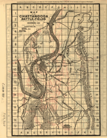
Chattanooga battle-fields, November, 1863
$17.95 – $47.95 -
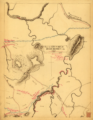
From the Etowah to Burnt-Hickory, Ga.
$17.95 – $47.95 -
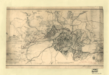
Map illustrating the siege of Atlanta, Ga.
$17.95 – $47.95 -
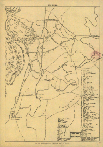
Map of Chickamauga National Military Park.
$17.95 – $47.95