-

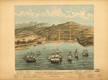
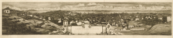
View of San Francisco, formerly Yerba Buena, in 1846-7 before the discovery of gold.
Price range: $39.95 through $69.95 -
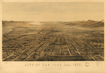
City of San Jose, Cal.
Price range: $39.95 through $69.95 -
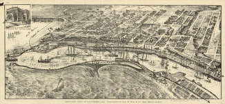
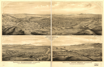
Bird's-eye view of San Pedro, Cal.
Price range: $39.95 through $69.95 -
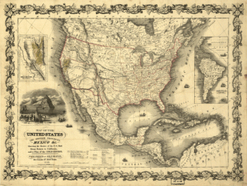
Map of the United States, the British provinces, Mexico &c.
Price range: $39.95 through $69.95 -
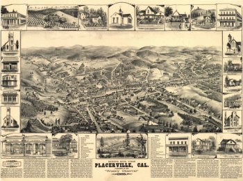
Bird's eye view, Placerville, Cal.
Price range: $39.95 through $69.95 -
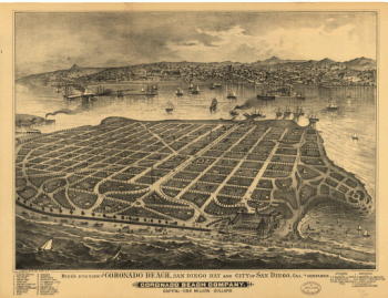
Bird's eye view of Coronado Beach, San Diego Bay and city of San Diego, Cal. in distance
Price range: $39.95 through $69.95 -
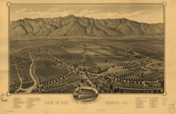
View of San Gabriel, Cal.
Price range: $39.95 through $69.95 -
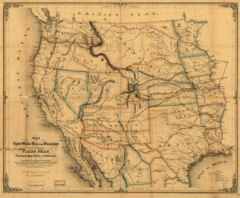
Map of the United States west of the Mississippi
Price range: $39.95 through $69.95 -
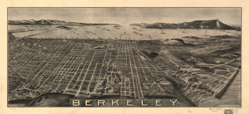
Berkeley.
Price range: $39.95 through $69.95 -
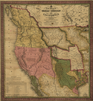
A new map of Texas, Oregon and California.
Price range: $39.95 through $69.95 -
San Francisco.
Price range: $39.95 through $69.95 -
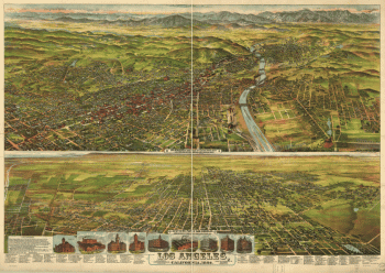
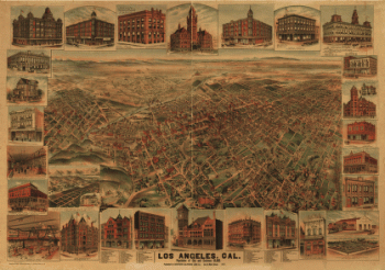
Los Angeles, California, 1894. Drawn & lithographed by B. W. Pierce.
Price range: $39.95 through $69.95 -
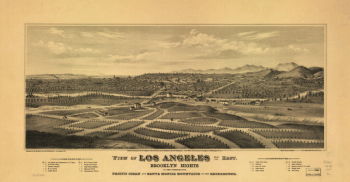
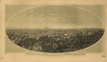
View of Los Angeles from the east
Price range: $39.95 through $69.95 -
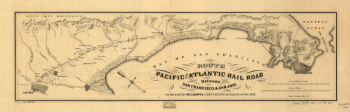
Route of the Pacific and Atlantic Rail Road between San Francisco, & San Jose
Price range: $39.95 through $69.95 -
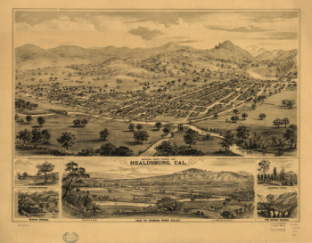
Bird's eye view of Healdsburg, Cal. Drawn by E. S. Glover. A.L. Bancroft & Co., lith.
Price range: $39.95 through $69.95 -
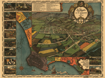
Los Angeles as it appeared in 1871. Gores, fecit.
Price range: $39.95 through $69.95 -
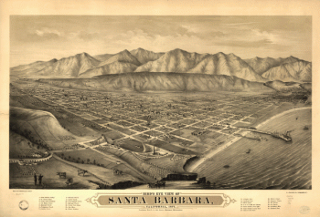
Bird's eye view of Santa Barbara, California, 1877
Price range: $39.95 through $69.95 -
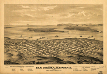
Bird's eye view of San Diego, California 1876. Drawn by E. S. Glover. A.L. Bancroft & Co., lithographers.
Price range: $39.95 through $69.95 -
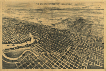
View of the city of Stockton, the Manufacturing City of California
Price range: $39.95 through $69.95 -
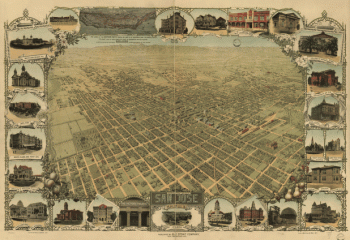
San Jose, California. Copyright by N. J. Stone. Lith. Britton & Rey.
Price range: $39.95 through $69.95 -
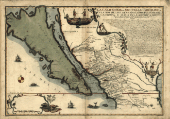
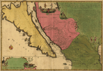
La Californie ou Nouvelle Caroline
Price range: $39.95 through $69.95 -
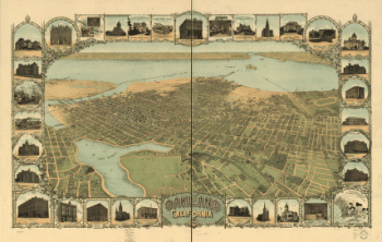
Oakland, California, 1900. Mutual L. & Lith. Co.
Price range: $39.95 through $69.95 -
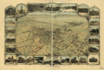
Bakersfield, Kern County, California, 1901. Photo-lith. Britton & Rey.
Price range: $39.95 through $69.95 -
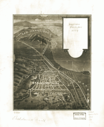
San Mateo Park.
Price range: $39.95 through $69.95 -
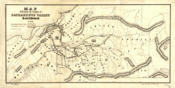
Map showing the location of Sacramento Valley Railroad, Cal.
Price range: $39.95 through $69.95 -
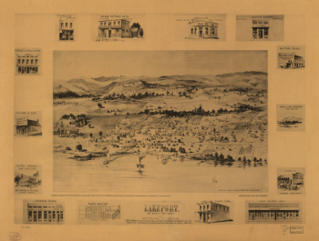
Lakeport, Lake County, California, the Switzerland of America.
Price range: $39.95 through $69.95 -
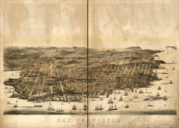
San Francisco Bird's-eye view / drawn & lithographed by C.B. Gifford.
Price range: $39.95 through $69.95 -
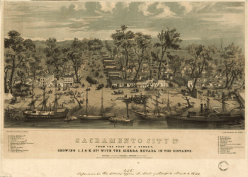
Sacramento city, Ca. from the foot of J. Street, showing I., J., & K. Sts. with the Sierra Nevada in the distance
Price range: $39.95 through $69.95 -
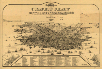
Graphic chart of the city and county of San Francisco
Price range: $39.95 through $69.95 -
Los Angeles, Cal. S.F. Cook del. ; lith. Britton & Rey, S.F.
Price range: $39.95 through $69.95 -
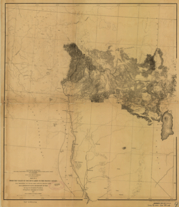
From the valley of the Mud Lakes to the Pacific Ocean.
Price range: $39.95 through $69.95 -
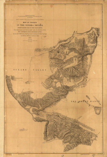
Map of passes in the Sierra Nevada from Walker's Pass to the Coast Range : from explorations and surveys
Price range: $39.95 through $69.95 -
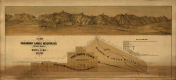
View of the Panamint Range Mountains, mines, mills and town site
Price range: $39.95 through $69.95 -
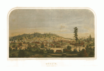
Shasta, Shasta County, Cal. drawn by Kuchel & Dresel ; print by Britton & Rey.
Price range: $39.95 through $69.95 -
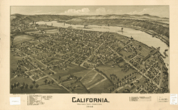
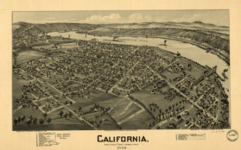
California, Washington County, Pennsylvania 1902. Drawn by T. M. Fowler.
Price range: $39.95 through $69.95 -
La Californie ou Nouvelle Caroline
Price range: $39.95 through $69.95 -
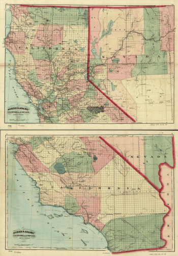
New commercial and topographical rail road map & guide of California and Nevada
Price range: $39.95 through $69.95 -
Los Angeles, Cal., population of city and environs 65,000.
Price range: $39.95 through $69.95 -
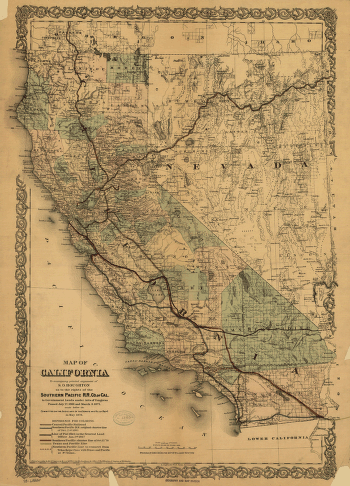
Map of California
Price range: $39.95 through $69.95 -
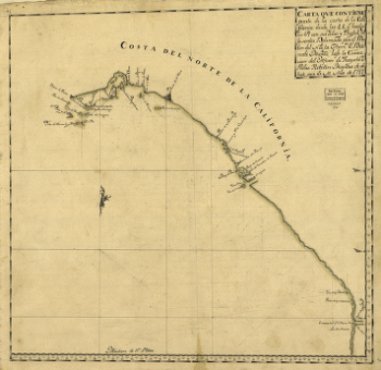
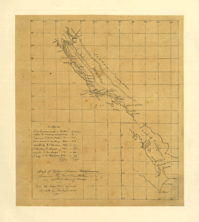
Carta que contiene parte de la costa de la California.
Price range: $39.95 through $69.95 -
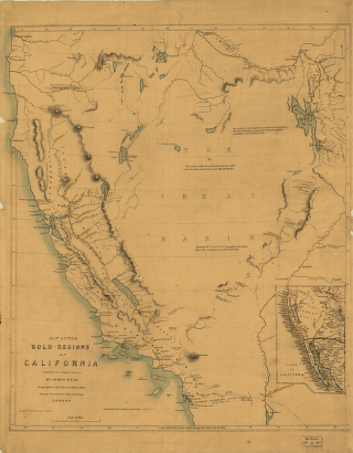
Map of the gold regions of California.
Price range: $39.95 through $69.95 -
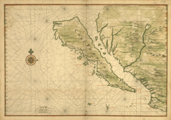
Map of California shown as an island
Price range: $39.95 through $69.95 -
Birds eye view of Los Angeles, California. A.L. Bancroft & Co., lith.
Price range: $39.95 through $69.95 -
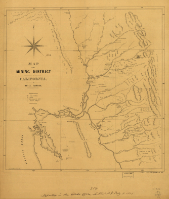
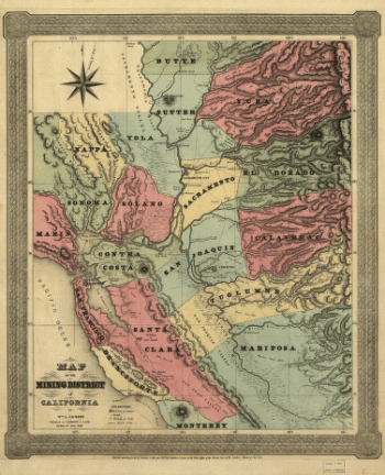
Map of the mining district of California.
Price range: $39.95 through $69.95 -
Map of Upper & Lower California showing the military stations and distribution of troops.
Price range: $39.95 through $69.95 -
California, Washington County, Pennsylvania, 1902
Price range: $39.95 through $69.95 -
Map of the mining district of California.
Price range: $39.95 through $69.95 -
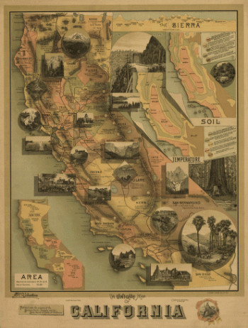
The unique map of California.
Price range: $39.95 through $69.95