Revolutionary War Maps
-

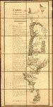
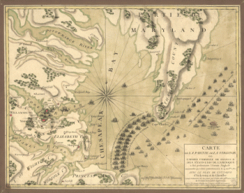
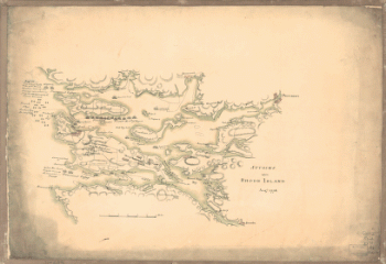
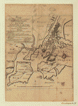
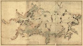
Attacks upon Rhode Island, Augt 1778
Price range: $39.95 through $69.95 -
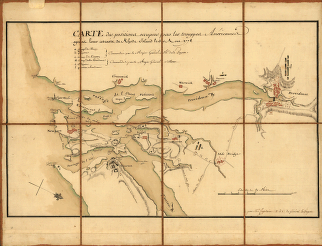
Attaque de l'armee des provinciaux dans Long Island du 27 aoust 1776
Price range: $39.95 through $69.95 -
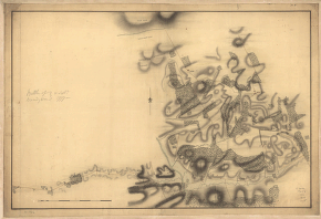
Battle of Brandywine, 11 Septr 1777
Price range: $39.95 through $69.95 -
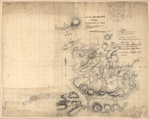
Battle of Brandywine, 11th Septr 1777, in which the rebels were defeated by the Army under the command of Genl Sir Willm Howe
Price range: $39.95 through $69.95 -
Battle of Bunker Hill
Price range: $39.95 through $69.95 -
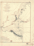
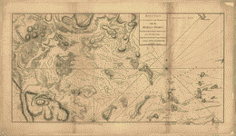
Boston Harbour, with the surroundings
Price range: $39.95 through $69.95 -
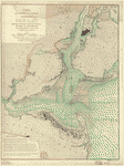
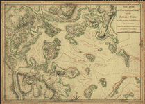
Boston, its environs and harbour
Price range: $39.95 through $69.95 -
Boston, its environs and harbour
Price range: $39.95 through $69.95 -
Boston, S West part No 25
Price range: $39.95 through $69.95 -
Bowles's new pocket map of the United States of America
Price range: $39.95 through $69.95 -
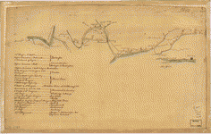
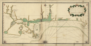
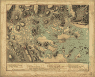
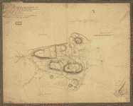
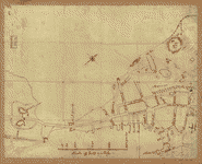
British camp at Trudruffrin from [sic] with the attack made by Major General Grey against the rebels near White Horse Tavern
Price range: $39.95 through $69.95 -
British outposts between Burlington and New Bridge, New Jersey
Price range: $39.95 through $69.95 -
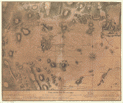
Bunker Hill–rough sketch
Price range: $39.95 through $69.95 -
Buzzards Bay and shoals of Nantucket
Price range: $39.95 through $69.95 -
Buzzards Bay and shoals of Nantucket
Price range: $39.95 through $69.95 -
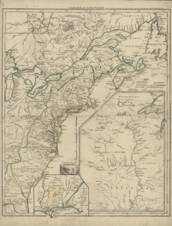
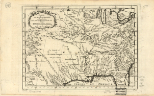
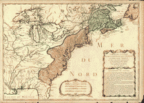
Canada et Louisiane
Price range: $39.95 through $69.95 -
Canada et Louisiane
Price range: $39.95 through $69.95 -
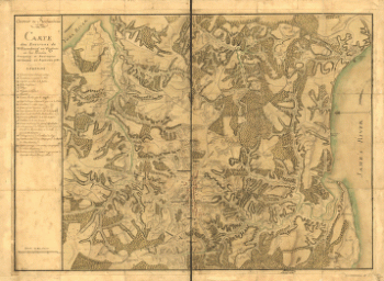
Canada et Louisiane, par le Sr le Rouge ingenieur geographe du Roy
Price range: $39.95 through $69.95 -
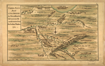
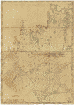
Captain Snow's scetch of the country by himself, and the best accounts he could receive from the Indian traders
Price range: $39.95 through $69.95 -
Carte de l'affaire de Montmouth
Price range: $39.95 through $69.95 -
Carte de l'entree de la rivière d'Hudson
Price range: $39.95 through $69.95 -
Carte de l'entree de la rivière d'Hudson
Price range: $39.95 through $69.95 -
Carte de l'entree de la rivière d'Hudson
Price range: $39.95 through $69.95 -
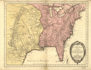
Carte de la Florida, de la Louisiane, et pays voisins : pour servir a l'Histoire generale des voyages / par M B, ing de la marine, 1757
Price range: $39.95 through $69.95 -
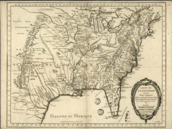
Carte de la Louisiane et pays voisins, pour servir a l'Histoire generale des voyages Par M B, ing de la marine
Price range: $39.95 through $69.95 -
Carte des possessions francoises et angloises dans le Canada
Price range: $39.95 through $69.95 -
Carte des possessions francoises et angloises dans le Canada, et partie de la Louisiane, 1756 L Thevenard fil sculp
Price range: $39.95 through $69.95 -
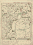
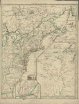
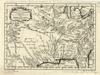
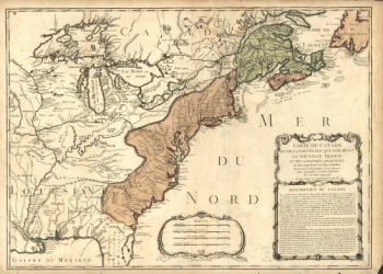
Carte du Canada et de la Louisiane
Price range: $39.95 through $69.95 -
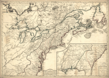
Carte du Canada et de la Louisiane qui forment la Nouvelle France et des colonies angloises ou sont representez les pays contestez
Price range: $39.95 through $69.95 -
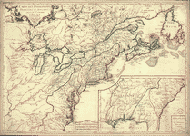
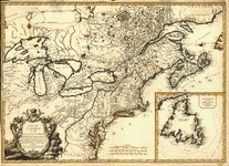
Carte du Canada et des Etats-Unis de l'Amerique Septentrionale
Price range: $39.95 through $69.95 -
Carte du port et havre de Boston
Price range: $39.95 through $69.95 -
Carte von dem Hafen und der Stadt Boston
Price range: $39.95 through $69.95 -
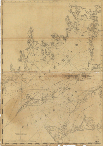
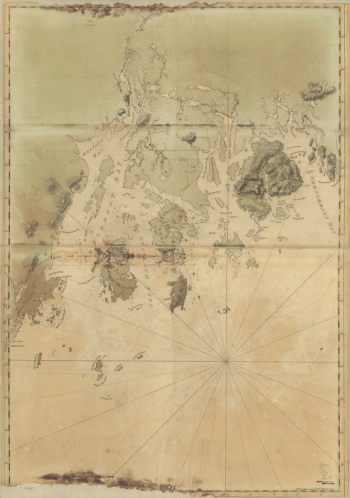
Chart of Buzzards Bay and Vineyard Sound
Price range: $39.95 through $69.95 -
Chart of Buzzards Bay and Vineyard Sound
Price range: $39.95 through $69.95 -
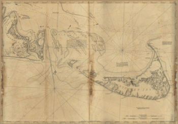
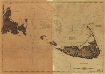
Chart of Nantucket Island and the eastern half of Martha's Vineyard
Price range: $39.95 through $69.95 -
Chart of Nantucket Island and the eastern half of Martha's Vineyard
Price range: $39.95 through $69.95 -
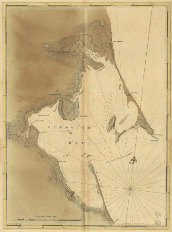
Chart of Plymouth Bay
Price range: $39.95 through $69.95 -
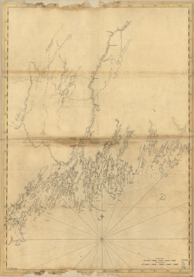
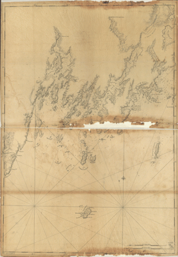
Coast of Maine from Frenchman Bay to Mosquito Harbor
Price range: $39.95 through $69.95 -
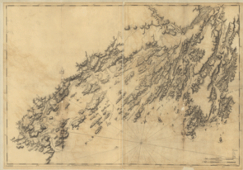
Coast of Maine from Mosquito Head to Spurwink River
Price range: $39.95 through $69.95 -
Coast of Maine from Rockland Harbor to Pemaquid Point
Price range: $39.95 through $69.95 -
Coast of Maine from Salter Island to Portland Head
Price range: $39.95 through $69.95
![British camp at Trudruffrin from [sic] with the attack made by Major General Grey against the rebels near White Horse Tavern](https://www.ushistoricalarchive.com/wp-content/uploads/nc/data/products/im/rw/south/b41.gif)