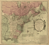
The British possessions of Canada, Nova Scotia, and Newfoundland, with the French and Spanish territories of Louisiana and Florida, as settled by the preliminary articles of peace signed at Versailles the 20th. Jany. 1783. Bowles, Carington, 1724-1793. CREATED/PUBLISHED London, 1784. NOTES Scale ca. 1:6,500,000. Hand colored. Relief shown pictorially. Prime meridian: Ferro and London.


