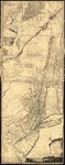
Par le Sr. Robert de Vaugondy, Geog. Ord. du Roi … et Censeur Royal. Robert de Vaugondy, Gilles, 1688-1766. CREATED/PUBLISHED Paris : Chez Fortin, Ing'r mecanicien du Roi pour les globes et sphères, 1778. NOTES Covers Canada east of Lake Superior and south of James Bay, covers U.S. north of Albemarle Bay (N.C.). Relief shown pictorially. Third state. Meridians numbered eastward from unspecified prime (Montreal at 3050E). Believed to be the earlist map to use the name United States of America (in any language). Watermarked (unclear wording with pointed cross at center of embellished circle with pendant cross). Includes Newfoundland inset and pictorial title cartouche.
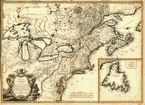
Carte du Canada et des Etats-Unis de l'Amerique Septentrionale
$17.95 – $47.95
SKU: rwcaar300000
Related products
-

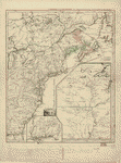
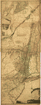
The provinces of New York and New Jersey
$17.95 – $47.95 -
Canada et Louisiane
$17.95 – $47.95 -
The provinces of New York and New Jersey
$17.95 – $47.95 -
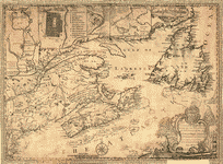
This map of the province of Nova-Scotia and parts adjacent
$17.95 – $47.95