-

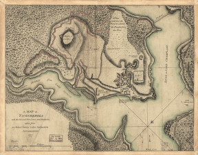
Ticonderoga
Price range: $39.95 through $69.95 -
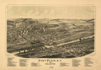
Fort Plain, N.Y. and Nelliston. Burleigh Lithographing Establishment.
Price range: $39.95 through $69.95 -
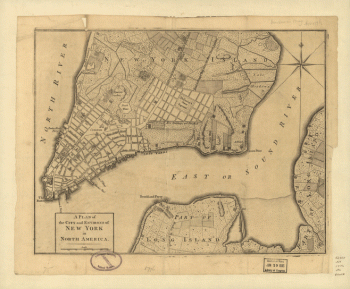
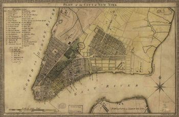
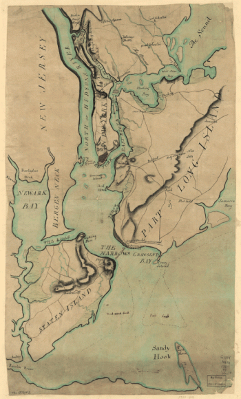
A plan of the city and environs of New York in North America.
Price range: $39.95 through $69.95 -
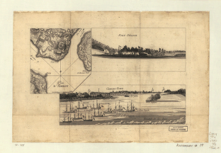
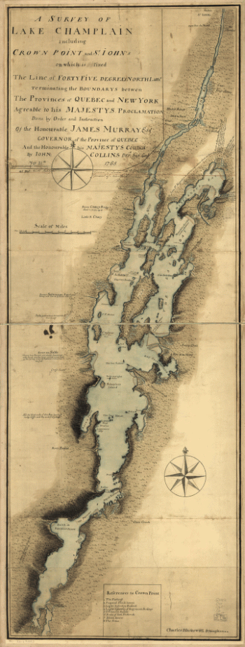
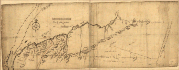
A survey of Lake Champlain including Crown Point and St. Iohn's
Price range: $39.95 through $69.95 -
Plan of the city of New York. I. M. Comb, Junr., delt. C. Tiebout, sculpt.
Price range: $39.95 through $69.95 -
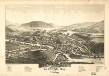
Luzerne, N.Y. and Hadley. Drawn & published by L. R. Burleigh.
Price range: $39.95 through $69.95 -
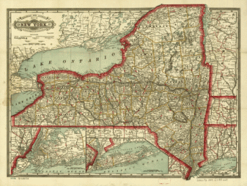
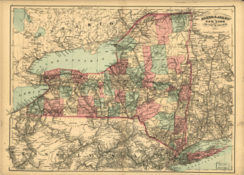
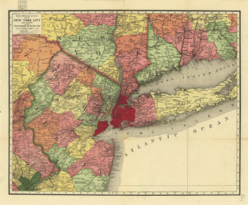
Cram's township and rail road map of New York.
Price range: $39.95 through $69.95 -
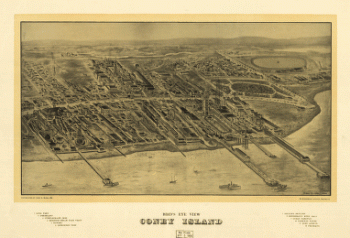
Bird's eye view Coney Island.
Price range: $39.95 through $69.95 -
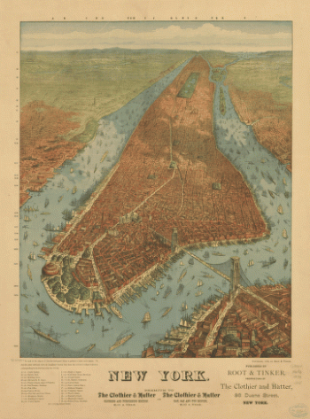
New York. J. W. Williams, del.
Price range: $39.95 through $69.95 -
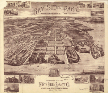
Bay Side Park, 3d ward, borough of Queens, New York City.
Price range: $39.95 through $69.95 -
Bird's-eye-view of Brooklyn] Compliments of Woldmere Realty Co.
Price range: $39.95 through $69.95 -
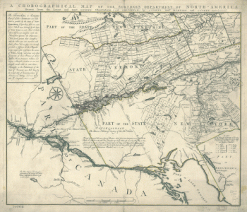
A chorographical map of the Northern Department of North-America
Price range: $39.95 through $69.95 -
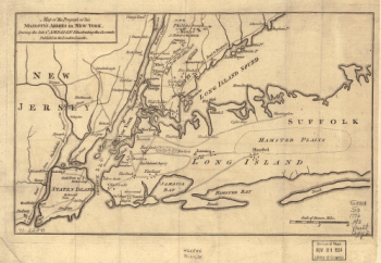
Map of the progress of His Majesty's armies in New York, during the late campaign, illustrating the accounts.
Price range: $39.95 through $69.95 -
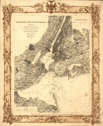
New York City and environs.
Price range: $39.95 through $69.95 -
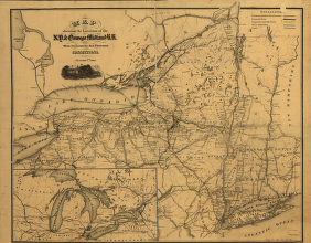
Map showing the location of the N.Y. & Oswego Midland R.R. with existing and proposed connection, January 1st 1869
Price range: $39.95 through $69.95 -
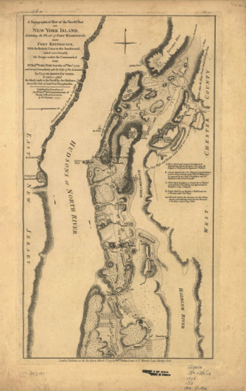
A topographical map of the northn. part of New York Island
Price range: $39.95 through $69.95 -
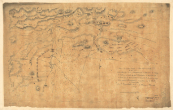
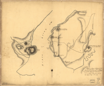
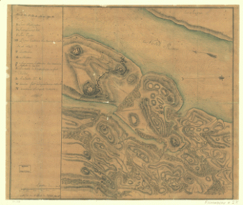
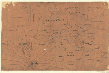
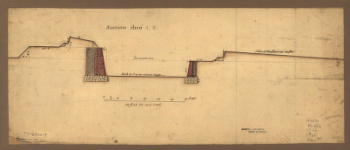
Skecth [sic] of the road from Kings Bridge to White Plains.
Price range: $39.95 through $69.95 -
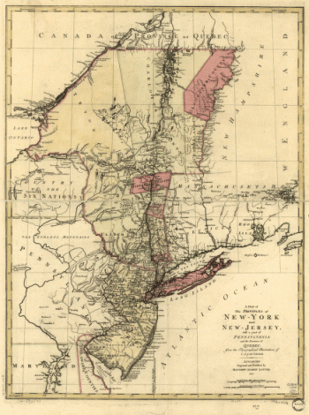
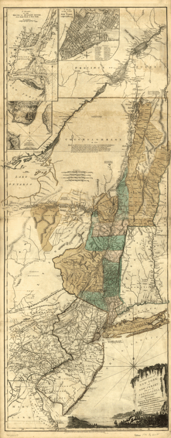
A map of the provinces of New-York and New Jersey, with a part of Pennsylvania and the Province of Quebec
Price range: $39.95 through $69.95 -
Asher & Adams' New York and part of Ontario.
Price range: $39.95 through $69.95 -
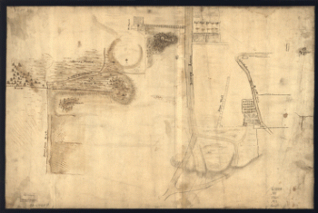
Draft of the lands disputed by Philipse Patent against Beekmans & Rambaults.
Price range: $39.95 through $69.95 -
Disposition of British troops, with fortifications north of Fort Knipehausen, i.e. Fort Washington to Fort Independence.
Price range: $39.95 through $69.95 -
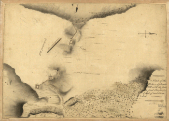
A Plan of the works on Spikendevil Hill with the ground in front, protracted from a scale of 200 feet to an inch
Price range: $39.95 through $69.95 -
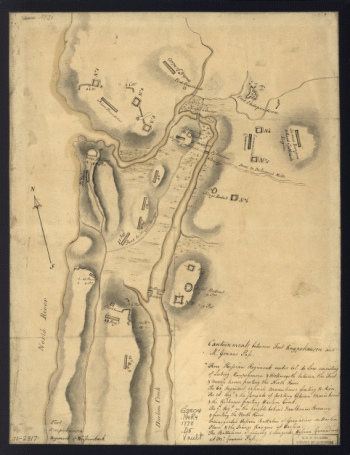
Sketch of Stoney & Verplank's Points upon the North River
Price range: $39.95 through $69.95 -
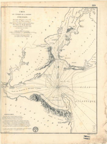
Carte de l'entrée de la rivière d'Hudson, dépuis Sandy-Hook jusques à New-York avec les bancs, sondes, marques de navigation
Price range: $39.95 through $69.95 -
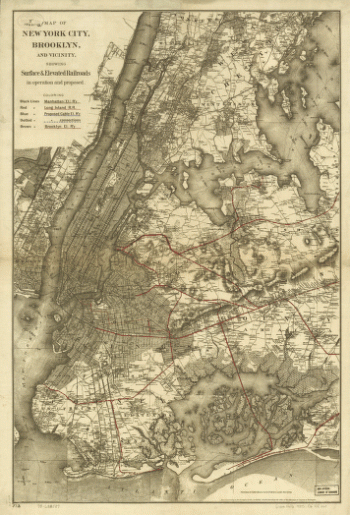
Map of New York City, Brooklyn, and vicinity showing surface & elevated railroads in operation and proposed
Price range: $39.95 through $69.95 -
The provinces of New York and New Jersey; with part of Pensilvania, and the Province of Quebec
Price range: $39.95 through $69.95 -
Nord de l'Ile de New-York.
Price range: $39.95 through $69.95 -
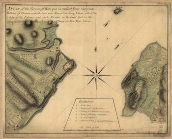
A plan of the Narrows of Hells-gate in the East River
Price range: $39.95 through $69.95 -
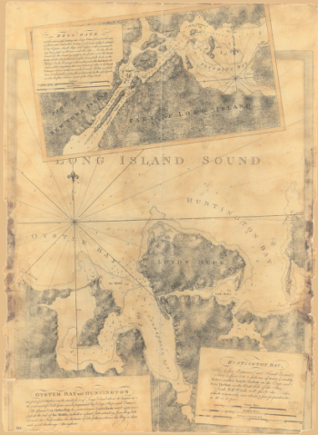
Oyster Bay and Huntington. Huntington Bay.
Price range: $39.95 through $69.95 -
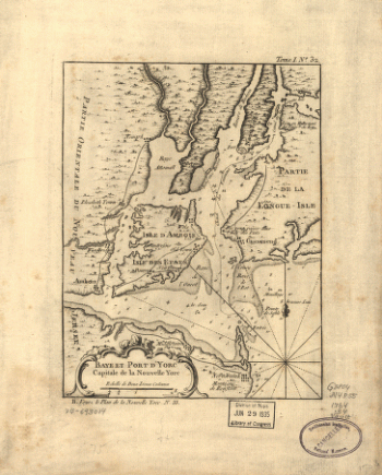
Baye et port d'Yorc, capitale de la Nouvelle Yorc.
Price range: $39.95 through $69.95 -
Rand, McNally & Co.'s map of New York city and vicinity showing steam railroads and electric lines.
Price range: $39.95 through $69.95 -
Environs de New-York, de Long-Island, etc.
Price range: $39.95 through $69.95 -
Map showing the Bowery Lane area of Manhattan.
Price range: $39.95 through $69.95 -
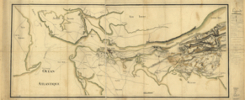
Position du camp de l'armée combinée a Philipsburg du 6 juillet au 19 aoust.
Price range: $39.95 through $69.95 -
Designs for fortifying Governors Island near New York.
Price range: $39.95 through $69.95 -
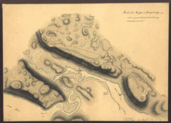
Sketch of the Heights of Kingsbridge 1777, with the proposed redoubts coloured orange
Price range: $39.95 through $69.95 -
Plan of New York and Staten Islands with part of Long Island.
Price range: $39.95 through $69.95 -
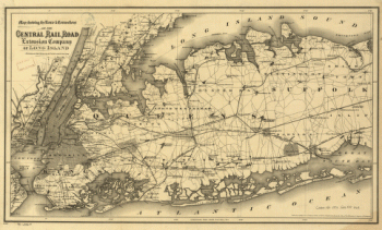
Map showing the route & connections of the Central Rail Road Extension Company of Long Island.
Price range: $39.95 through $69.95 -
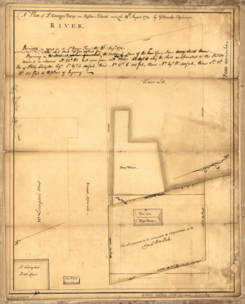
A plan of St. Georges Ferry on Nassau-Island made the 10th August 1774, by G. Bancker, city surveyor.
Price range: $39.95 through $69.95 -
Manatvs gelegen op de Noot [sic] Riuier.
Price range: $39.95 through $69.95 -
Plan d'Amboy. Vues de la rade de Charles-Town et de Fort Sulivan, mai 1780.
Price range: $39.95 through $69.95 -
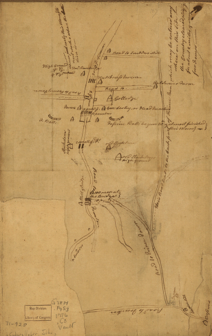
Plan de notre camp à New Brunswick
Price range: $39.95 through $69.95 -
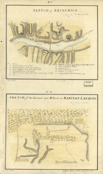
Sketch of Brunswick. Sketch of the ground near Mr. Low's at Rariton Landing.
Price range: $39.95 through $69.95 -
Plan of Princeton, Dec. 31, 1776.
Price range: $39.95 through $69.95 -
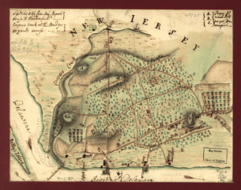
Map of the environs of Camden, N.J.
Price range: $39.95 through $69.95 -
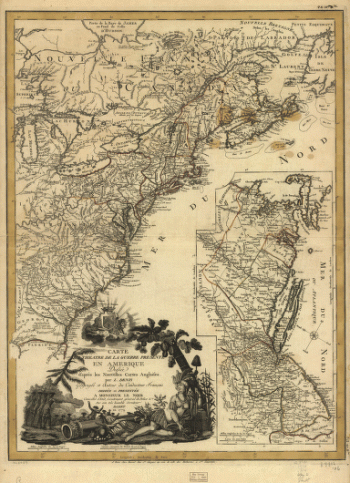
Carte du theatre de la guerre presente en Amerique, dressée d'après les nouvelles cartes anglaises par L. Denis.
Price range: $39.95 through $69.95 -
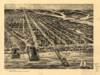
Aeroplane view of Asbury Park, N.J. showing location of 'Asbury Park Estates' among the hills on Asbury Ave
Price range: $39.95 through $69.95 -
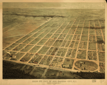
Birds eye view of Egg Harbor City, N.J. Herline & Hensel, lith.
Price range: $39.95 through $69.95
![Bird's-eye-view of Brooklyn] Compliments of Woldmere Realty Co.](https://www.ushistoricalarchive.com/wp-content/uploads/nc/data/products/im/sm/ny/b38-350x370.gif)
![Skecth [sic] of the road from Kings Bridge to White Plains.](https://www.ushistoricalarchive.com/wp-content/uploads/nc/data/products/im/sm/ny/b29-350x507.gif)
![Manatvs gelegen op de Noot [sic] Riuier.](https://www.ushistoricalarchive.com/wp-content/uploads/nc/data/products/im/sm/ny/b1-350x251.gif)