Exhibiting the plan of Fort Washington, now Fort Knyphausen, with the rebels lines to the southward, which were forced by the troops under the command of the Rt. Honble. Earl Percy on the 16th. Novr. 1776, and survey'd immediately after by order of His Lordship, by Claude Joseph Sauthier. To which is added the attack made to the northd. by the Hessians, survey'd by order of Lieutt. Genl. Knyphausen. Published by permission of the Rt. Honble. the Commissioners of Trade & Plantations. Sauthier, Claude Joseph. CREATED/PUBLISHED London, W. Faden, 1777. NOTES Scale ca. 1:20,000. Relief shown by hachures
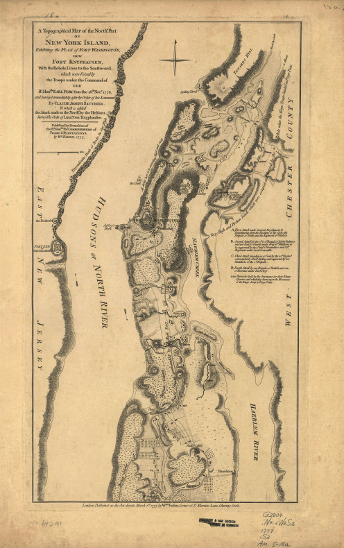
A topographical map of the northn. part of New York Island
$17.95 – $47.95
SKU: smny30
Related products
-

West Point.
$17.95 – $47.95
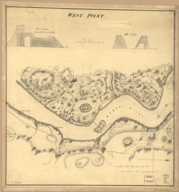
![Topographic map of West Point, Constitution Island, and vicinity, N.Y.] / T.B.J. Weld.](https://www.ushistoricalarchive.com/wp-content/uploads/nc/data/products/im/sm/ny/b83-350x414.gif)