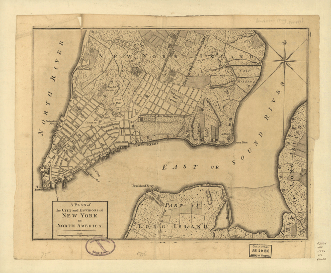
CREATED/PUBLISHED [London : s.n., 1776] NOTES General street map showing selected letter-keyed buildings in built-up area and field lines with generalized land use in rural areas. Relief shown by hachures. Also shows 'Road to Kings Bridge where the Rebels mean to make a stand' and 'Road to Kepps Bay where the Kings troops landed'. Also covers rural part of Manhattan Island up to present-day 14th Street and small parts of Long Island. Removed from: The Universal Magazine of Knowledge and Pleasure, London, Nov. 1776, v. 59.


