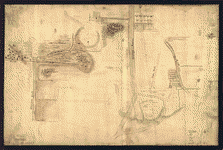
Drawn from surveys compiled by Thomas Millidge, major 1st Battalion, New Jersey Volunteers, 1780. This map is drawn for Oliver Delancey, Esquire, adjutant general of N: America & major of the 17th Light Dragoons, by Andrew Skinner, 1781. Skinner, Andrew, geographer. CREATED/PUBLISHED [1781] NOTES Scale ca. 1:126,000. Manuscript, pen-and-ink and watercolor. Relief shown by shading. Shows area between the Hudson and Delaware Rivers, from Kingston, N.Y. to Trenton, including names of some property owners.
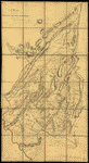
A map containing part of the Provinces of New York and New Jersey
$17.95 – $47.95
SKU: rwnyar105300
Related products
-

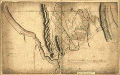
Map showing the Bowery Lane area of Manhattan
$17.95 – $47.95 -
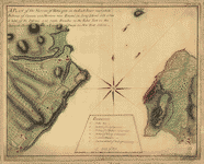
A plan of the Narrows of Hells-gate in the East River
$17.95 – $47.95 -
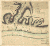
Position of the army on the 8th Octbr 1777
$17.95 – $47.95