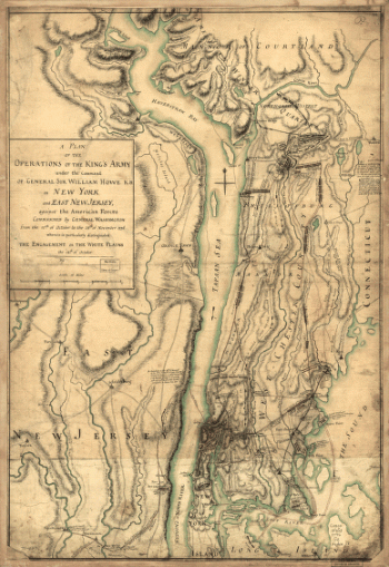
New Jersey
-

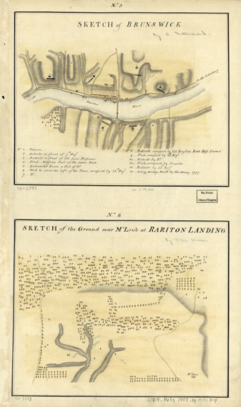
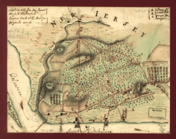
Plan de notre camp à New Brunswick
$17.95 – $47.95 -
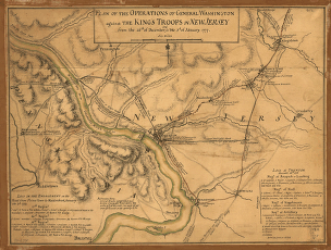
Plan of Princeton, Dec. 31, 1776.
$17.95 – $47.95 -
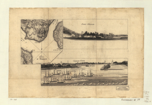
Map of the environs of Camden, N.J.
$17.95 – $47.95 -
Birds eye view of Egg Harbor City, N.J. Herline & Hensel, lith.
$17.95 – $47.95 -
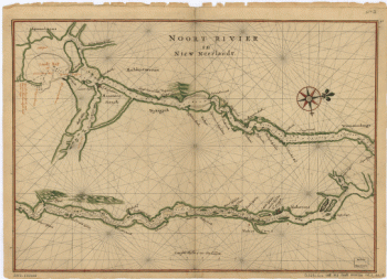
Noort Rivier in Niew Neerlandt.
$17.95 – $47.95 -
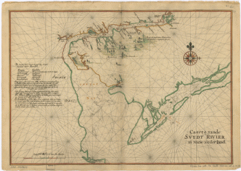
Caert vande Svydt Rivier in Niew Nederland.
$17.95 – $47.95 -
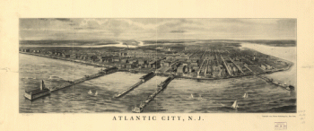
Atlantic City, N.J.
$17.95 – $47.95 -
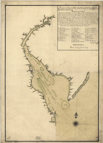
Plano de la Bahia de la Ware y entrada de Filadelfie
$17.95 – $47.95 -
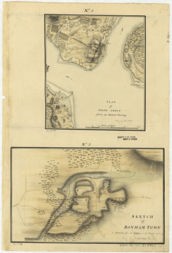
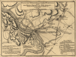
Plan of Perth Amboy from an actual survey. Sketch of Bonham Town
$17.95 – $47.95 -
Sketch of Haddonfield
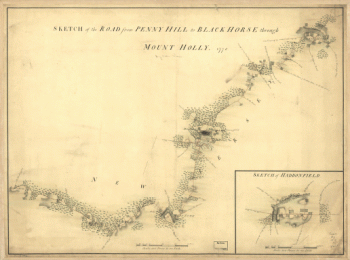
$17.95 – $47.95 -
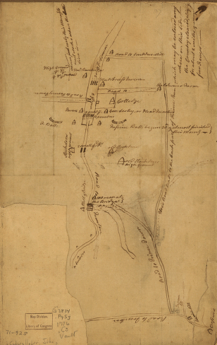
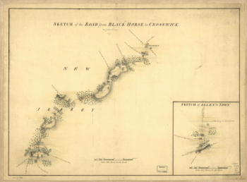
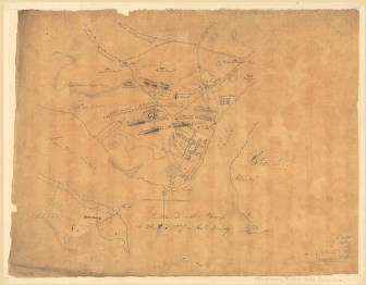
The road from Black Horse to Crosswick and Allen's Town
$17.95 – $47.95 -
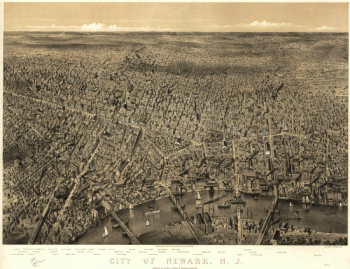
City of Newark, N.J. / Parsons & Atwater, del
$17.95 – $47.95 -
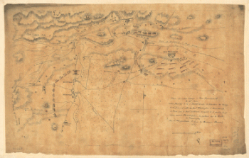
Position de notre camp le 24 juin 1777 à Perth Amboy
$17.95 – $47.95 -
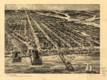
Aero view of Egg Harbor City, New Jersey.
$17.95 – $47.95 -
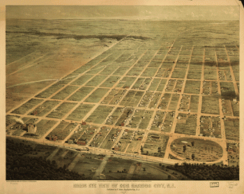
Aero-view of Somers-Point 1925, New Jersey. Drawn by R. Cinquin.
$17.95 – $47.95 -
Aero-view of Absecon, New Jersey 1924.
$17.95 – $47.95 -
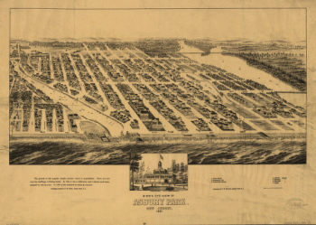
Bird's eye view of Asbury Park, New Jersey, 1881.
$17.95 – $47.95 -
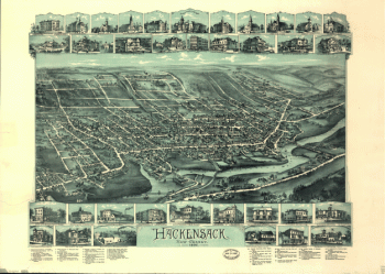
Hackensack, New Jersey / O.H. Bailey & Co., lith. & pub.
$17.95 – $47.95 -
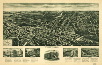
Aeroview of Westwood, New Jersey 1924.
$17.95 – $47.95 -
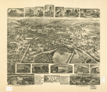
Dover, New Jersey 1903.
$17.95 – $47.95 -
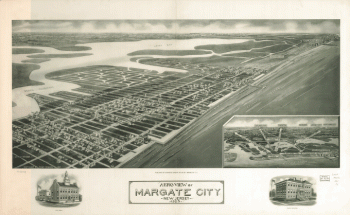
Aeroview of Margate City, New Jersey 1925.
$17.95 – $47.95 -
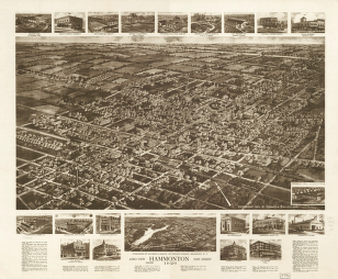
Aero view of Hammonton, New Jersey 1926.
$17.95 – $47.95 -
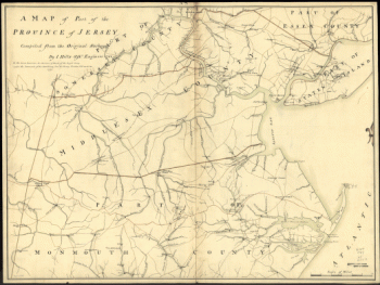
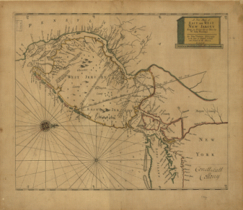
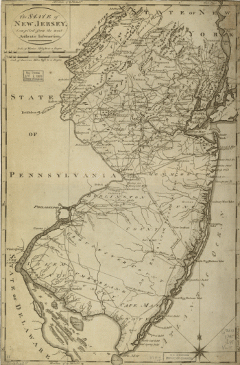
A new map of East and West New Jersey
$17.95 – $47.95 -
New York reduced from the large drawing of that Province
$17.95 – $47.95 -
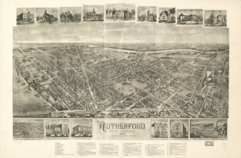
Rutherford, New Jersey 1904.
$17.95 – $47.95 -
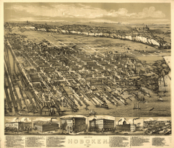
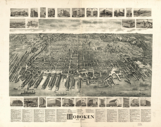
City of Hoboken, New Jersey 1904.
$17.95 – $47.95 -
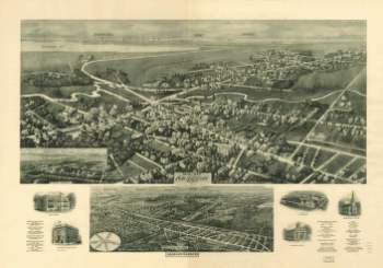
Atlantic Highlands, New Jersey 1894.
$17.95 – $47.95 -
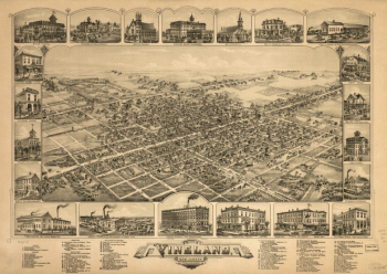
The city of Vineland, New Jersey, 1885.
$17.95 – $47.95 -
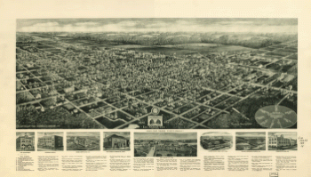
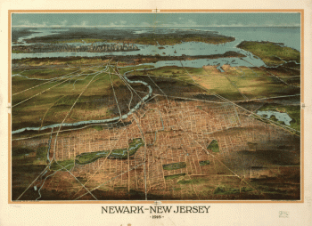
Newark-New Jersey 1916.
$17.95 – $47.95 -
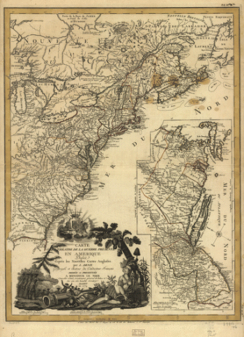
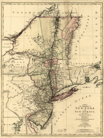
A map of the provinces of New-York and New-Yersey
$17.95 – $47.95 -
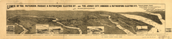
Lines of the Paterson, Passaic, & Rutherford Electric Railway
$17.95 – $47.95 -
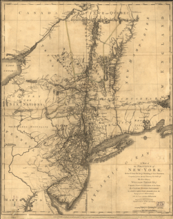
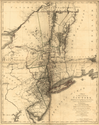
A map of the Province of New-York
$17.95 – $47.95 -
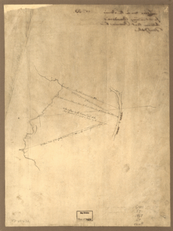
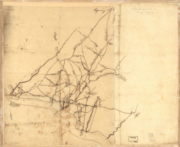
Draft of roads in New Jersey.
$17.95 – $47.95