Showing the routes to Pike's Peak, overland mail route to California and Pacific rail road surveys. To which are added the new state & territorial boundaires, the principal mail & rail road routes with all the arrangements & corrections made by Congress up to the date of its issue. Compiled and drawn from U.S. land & coast surveys and other reliable sources, by D. McGowan and Geo. H. Hildt. McGowan, D. CREATED/PUBLISHED St. Louis, Leopold Gast & Bro., 1859. NOTES Scale ca. 1:5,000,000. Cover title: Map exhibiting the routes to Pike's Peak. Relief shown by hachures.
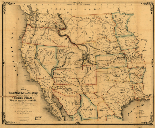
Map of the United States west of the Mississippi
Price range: $39.95 through $69.95
SKU: smca64
Related products
-

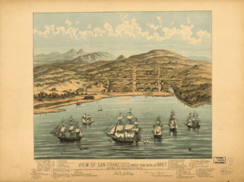
View of San Francisco, formerly Yerba Buena, in 1846-7 before the discovery of gold.
Price range: $39.95 through $69.95 -
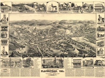
Bird's eye view, Placerville, Cal.
Price range: $39.95 through $69.95 -
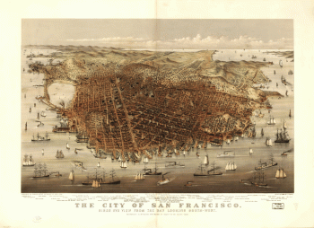
The city of San Francisco. Birds eye view from the bay looking south-west.
Price range: $39.95 through $69.95 -
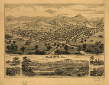
Bird's eye view of Healdsburg, Cal. Drawn by E. S. Glover. A.L. Bancroft & Co., lith.
Price range: $39.95 through $69.95