-

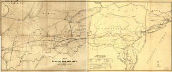
Map of the Central Ohio Railroad and connecting lines.
Price range: $39.95 through $69.95 -
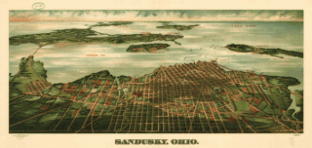
Sandusky, Ohio. Gugler Litho. Co.
Price range: $39.95 through $69.95 -
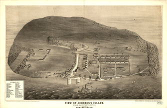
View of Johnson's Island, near Sandusky City, O. Sketched by Edward Gould.
Price range: $39.95 through $69.95 -
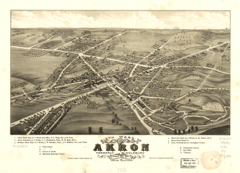
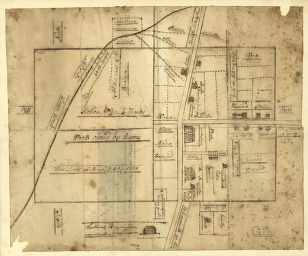
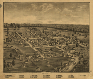
Sixth ward of Akron, formerly Middlebury, Summit Co., Ohio 1882. Beck & Pauli, lithographers.
Price range: $39.95 through $69.95 -
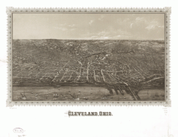
Cleveland, Ohio.
Price range: $39.95 through $69.95 -
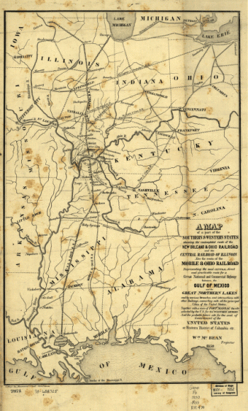
A map of a part of the southern & western states
Price range: $39.95 through $69.95 -
Hillsborough & Cincinnati Railroad map
Price range: $39.95 through $69.95 -
Hillsborough & Cincinnati Rail-road map
Price range: $39.95 through $69.95 -
New rail road map of Ohio prepared by H. Sabine, Commissioner of Rail Roads & Telegraphs.
Price range: $39.95 through $69.95 -
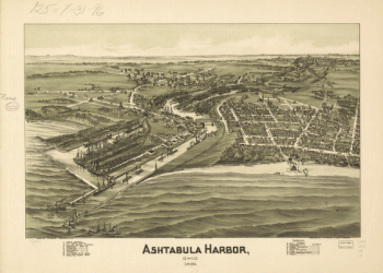
Ashtabula Harbor, Ohio 1896.
Price range: $39.95 through $69.95 -
A plan of the section of land on which the Believers live in the state of Ohio, Nov. 7th, 1807.
Price range: $39.95 through $69.95 -
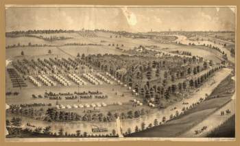
Army camp at Gaylord's Grove, Cuyahoga Falls, Ohio
Price range: $39.95 through $69.95 -
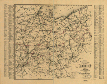
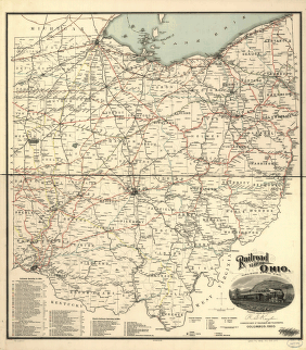
Railroad map of Ohio
Price range: $39.95 through $69.95 -
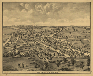
Map of Logan county, Ohio
Price range: $39.95 through $69.95 -
Map of Logan county, Ohio
Price range: $39.95 through $69.95 -
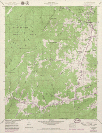
North Carolina. – Dellwood
Price range: $39.95 through $69.95 -
North Carolina. – Luftee Knob
Price range: $39.95 through $69.95 -
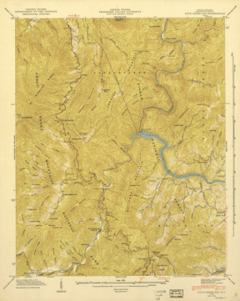
North Carolina. – Cove Creek
Price range: $39.95 through $69.95 -
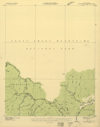
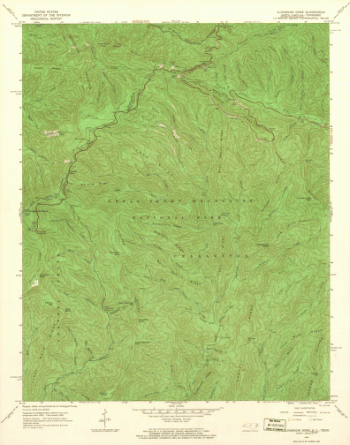
North Carolina. – Bunches Bald
Price range: $39.95 through $69.95 -
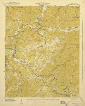
North Carolina. – Whittier
Price range: $39.95 through $69.95 -
North Carolina. – Smokemont
Price range: $39.95 through $69.95 -
North Carolina. – Clingmans Dome
Price range: $39.95 through $69.95 -
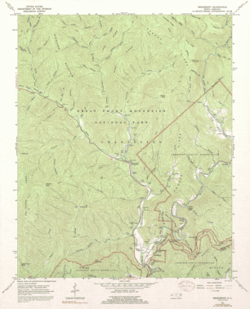
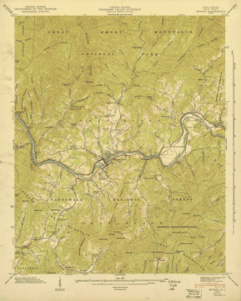
North Carolina. – Bryson
Price range: $39.95 through $69.95 -
North Carolina. – Tuskeegee
Price range: $39.95 through $69.95 -
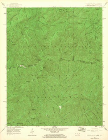
North Carolina. – Thunderhead Mountain
Price range: $39.95 through $69.95 -
North Carolina. – Fontana Dam
Price range: $39.95 through $69.95 -
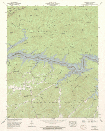
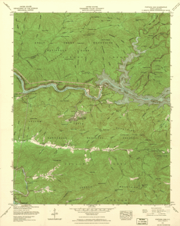
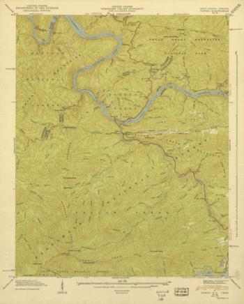
North Carolina. – Tapoco
Price range: $39.95 through $69.95 -
Western border states
Price range: $39.95 through $69.95 -
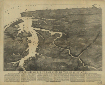
Interesting Bird's eye view of the seat of war
Price range: $39.95 through $69.95 -
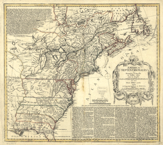
America Septentrionalis a Domino d'Anville in Galliis edita nunc in Anglia
Price range: $39.95 through $69.95 -
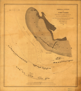
Attack on Fort Fisher
Price range: $39.95 through $69.95 -
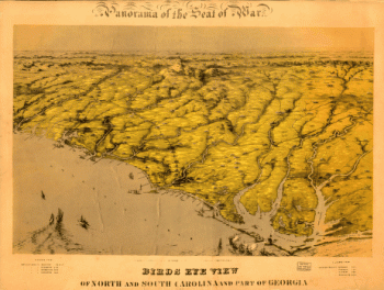
Birds eye view of North and South Carolina and part of Georgia.
Price range: $39.95 through $69.95 -
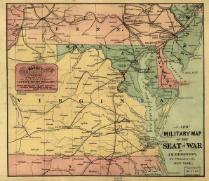
A new military map of the seat of war by J.H. Higginson.
Price range: $39.95 through $69.95 -
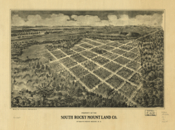
Property of the South Rocky Mount Land Co. at South Rocky Mount, N.C.
Price range: $39.95 through $69.95 -
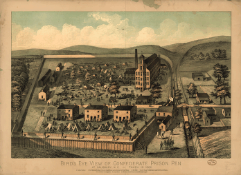
Bird's eye view of Confederate prison pen at Salisbury, N.C., taken in 1864.
Price range: $39.95 through $69.95 -
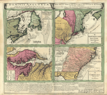
Dominia Anglorum in America Septentrionali. Specialibus mappis Londini primum a Mollio edita, nunc recusa ab Hommanianis Hered.
Price range: $39.95 through $69.95 -
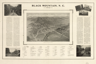
Black Mountain, N.C. 1912.
Price range: $39.95 through $69.95 -
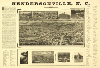
Hendersonville, N.C. 1913.
Price range: $39.95 through $69.95 -
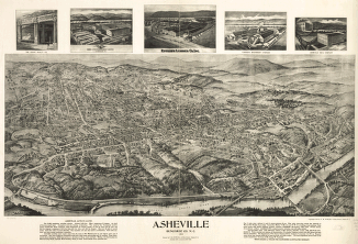
Asheville, Buncombe Co. N.C. 1912.
Price range: $39.95 through $69.95 -
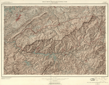
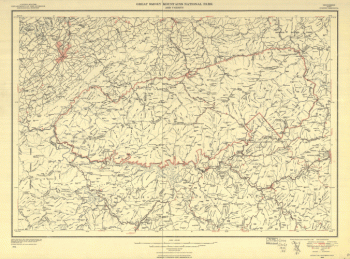
Great Smoky Mountains National Park and vicinity.
Price range: $39.95 through $69.95 -
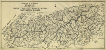
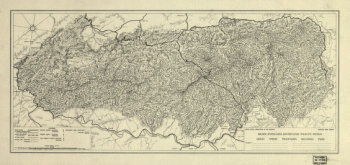
Preliminary base map, Great Smoky Mountains National Park.
Price range: $39.95 through $69.95 -
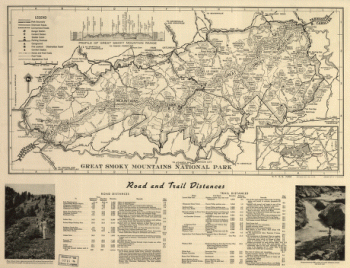
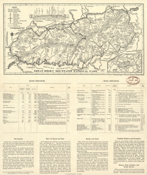
Great Smoky Mountains National Park.
Price range: $39.95 through $69.95 -
Great Smoky Mountains National Park and vicinity.
Price range: $39.95 through $69.95 -
Great Smoky Mountains National Park.
Price range: $39.95 through $69.95 -
Great Smoky Mountains National Park.
Price range: $39.95 through $69.95 -
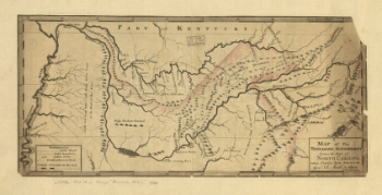
A map of the Tennessee government, formerly part of North Carolina.
Price range: $39.95 through $69.95 -
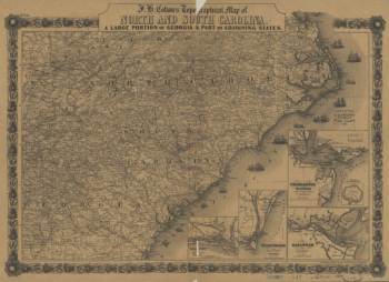
J. H. Colton's topographical map of North and South Carolina
Price range: $39.95 through $69.95 -
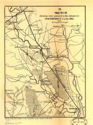
Sketch showing route pursued in the advance to Goldsboro, N.C., in Dec. 1862
Price range: $39.95 through $69.95