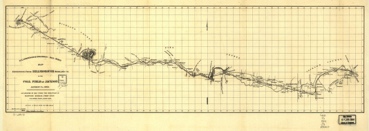
Extending from Hillsborough, Highland Co. to the coal field at Jackson, Jackson Co. Ohio; as located in 1852 under the direction of Ellwood Morris, Chief Engr. N. F. Jones, Princ. Assist. Eng. Jacobi, L. CREATED/PUBLISHED [n.p., 1852] NOTES Scale 1:126,720. Topographic strip map indicating drainage, relief by hachures, roads, houses, property owners names, and county names. This line was chartered in Ohio, March 2, 1846. It was purchased by the Baltimore and Ohio Railroad in 1860.


