-

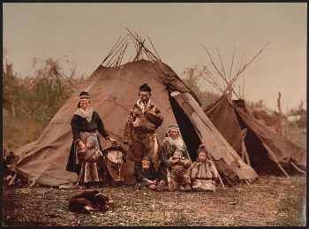
A Lapp family, Norway
$39.95 -
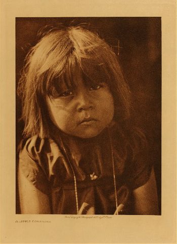
A little Comanche 1927
$39.95 -
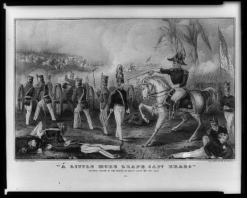
A little more grape Capt. Bragg'–General Taylor
Price range: $39.95 through $69.95 -
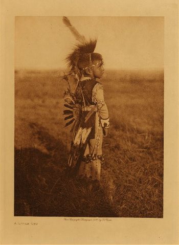
A little Oto 1927
$39.95 -
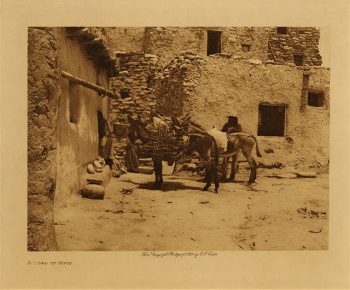
A load of wood 1921
$39.95 -
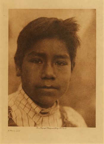
A Maidu boy 1924
$39.95 -
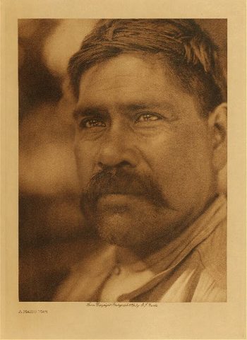
A Maidu man 1924
$39.95 -
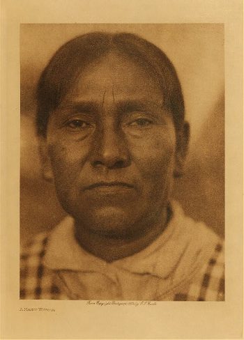
A Maidu woman 1924
$39.95 -
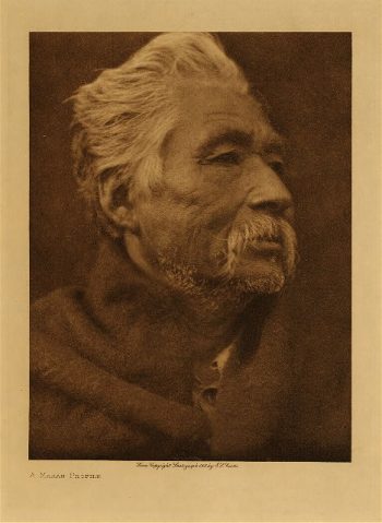
A Makah profile 1915
$39.95 -
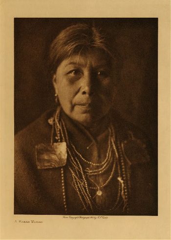
A Makah woman 1915
$39.95 -
A map containing part of the Provinces of New York and New Jersey
Price range: $39.95 through $69.95 -
A Map of 100 miles round Boston
Price range: $39.95 through $69.95 -
A map of a part of the southern & western states
Price range: $39.95 through $69.95 -
A map of Canada and the north part of Louisiana
Price range: $39.95 through $69.95 -
A map of Canada and the north part of Louisiana
Price range: $39.95 through $69.95 -
A map of Canada and the north part of Louisiana with the adjacent countrys
Price range: $39.95 through $69.95 -
A map of Canada and the north part of Louisiana with the adjacent countrys
Price range: $39.95 through $69.95 -
A map of Canada and the north part of Louisiana with the adjacent countrys By Thos Jefferys, geographer to His Majesty, 1762
Price range: $39.95 through $69.95 -
A map of Canada and the north part of Louisiana with the adjacent countrys By Thos Jefferys, geographer to His Majesty, 1762
Price range: $39.95 through $69.95 -
A map of Connecticut and Rhode Island with Long Island Sound, &c
Price range: $39.95 through $69.95 -
A Map of forty miles north, thirty miles west, and twentyfive miles south of Boston
Price range: $39.95 through $69.95 -
A map of Louisiana and of the river Mississipi
Price range: $39.95 through $69.95 -
A map of part of New-York Island
Price range: $39.95 through $69.95 -
A map of part of the province of Jersey
Price range: $39.95 through $69.95 -
A map of part of the province of Jersey. Compiled from the original surveys by I. Hills, asst. engineer, 1781.
Price range: $39.95 through $69.95 -
A map of Philadelphia and parts adjacent : with a perspective view of the State-House / by N Scull and G Heap , L Hebert sculpt
Price range: $39.95 through $69.95 -
A map of the Baltimore & Ohio Railroad and its principal connecting lines uniting all parts of the East & West.
Price range: $39.95 through $69.95 -
A map of the bay of Narraganset with the islands therein and part of the country adjacent
Price range: $39.95 through $69.95 -
A map of the British and French settlements in North America
Price range: $39.95 through $69.95 -
A map of the British and French settlements in North America. J. Lodge
Price range: $39.95 through $69.95 -
A map of the colonies in Connecticut and Rhode Island, divided by counties & townships, from best authorities
Price range: $39.95 through $69.95 -
A Map of the Country in which the Army under Lt. Gen. Burgoyne acted in the Campaign of 1777
Price range: $39.95 through $69.95 -
A Map of the country round Philadelphia including part of New Jersey, New York, Staten Island, & Long Island
Price range: $39.95 through $69.95 -
A map of the Georgia Rail Road and the several lines of railroad connecting with it, Febr. 1839.
Price range: $39.95 through $69.95 -
A map of the land abt Red Stone and Fort Pitt, given to me by Cap Crawfd
Price range: $39.95 through $69.95 -
A map of the middle British colonies in North America
Price range: $39.95 through $69.95 -
A map of the north west parts of America
Price range: $39.95 through $69.95 -
A map of the Province of New York
Price range: $39.95 through $69.95 -
A map of the Province of New-York
Price range: $39.95 through $69.95 -
A map of the Province of New-York
Price range: $39.95 through $69.95 -
A map of the Province of New-York
Price range: $39.95 through $69.95 -
A map of the province of Pensilvania / drawn from the best authorities by T Kitchin gr
Price range: $39.95 through $69.95 -
A map of the provinces of New-York and New Jersey
Price range: $39.95 through $69.95 -
A map of the provinces of New-York and New Jersey
Price range: $39.95 through $69.95 -
A map of the provinces of New-York and New Jersey, with a part of Pennsylvania and the Province of Quebec
Price range: $39.95 through $69.95