CREATED/PUBLISHED [London : s.n., 1755] NOTES Relief shown pictorially. Shows boundaries, rivers, forests, principal settlements and notes. Prime meridian: London. Pt. the first. Containing Canada, Nova scotia, Newfoundland, New England, part of New York, with the Lakes, Six Nations, and all the countries westward in the same parallels so far as discover'd; exhibiting the just boundaries, and the French encroachments: laid down from authentic surveys — Pt. the second. Containing part of New York, Pensilvania, New Jersey, Mary Land, Virginia, North & South Carolina, Georgia, Louisiana, and all the countries westward in the same parellels so far as discovered, shewing the course of the Rivers Ohio, Missisipi &c. exhibiting the just boundaries & the French encroachments laid down from authentic surveys.
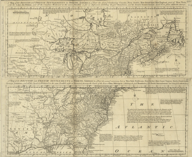
A map of the British and French settlements in North America
$17.95 – $47.95
SKU: smoh89
Related products
-

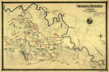
Chickamauga battlefield
$17.95 – $47.95