Washington, George, 1732-1799. CREATED/PUBLISHED [ca. 1780] NOTES Scale ca. 1:600,000. Relief shown pictorially. The title, land tract boundaries with owners' initials, and some place names have been identified as annotations by George Washington made ca. 1780. The author and date of the manuscript map is not known, reference sources indicate between 1758 and 1771. Shows Ohio River watershed in Pennsylvania and West Virginia.
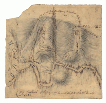
A map of the land abt Red Stone and Fort Pitt, given to me by Cap Crawfd
$17.95 – $47.95
SKU: rwso54
Related products
-

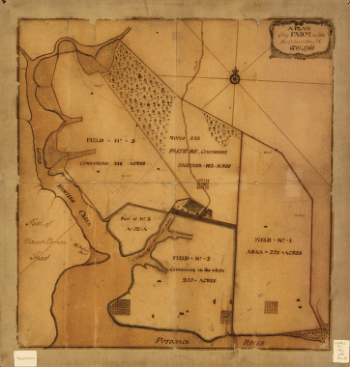
A plan of my farm on Little Huntg Creek & Potomk R G W
$17.95 – $47.95
![[Zehn Karten und Ansichten den Schlachtfelden des amerikanischen Unabhangigkeitskreiges in den Staaten Pennsylvanien und New York]](https://www.ushistoricalarchive.com/wp-content/uploads/nc/data/products/im/rw/south/b46-350x245.gif)