Magnus, Charles. CREATED/PUBLISHED New York, [1861] NOTES Scale ca. 1:5,800,000. In lower margin of main map is printed 'Entered, according to act of Congress, in the year 1859….' At the bottom edge below the inset neat lines is printed 'Entered, according to act of Congress, in the year 1861….' Insets: Military map of Maryland & Virginia. –Map of northern military movements: between New York & St. Louis. –[View of the U.S. Capitol] —[Entrance to Mobile Bay] –[United States and the Gulf of Mexico].
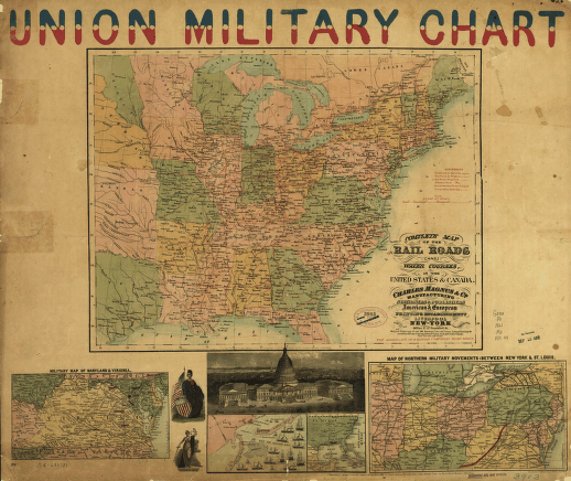
Complete map of the rail roads and water courses, in the United States & Canada
$17.95 – $47.95
SKU: smcan55
Related products
-

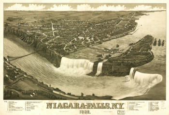
Niagara-Falls, N.Y. 1882
$17.95 – $47.95 -
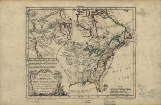
Canada and Louisiane
$17.95 – $47.95