Tennessee
Search
Sort By
- Default
- Price: Low to High
- Price: High to Low
- Alphabetical
- SKU
Categories
-
Shiloh National Military Park, Tenn.
$17.95 – $47.95 -
Topographical sketch of the environs of Murfreesboro, Tennessee
$17.95 – $47.95 -
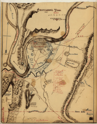
Chattanooga Tenn. 1863 / G.H. Blakeslee, U.S. Top. Eng.
$17.95 – $47.95 -
Chattanooga, Tenn. as seen from Bragg Hill, Missionary Ridge
$17.95 – $47.95 -
Great Smoky Mountains National Park
$17.95 – $47.95 -
Original maps of Forts Henry & Donelson and vicinity
$17.95 – $47.95 -
Great Smoky Mountains National Park
$17.95 – $47.95 -
Preliminary base map, Great Smoky Mountains National Park
$17.95 – $47.95 -
Franklin, Tennessee
$17.95 – $47.95 -
Map of the battle of Nashville
$17.95 – $47.95 -
Map of a portion of Missionary Ridge
$17.95 – $47.95 -
Field works at Franklin, Tenn.
$17.95 – $47.95 -
Battlefield in front of Franklin, Ten. November 30th, 1864
$17.95 – $47.95 -
Battlefield in front of Franklin, Ten. November 30th, 1864
$17.95 – $47.95


![Rough plan of part of battle of Wauhatchie, Tenn., night of Oct. 28-29, 1863 Drawn from memory by H. T. [i.e., Hector Tyndale. 188-].](https://www.ushistoricalarchive.com/wp-content/uploads/nc/data/products/im/sm/tn/b63-350x241.gif)


![General Buell's map of the battle-field of Shiloh. [April 6-7, 1862]](https://www.ushistoricalarchive.com/wp-content/uploads/nc/data/products/im/sm/tn/b67-350x287.gif)


![Winter quarters 1864 : [vicinity of Lookout Mountain, Tennessee] / profile by G.H. Blakeslee T.E., March 10-1864.](https://www.ushistoricalarchive.com/wp-content/uploads/nc/data/products/im/sm/tn/b76-350x275.gif)
![Knoxville, Tenn. county seat of Knox County 1886. [Drawn by] H. Wellge. Beck & Pauli, litho.](https://www.ushistoricalarchive.com/wp-content/uploads/nc/data/products/im/sm/tn/b77-350x246.gif)


![Map of Chattanooga and environs. Engraved by Buff[alo] Elec. & Eng. Co.](https://www.ushistoricalarchive.com/wp-content/uploads/nc/data/products/im/sm/tn/b81.gif)


![Battle of Pittsburgh Landing [i.e., Shiloh] Engraved for 'Grant and his campaigns.' [April 6-7, 1862]](https://www.ushistoricalarchive.com/wp-content/uploads/nc/data/products/im/sm/tn/b85.gif)


