Home
All Products
Historic Maps
American Indian Maps
Birds Eye View Maps
Civil War Maps
Panoramic Maps
Railroad Maps
Revolutionary War Maps
State Maps
Historic Prints
Civil War Prints
Civil War Posters
Historic Portraits
Presidential Portraits
Contact Us
0
0
press
Enter
to search
Showing all results:
No products found.
Ohio
Search
Search Product or SKU
×
Sort By
Default
Price: Low to High
Price: High to Low
Alphabetical
SKU
Categories
All
American Indian Maps
American Indian Photos
Birds Eye View Maps
CD Collections
Civil War Maps
Civil War Posters
Civil War Prints
Panoramic Maps
Photo-chromes
Presidential Portraits
Railroad Maps
Revolutionary War Maps
St. Augustine
State Maps
Alabama
California
Canada
Georgia
Louisiana
Michigan
New Hampshire
New Jersey
New York
New York City
North Carolina
Ohio
South Carolina
Tennessee
Texas
Washington DC
Showing
“Ohio”
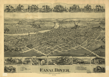
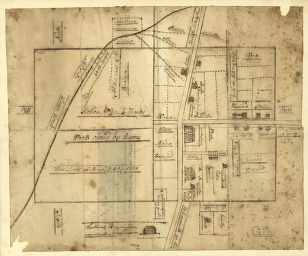
Canal Dover, Tuscarawas County, Ohio 1899. Drawn by A. E. Downs.
$
17.95
–
$
47.95
Camp Dennison : taken from Old Aunt Roady's Hill / drawn by Johnson in the Zouave Lt. Guard, Company A.
$
17.95
–
$
47.95
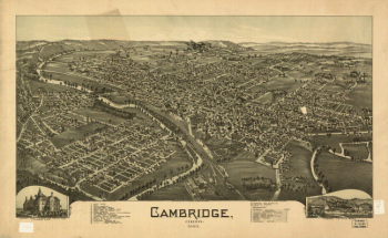
Cambridge, Ohio 1899. Drawn by T. M. Fowler.
$
17.95
–
$
47.95
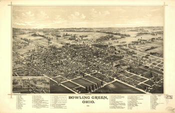
Bowling Green, Ohio 1888. Burleigh Lith. Est.
$
17.95
–
$
47.95
Birds eye view of the city of Circleville, Pickaway County, Ohio 1876. Krebs Lithographing Company.
$
17.95
–
$
47.95
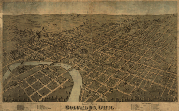
Birds eye view of Columbus, Ohio / drawn by H.H. & O.H. Bailey.
$
17.95
–
$
47.95
Birds eye view of Cleveland, Ohio 1877. A. Ruger artist. Lith. by Shober & Carqueville.
$
17.95
–
$
47.95
Bird's-eye-view of the city of Sandusky, Erie County, Ohio 1870. Drawn by A. Ruger. Chicago Lithographing Co.
$
17.95
–
$
47.95
Bird's eye view of Warren, Trumbull County, Ohio 1870. Merchants Lithographing Co.
$
17.95
–
$
47.95
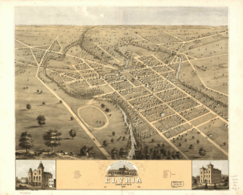
Bird's eye view of the town of Elyria, Lorain Co., Ohio 1868
$
17.95
–
$
47.95
Bird's eye view of the city of Mount Vernon, Knox County, Ohio 1870. Merchants Lith. Co.
$
17.95
–
$
47.95
Bird's eye view of the city of Akron, Summit County, Ohio 1870. Drawn by A. Ruger. Chicago Lithographing Co.
$
17.95
–
$
47.95
Bird's eye view of Norwalk, Huron County, Ohio 1870. Merchants Lithographing Co.
$
17.95
–
$
47.95
Bird's eye view of Massillon, Stark County, Ohio 1870. Lithographed by Merchants Lith. Co.
$
17.95
–
$
47.95
Bird's eye view of Camp Chase near Columbus, Ohio. Drawn by A. Ruger.
$
17.95
–
$
47.95
Bird's eye view of Bellaire, Ohio 1882. H. Wellge, del. Beck & Pauli, lithographers.
$
17.95
–
$
47.95
Bellevue, Ohio, Sandusky & Huron counties 1888. Burleigh Lith. Est.
$
17.95
–
$
47.95
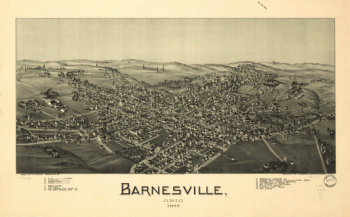
Barnesville, Ohio 1899
$
17.95
–
$
47.95
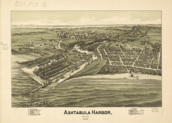
Ashtabula Harbor, Ohio 1896.
$
17.95
–
$
47.95
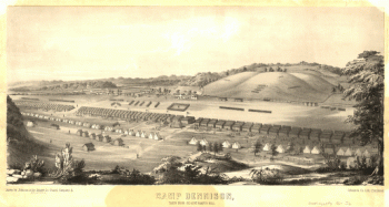
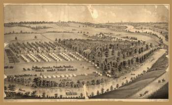
Army camp at Gaylord's Grove, Cuyahoga Falls, Ohio
$
17.95
–
$
47.95
An accurate map of the British colonies in North America bordering on the river Ohio.
$
17.95
–
$
47.95
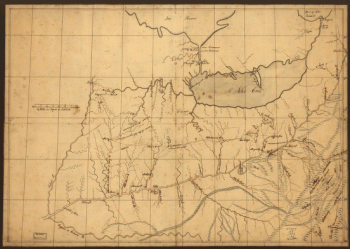
A trader's map of the Ohio country before 1753.
$
17.95
–
$
47.95
A plan of the section of land on which the Believers live in the state of Ohio, Nov. 7th, 1807.
$
17.95
–
$
47.95
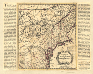
A map of the middle British colonies in North America
$
17.95
–
$
47.95
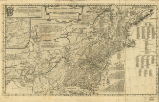
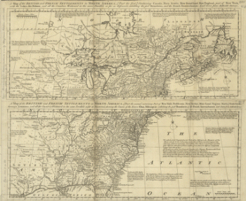
A map of the British and French settlements in North America
$
17.95
–
$
47.95
A map of the Baltimore & Ohio Railroad and its principal connecting lines uniting all parts of the East & West.
$
17.95
–
$
47.95
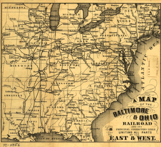
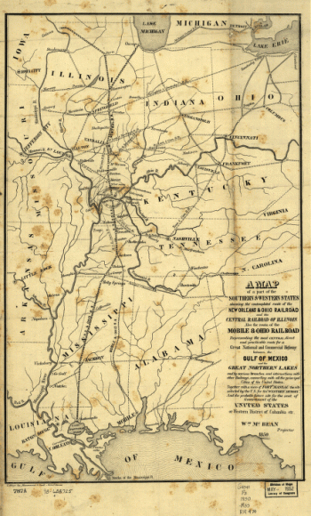
A map of a part of the southern & western states
$
17.95
–
$
47.95
1
2
Load More
All products loaded.
Search Product or SKU
×
Home
All Products
Historic Maps
American Indian Maps
Birds Eye View Maps
Civil War Maps
Panoramic Maps
Railroad Maps
Revolutionary War Maps
State Maps
Historic Prints
Civil War Prints
Civil War Posters
Historic Portraits
Presidential Portraits
Contact Us
Cart
0
Cart
Close
Updating…
No products in the cart.
Continue shopping