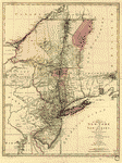
In the 45th degree of north latitude. Survey'd in the year 1771 & 1772. By Thomas Valentine & John Collins, esquirs. Drawn by C. J. Sauthier. Valentine, Thomas. CREATED/PUBLISHED [1772] NOTES Scale ca. 1:125,000. Manuscript, black and red ink and watercolor. Relief shown by hachures. Map shows primarily Vermont with Quebec (Province) and New York (State)
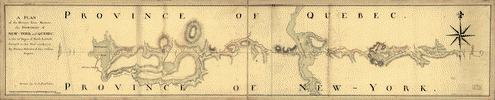
A plan of the division line between the provinces of New-York and Quebec
$17.95 – $47.95
SKU: rwcaar107100
Related products
-

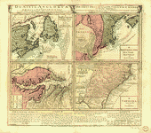
A map of the provinces of New-York and New Jersey
$17.95 – $47.95 -
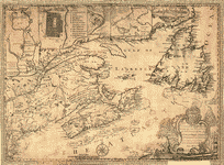
This map of the province of Nova-Scotia and parts adjacent
$17.95 – $47.95 -
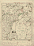
Dominia Anglorum in America Septentrionali
$17.95 – $47.95 -
Canada et Louisiane
$17.95 – $47.95