-

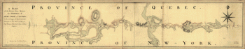
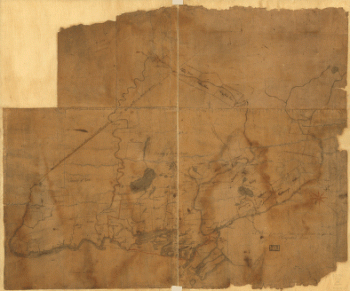
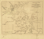
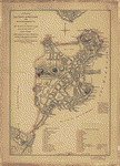
A plan of the division line between the provinces of New-York and Quebec
Price range: $39.95 through $69.95 -
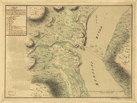
A plan of the Forts Montgomery & Clinton
Price range: $39.95 through $69.95 -
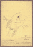
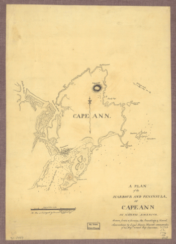
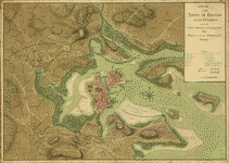
A plan of the harbour and peninsula of Cape Ann
Price range: $39.95 through $69.95 -
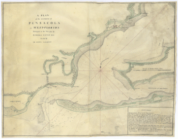
A plan of the harbour of Pensacola in West-Florida Surveyed in the year 1764 by George Gauld, MA The bar by Sir John Lindsay
Price range: $39.95 through $69.95 -
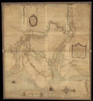
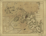
A plan of the inlets & rivers of Savannah & Warsaw in the Province of Georgia
Price range: $39.95 through $69.95 -
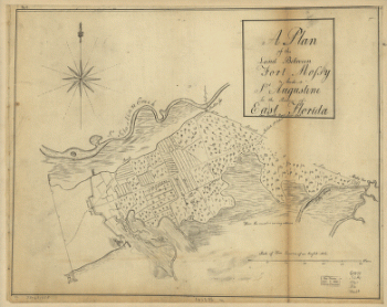
A plan of the land between Fort Mossy and St Augustine in the province of East Florida Sam Roworth, dept survr genl
Price range: $39.95 through $69.95 -
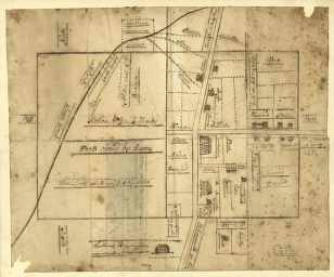
A plan of the lands in New London
Price range: $39.95 through $69.95 -
A Plan of the late Province of Main as far as Kennebeck River
Price range: $39.95 through $69.95 -
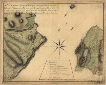
A plan of the Narrows of Hells-gate in the East River
Price range: $39.95 through $69.95 -
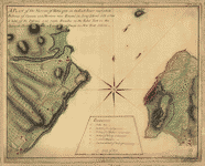
A plan of the Narrows of Hells-gate in the East River
Price range: $39.95 through $69.95 -
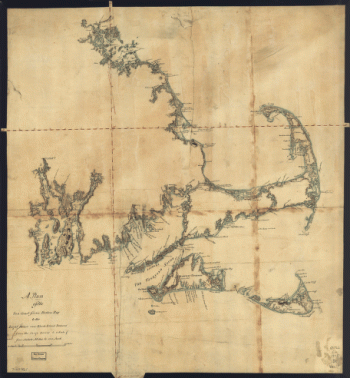
A plan of the sea coast from Boston Bay to the light house near Rhode Island, reduced from the large survey
Price range: $39.95 through $69.95 -
A plan of the section of land on which the Believers live in the state of Ohio, Nov. 7th, 1807.
Price range: $39.95 through $69.95 -
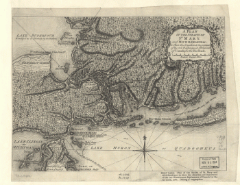
A Plan of the Straits of St. Mary, and Michilimakinac
Price range: $39.95 through $69.95 -
A plan of the town and chart of the harbour of Boston
Price range: $39.95 through $69.95 -
A plan of the town and harbour of Boston
Price range: $39.95 through $69.95 -
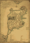
A plan of the town of Boston
Price range: $39.95 through $69.95 -
A plan of the town of Boston
Price range: $39.95 through $69.95 -
A plan of the town of Boston and its environs
Price range: $39.95 through $69.95 -
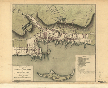
A plan of the town of Newport in Rhode Island Surveyed by Charles Blaskowitz, engraved and publish'd by Willm Faden
Price range: $39.95 through $69.95 -
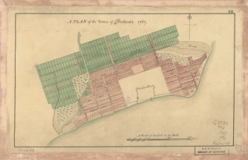
A Plan of the town of Pensacola, 1767
Price range: $39.95 through $69.95 -
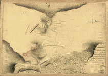
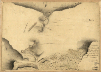
A Plan of the works on Spikendevil Hill with the ground in front
Price range: $39.95 through $69.95 -
A Plan of the works on Spikendevil Hill with the ground in front, protracted from a scale of 200 feet to an inch
Price range: $39.95 through $69.95 -
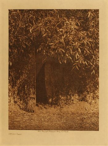
A Pomo camp 1924
$39.95 -
A Pomo girl 1924
$39.95 -
A Ponca dancer 1927
$39.95 -
A prairie camp (Piegan) 1911
$39.95 -
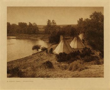
A prairie camp 1908
$39.95 -
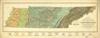
A preliminary agricultural map of Tennessee based on the distribution of geological formations
Price range: $39.95 through $69.95 -
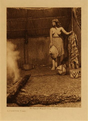
A primitive camp 1912
$39.95 -
A Quinault type 1910
$39.95 -
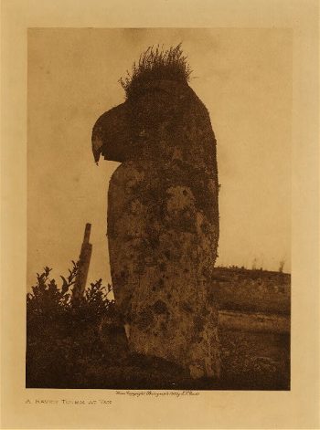
A raven totem at Yan 1915
$39.95 -
A rner of L
$39.95 -
A San Juan farmhouse 1925
$39.95 -
A San Juan home 1905
$39.95 -
A San Juan man 1905
$39.95 -
A San Juan matron 1905
$39.95 -
A Santa Ana man 1925
$39.95 -
A Santa Clara man 1905
$39.95 -
A Santo Domingo man 1925
$39.95 -
A Sarsi kitchen 1926
$39.95 -
A Sarsi tipi 1926
$39.95