-

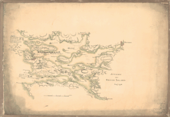
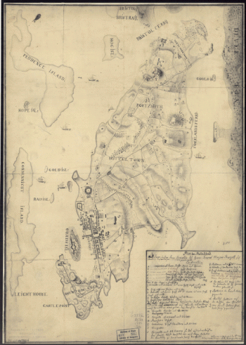
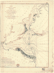
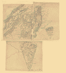
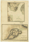
Attacks upon Rhode Island, Augt 1778
Price range: $39.95 through $69.95 -
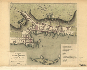
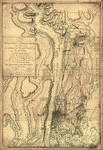
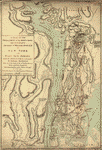
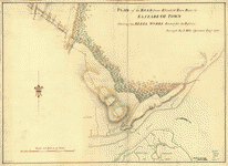
A plan of the town of Newport in Rhode Island Surveyed by Charles Blaskowitz, engraved and publish'd by Willm Faden
Price range: $39.95 through $69.95 -
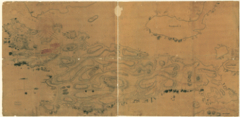
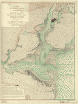
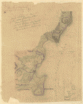
Plan de la ville, du port, et de la rade de New-port et Rhode Island Debarquement en 1780
Price range: $39.95 through $69.95 -
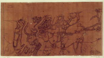
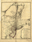
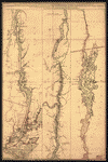
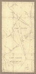
Marche de l'armee francaise de Providence a la Rivière du Nord
Price range: $39.95 through $69.95 -
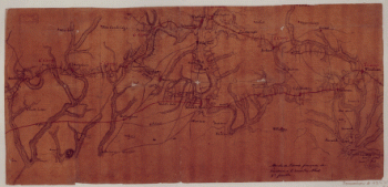
Marche de l'armee francaise de Providence a la Rivière du Nord
Price range: $39.95 through $69.95 -
Marche de l'armee francaise de Providence a la Rivière du Nord
Price range: $39.95 through $69.95 -
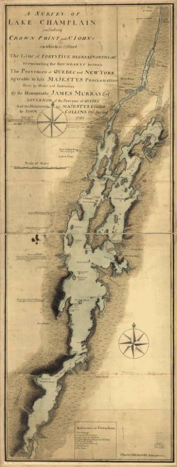
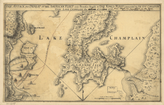
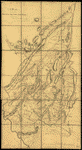
A survey of Lake Champlain
Price range: $39.95 through $69.95 -
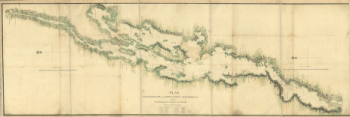
Plan, Lake Champlain from Fort St John's to Ticonderoga, with the soundings, rocks, shoals, and sands, surveyed in the years 1778, 1779
Price range: $39.95 through $69.95 -
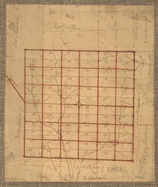
The Above is a plan of the town of Cabot, State of Vermont
Price range: $39.95 through $69.95 -
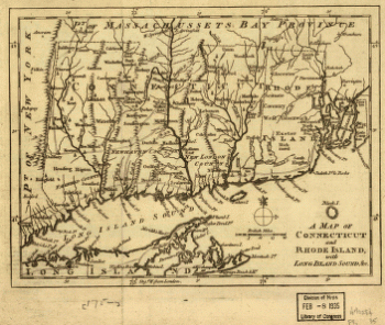
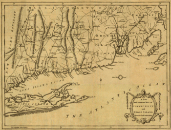
A map of Connecticut and Rhode Island with Long Island Sound, &c
Price range: $39.95 through $69.95 -
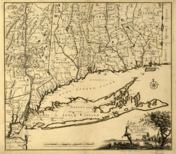
A new and accurate map of Connecticut and Rhode Island, from best authorities
Price range: $39.95 through $69.95 -
Connecticut and parts adjacent At Amsterdam by Covens and Mortier and Covens Junior H Klockhoff, sculp
Price range: $39.95 through $69.95 -
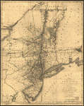
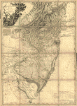
The provinces of New York, and New Jersey
Price range: $39.95 through $69.95 -
The provinces of New York, and New Jersey
Price range: $39.95 through $69.95 -
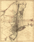
The provinces of New York and New Jersey, with part of Pensilvania, and the province of Quebec
Price range: $39.95 through $69.95 -
The provinces of New York and New Jersey
Price range: $39.95 through $69.95 -
The provinces of New York, and New Jersey
Price range: $39.95 through $69.95 -
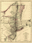
A map of the Province of New-York
Price range: $39.95 through $69.95 -
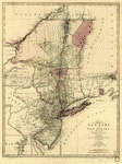
Province of New-York
Price range: $39.95 through $69.95 -
Province of New York
Price range: $39.95 through $69.95 -
A map of the provinces of New-York and New-Yersey
Price range: $39.95 through $69.95 -
A map of the provinces of New-York and New Jersey
Price range: $39.95 through $69.95 -
Mappa geographica Provinciae Nova Eboraci ab Anglis New-York
Price range: $39.95 through $69.95 -
Seat of war in North America, comprehending New Jersey, Philadelphia, Pensylvania, New-York
Price range: $39.95 through $69.95 -
Part of the Provinces of New York and New Jersey
Price range: $39.95 through $69.95 -
Operations of the King's army under the command of General Sir William Howe
Price range: $39.95 through $69.95 -
The operations of the King's army under the command of General Sr William Howe
Price range: $39.95 through $69.95 -
A sketch of the operations of His Majesty's fleet
Price range: $39.95 through $69.95 -
Operations in America No 2
Price range: $39.95 through $69.95 -
Hudsons River – topographical
Price range: $39.95 through $69.95 -
New York Island and East Jersey
Price range: $39.95 through $69.95 -
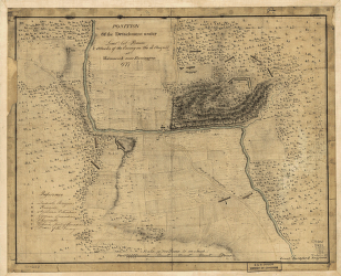
Position du camp de l'armee combinee a Philipsburg du 6 juillet au 19 aoust
Price range: $39.95 through $69.95 -
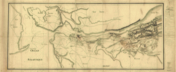
Carte de l'entree de la rivière d'Hudson
Price range: $39.95 through $69.95 -
Carte de l'entree de la rivière d'Hudson
Price range: $39.95 through $69.95 -
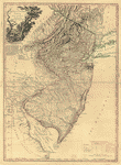
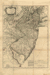
The State of New Jersey
Price range: $39.95 through $69.95 -
The Province of New Jersey, divided into East and West, commonly called the Jerseys
Price range: $39.95 through $69.95 -
The Province of New Jersey, divided into East and West, commonly called the Jerseys
Price range: $39.95 through $69.95 -
The Province of New Jersey, divided into East and West, commonly called the Jerseys
Price range: $39.95 through $69.95 -
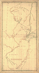
New York & New Jersey commissioners line from 410 on Hudson's River taken in 1769
Price range: $39.95 through $69.95 -
Lines run in the Jersies for determining boundaries between that Province & New York
Price range: $39.95 through $69.95 -
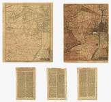
Northern New Jersey – 3 Maps
Price range: $39.95 through $69.95 -
Map showing the west shore of the North or Hudson River
Price range: $39.95 through $69.95 -
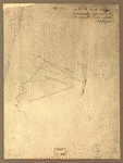
Plan of the road from Elizabeth Town Point to Elizabeth Town
Price range: $39.95 through $69.95 -
Amboy to Elizabethtown
Price range: $39.95 through $69.95 -
Plan of Perth Amboy from an actual survey
Price range: $39.95 through $69.95