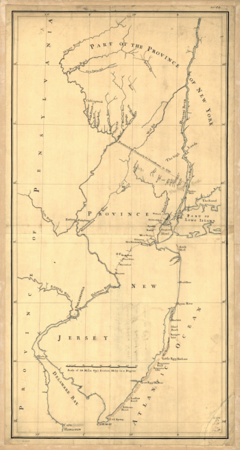
Home
All Products
Historic Maps
American Indian Maps
Birds Eye View Maps
Civil War Maps
Panoramic Maps
Railroad Maps
Revolutionary War Maps
State Maps
Historic Prints
Civil War Prints
Civil War Posters
Historic Portraits
Presidential Portraits
Contact Us
0
0
press
Enter
to search
Showing all results:
No products found.
New Jersey
Search
Search Product or SKU
×
Sort By
Default
Price: Low to High
Price: High to Low
Alphabetical
SKU
Categories
All
American Indian Maps
American Indian Photos
Birds Eye View Maps
CD Collections
Civil War Maps
Civil War Posters
Civil War Prints
Panoramic Maps
Photo-chromes
Presidential Portraits
Railroad Maps
Revolutionary War Maps
St. Augustine
State Maps
Alabama
California
Canada
Georgia
Louisiana
Michigan
New Hampshire
New Jersey
New York
New York City
North Carolina
Ohio
South Carolina
Tennessee
Texas
Washington DC
Showing
“New Jersey”
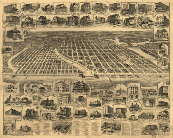
Asbury Park, Ocean Grove and vicinity, New Jersey 1897.
$
17.95
–
$
47.95
Map of British outposts between Burlington and New Bridge, New Jersey, December 1776.
$
17.95
–
$
47.95
Operations of General Washington, against the Kings troops in New Jersey, from the 26th, of December, 1776, to the 3d. January 1777
$
17.95
–
$
47.95
Map of the coast of New Jersey from Barnegat Inlet to Cape May.
$
17.95
–
$
47.95
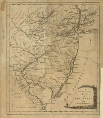
A new and accurate map of New Jersey, from the best authorities
$
17.95
–
$
47.95
City of New Brunswick, New Jersey / Packard & Butler Lith. Philada.
$
17.95
–
$
47.95
New York & New Jersey commissioners line from 41 on Hudson's River taken in 1769.
$
17.95
–
$
47.95
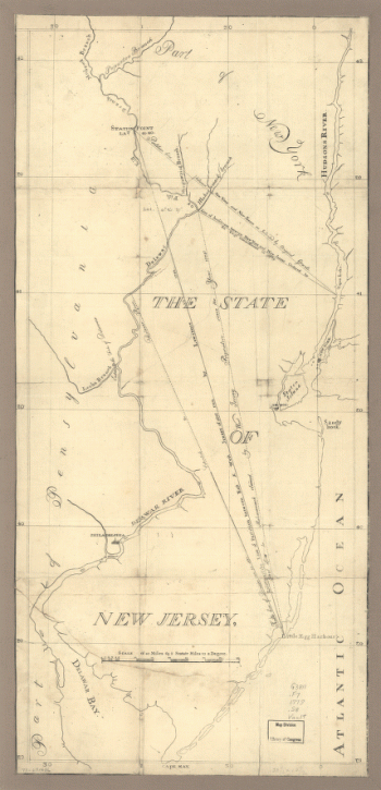
The State of New Jersey
$
17.95
–
$
47.95
1
2
Load More
All products loaded.
Search Product or SKU
×
Home
All Products
Historic Maps
American Indian Maps
Birds Eye View Maps
Civil War Maps
Panoramic Maps
Railroad Maps
Revolutionary War Maps
State Maps
Historic Prints
Civil War Prints
Civil War Posters
Historic Portraits
Presidential Portraits
Contact Us
Cart
0
Cart
Close
Updating…
No products in the cart.
Continue shopping