Home
All Products
Historic Maps
American Indian Maps
Birds Eye View Maps
Civil War Maps
Panoramic Maps
Railroad Maps
Revolutionary War Maps
State Maps
Historic Prints
Civil War Prints
Civil War Posters
Historic Portraits
Presidential Portraits
Contact Us
0
0
press
Enter
to search
Showing all results:
No products found.
New Hampshire
Search
Search Product or SKU
×
Sort By
Default
Price: Low to High
Price: High to Low
Alphabetical
SKU
Categories
All
American Indian Maps
American Indian Photos
Birds Eye View Maps
CD Collections
Civil War Maps
Civil War Posters
Civil War Prints
Panoramic Maps
Photo-chromes
Presidential Portraits
Railroad Maps
Revolutionary War Maps
St. Augustine
State Maps
Alabama
California
Canada
Georgia
Louisiana
Michigan
New Hampshire
New Jersey
New York
New York City
North Carolina
Ohio
South Carolina
Tennessee
Texas
Washington DC
Showing
“New Hampshire”
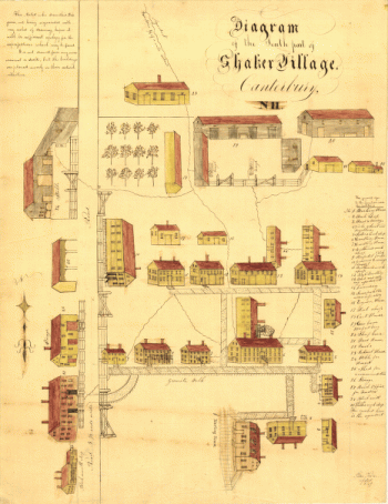
Diagram of the south part of Shaker Village, Canterbury, NH.
$
17.95
–
$
47.95
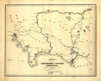
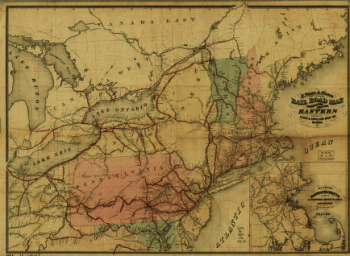
Portsmouth and Concord Railroad
$
17.95
–
$
47.95
New England states, Maine, New Hampshire, Vermont, Massachusetts, Rhode Island & Connecticut with the adjacent parts of New York & Lower Canada
$
17.95
–
$
47.95
Maine, New Hampshire, Vermont, Massachusetts, Rhode Island, Connecticut and Lower Canada, 1860
$
17.95
–
$
47.95
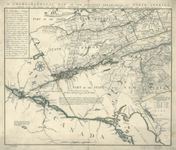
Chorographical map Northern Department of North-America
$
17.95
–
$
47.95
J. Sage & Sons new & reliable rail road map, travellers edition, Eastern.
$
17.95
–
$
47.95
Peterborough, N.H. 1886. Drawn and published by L. R. Burleigh. Burleigh Lith. Establishment.
$
17.95
–
$
47.95
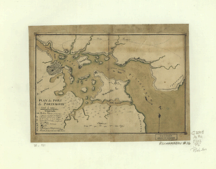
Plan du port de Portsmouth levé à vue.
$
17.95
–
$
47.95
1
2
Load More
All products loaded.
Search Product or SKU
×
Home
All Products
Historic Maps
American Indian Maps
Birds Eye View Maps
Civil War Maps
Panoramic Maps
Railroad Maps
Revolutionary War Maps
State Maps
Historic Prints
Civil War Prints
Civil War Posters
Historic Portraits
Presidential Portraits
Contact Us
Cart
0
Cart
Close
Updating…
No products in the cart.
Continue shopping