-

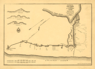
Plan and sections of Fort Fisher
Price range: $39.95 through $69.95 -
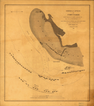
Order of attack on Fort Fisher by the Squadron
Price range: $39.95 through $69.95 -
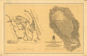
Map of the battlefield of Roanoke
Price range: $39.95 through $69.95 -
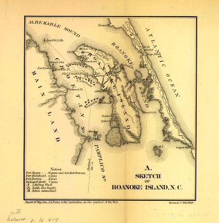
Sketch of Roanoke Island, N.C.
Price range: $39.95 through $69.95 -
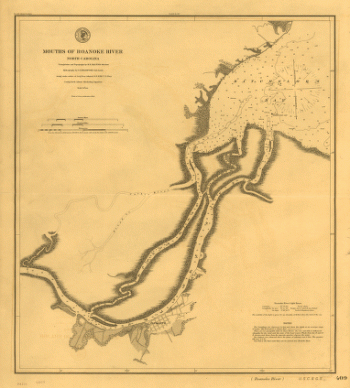
Mouths of Roanoke River, North Carolina
Price range: $39.95 through $69.95 -
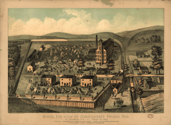
Bird's eye view of Confederate prison pen at Salisbury, N.C.
Price range: $39.95 through $69.95 -
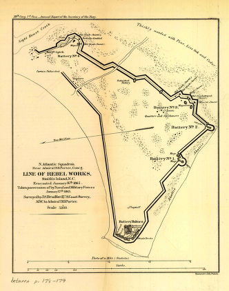
Line of rebel works, Smith's Island, N.C.
Price range: $39.95 through $69.95 -
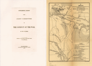
Sketch showing the position of the attacking and defending forces at the siege of Washington, N.C.
Price range: $39.95 through $69.95 -
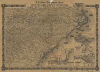
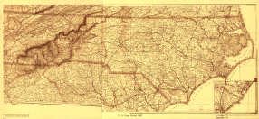
J. H. Colton's topographical map of North and South Carolina
Price range: $39.95 through $69.95 -
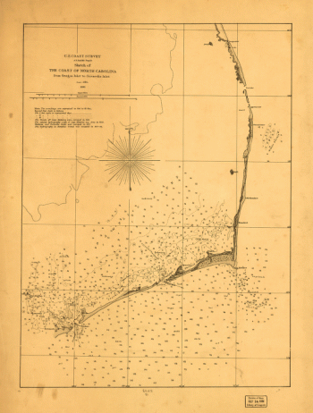
Sketch of the coast of North Carolina from Oregon Inlet to Ocracoke Inlet
Price range: $39.95 through $69.95 -
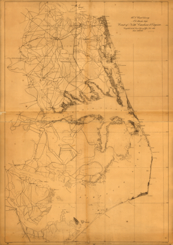
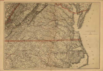
Coast of North Carolina & Virginia
Price range: $39.95 through $69.95 -
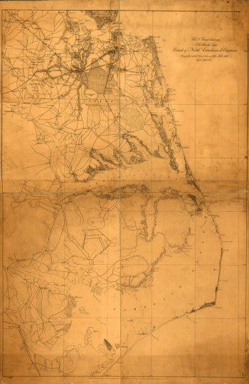
Coast of North Carolina & Virginia
Price range: $39.95 through $69.95 -
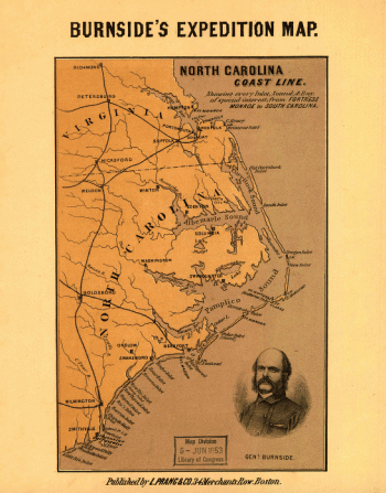
North Carolina coast line
Price range: $39.95 through $69.95 -
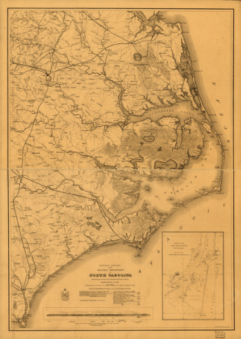
Eastern portion of the military department of North Carolina
Price range: $39.95 through $69.95 -
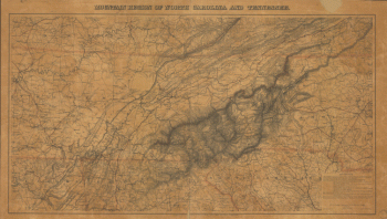
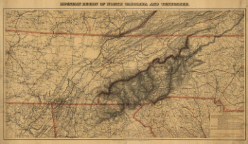
Mountain region of North Carolina and Tennessee
Price range: $39.95 through $69.95 -
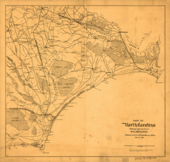
North Carolina showing approaches to Wilmington
Price range: $39.95 through $69.95 -
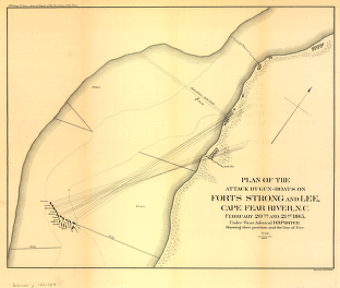
Plan of the attack by gun-boats on Forts Strong and Lee
Price range: $39.95 through $69.95 -
Mountain region of North Carolina and Tennessee
Price range: $39.95 through $69.95 -
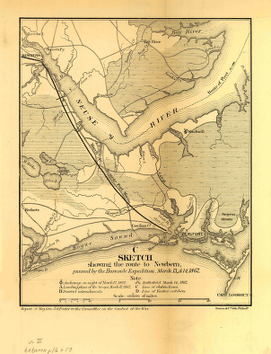
Sketch showing the route to Newbern
Price range: $39.95 through $69.95 -
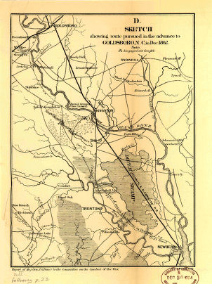
Sketch showing route pursued in the advance to Goldsboro, N.C.
Price range: $39.95 through $69.95 -
Sketch showing route of the Burnside expedition to Roanoke Island, N.C.
Price range: $39.95 through $69.95 -
North Carolina Drawn by A. Lindenkohl
Price range: $39.95 through $69.95 -
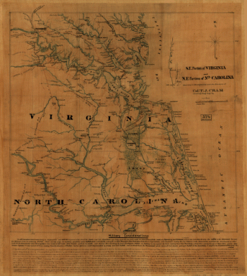
S.E. portion of Virginia and N.E. portion of North Carolina
Price range: $39.95 through $69.95 -
Southern Virginia and northern North Carolina
Price range: $39.95 through $69.95 -
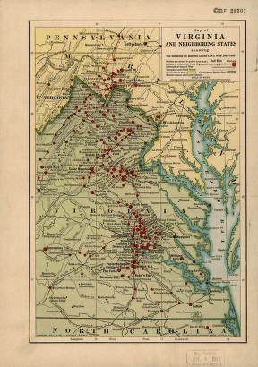
Map of Virginia and neighboring states
Price range: $39.95 through $69.95 -
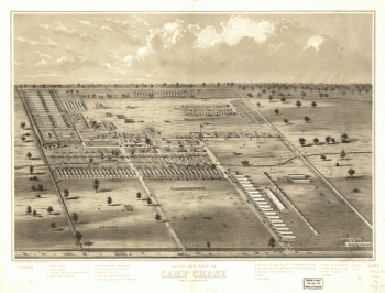
Bird's eye view of Camp Chase near Columbus, Ohio
Price range: $39.95 through $69.95 -
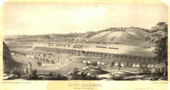
Camp Dennison : taken from Old Aunt Roady's Hill
Price range: $39.95 through $69.95 -
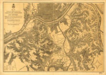
Military defences of Cincinnati, Covington and Newport
Price range: $39.95 through $69.95 -
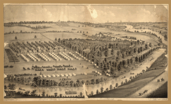
Army camp at Gaylord's Grove, Cuyahoga Falls, Ohio
Price range: $39.95 through $69.95 -
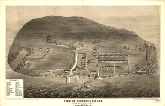
View of Johnson's Island, near Sandusky City
Price range: $39.95 through $69.95 -
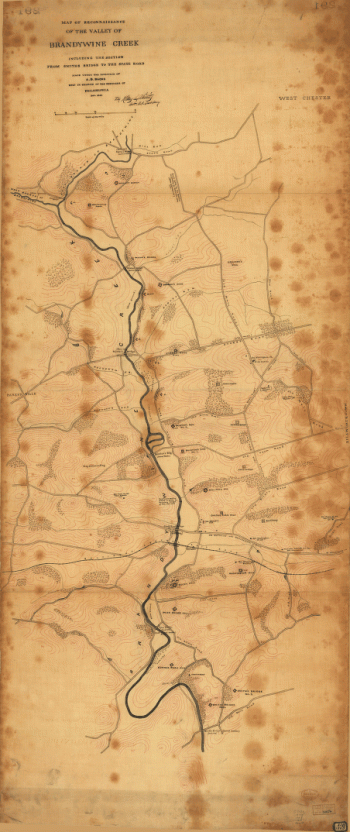
Map of reconnaissance of the valley of Brandywine Creek
Price range: $39.95 through $69.95 -
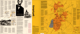
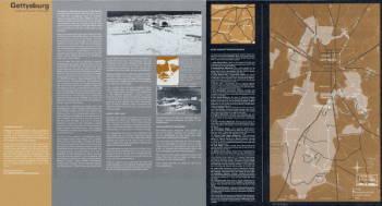
Gettysburg / National Park Service
Price range: $39.95 through $69.95 -
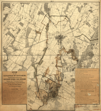
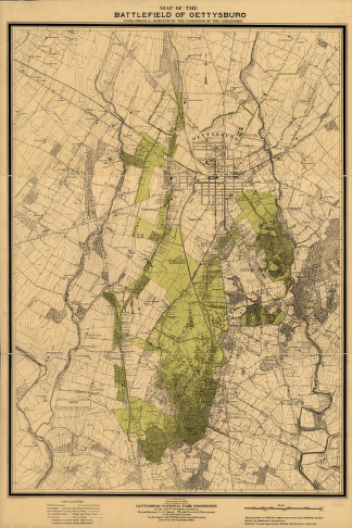
Map of the battlefield of Gettysburg
Price range: $39.95 through $69.95 -
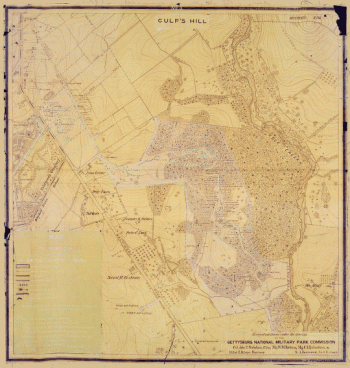
One square mile or 1/25 of the battlefield of Gettysburg
Price range: $39.95 through $69.95 -
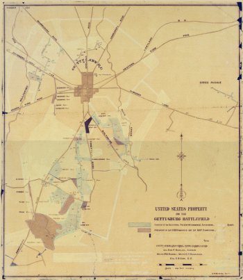
United States property on the Gettysburg battlefield
Price range: $39.95 through $69.95 -
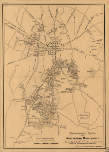
Monumental guide to the Gettysburg battlefield
Price range: $39.95 through $69.95 -
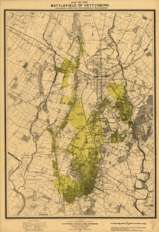
Map of the battlefield of Gettysburg
Price range: $39.95 through $69.95 -
Map of Gettysburg battlefield
Price range: $39.95 through $69.95 -
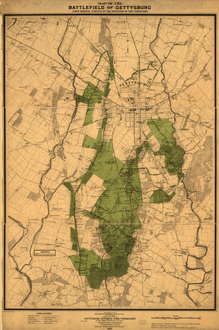
Map of the battlefield of Gettysburg
Price range: $39.95 through $69.95 -
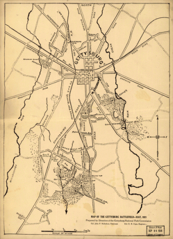
Map of the battlefield of Gettysburg
Price range: $39.95 through $69.95 -
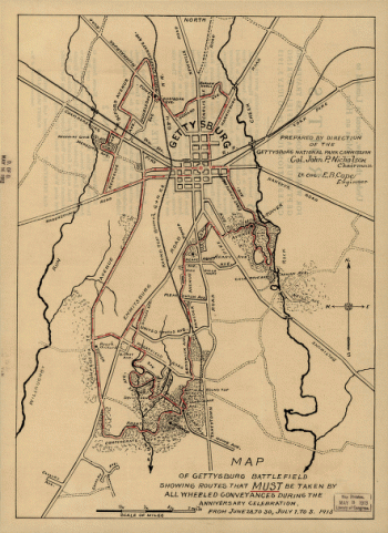
Map of the Gettysburg battlefield
Price range: $39.95 through $69.95 -
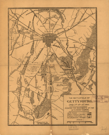
The battle of Gettysburg
Price range: $39.95 through $69.95 -
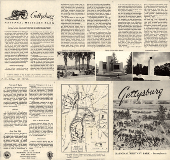
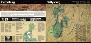
Gettysburg National Military Park, Pennsylvania
Price range: $39.95 through $69.95 -
Gettysburg National Military Park, Pennsylvania
Price range: $39.95 through $69.95 -
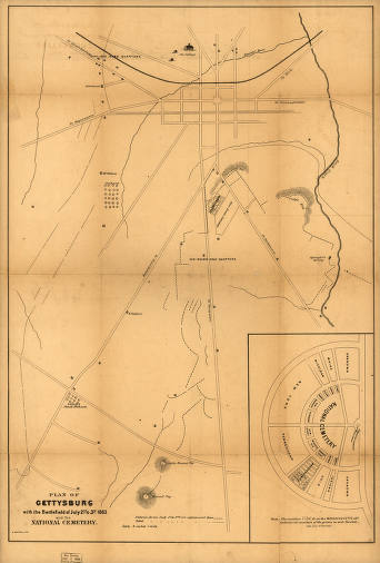
Plan of Gettysburg with the battlefield of July 2nd & 3rd, 1863 and the National Cemetery
Price range: $39.95 through $69.95 -
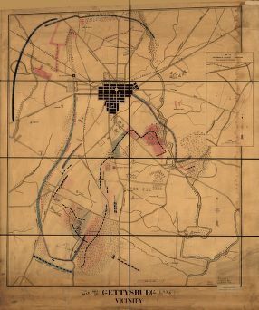
Map of Gettysburg and vicinity
Price range: $39.95 through $69.95 -
The battlefield of Gettysburg
Price range: $39.95 through $69.95 -
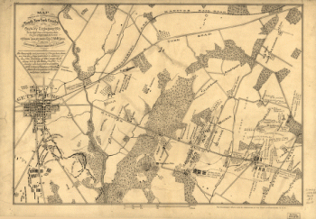
The positions occupied by the Tenth New York Cavalry at Gettysburg
Price range: $39.95 through $69.95