-

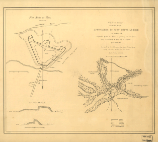
Approaches to Fort Butte La Rose, Louisiana
Price range: $39.95 through $69.95 -
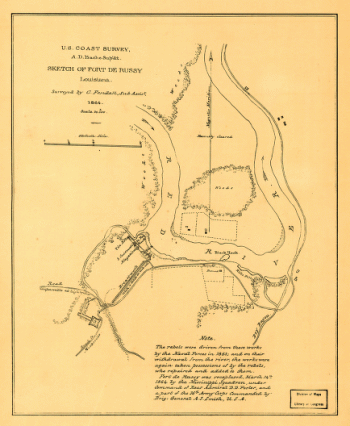
Sketch of Fort De Russy, Louisiana Surveyed by C. Fendall, Sub Assist
Price range: $39.95 through $69.95 -
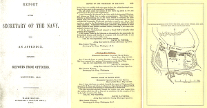
Plan showing the defences of the fort on Red River
Price range: $39.95 through $69.95 -
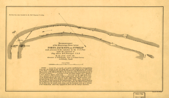
Reconnoissance of the Mississippi River below Forts Jackson and St. Philip
Price range: $39.95 through $69.95 -
Reconnoissance of the Mississippi River below Forts Jackson and St. Philip
Price range: $39.95 through $69.95 -
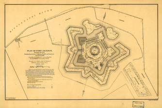
Plan of Fort Jackson
Price range: $39.95 through $69.95 -
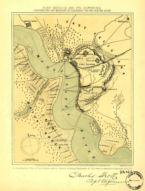
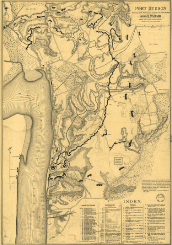
Port Hudson and its defences
Price range: $39.95 through $69.95 -
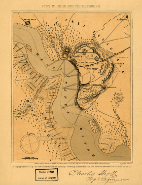
Port Hudson and its defences
Price range: $39.95 through $69.95 -
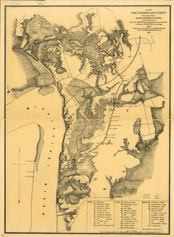
Map of Port Hudson and vicinity
Price range: $39.95 through $69.95 -
Port Hudson
Price range: $39.95 through $69.95 -
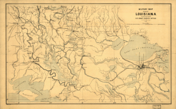
Military map of part of Louisiana
Price range: $39.95 through $69.95 -
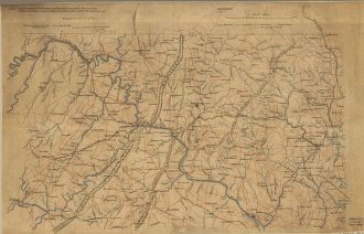
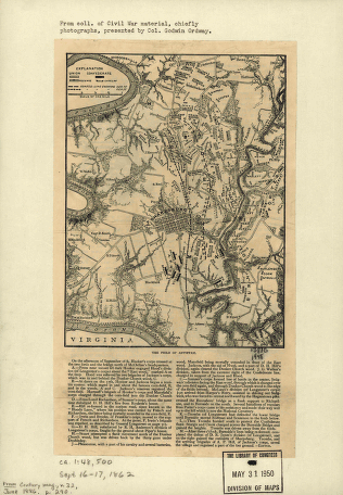
Part of map of portions of the milit'y dept's of Washington, Pennsylvania, Annapolis, and north eastern Virginia
Price range: $39.95 through $69.95 -
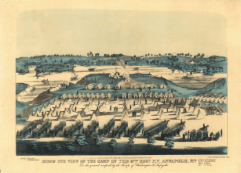
Birds' eye view of the camp of the 67th Reg't P.V. Annapolis, Md.
Price range: $39.95 through $69.95 -
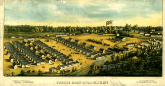
Parole Camp, Annapolis
Price range: $39.95 through $69.95 -
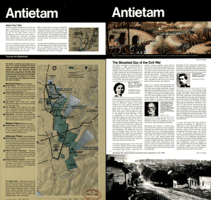
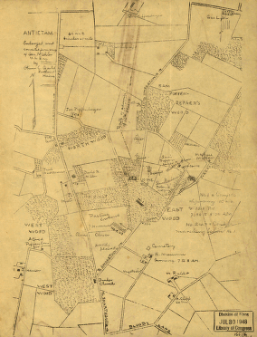
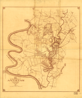
The field of Antietam
Price range: $39.95 through $69.95 -
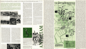
The Battle of Antietam
Price range: $39.95 through $69.95 -
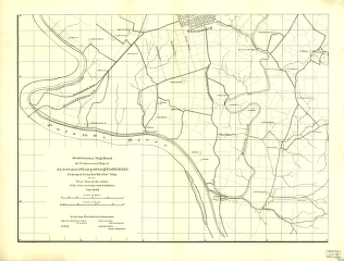
Northwest, or no. 1, sheet of preliminary map of Antietam (Sharpsburg) battlefield
Price range: $39.95 through $69.95 -
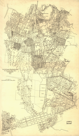
Southwest, or no. 2, sheet of preliminary map of Antietam (Sharpsburg) battlefield
Price range: $39.95 through $69.95 -
Antietam battlefield
Price range: $39.95 through $69.95 -
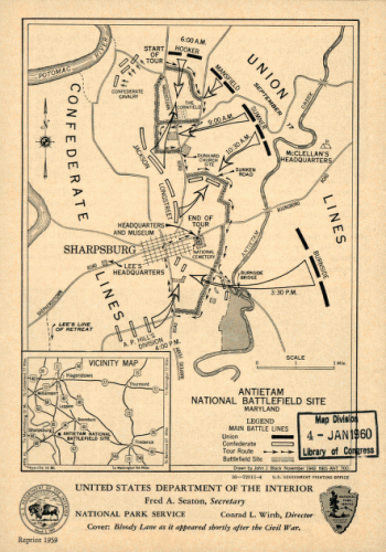
Antietam national battlefield site
Price range: $39.95 through $69.95 -
Antietam Battlefield
Price range: $39.95 through $69.95 -
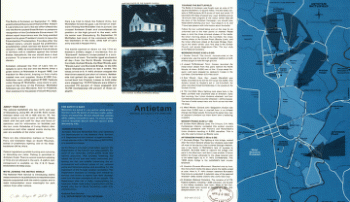
Antietam / National Park Service, U.S. Department of the Interior. United States. National Park Service
Price range: $39.95 through $69.95 -
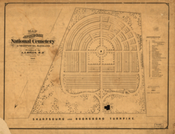
Map of Antietam National Cemetary at Sharpsburg, Maryland
Price range: $39.95 through $69.95 -
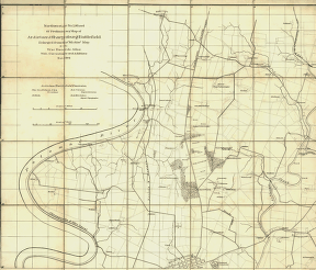
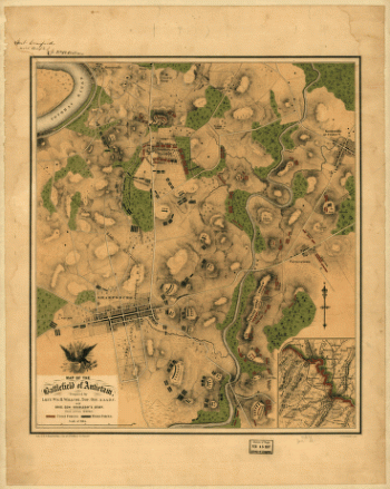
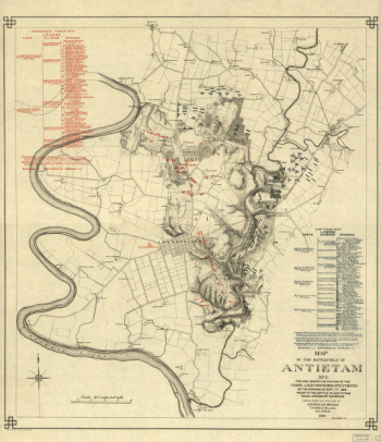
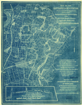
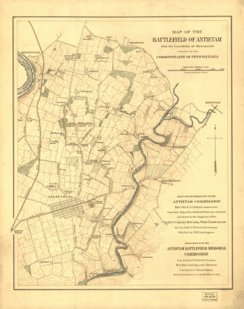
Map of the battlefield of Antietam
Price range: $39.95 through $69.95 -
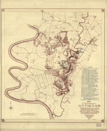
Map of the battlefield of Antietam
Price range: $39.95 through $69.95 -
Battle of the Antietam
Price range: $39.95 through $69.95 -
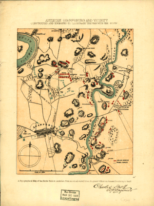
Antietam Sharpsburg and vicinity
Price range: $39.95 through $69.95 -
Antietam
Price range: $39.95 through $69.95 -
Antietam
Price range: $39.95 through $69.95 -
Map of the battlefield of Antietam. No. 1.
Price range: $39.95 through $69.95 -
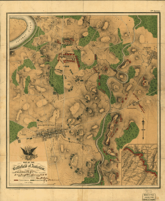
Map of the battlefield of Antietam
Price range: $39.95 through $69.95 -
(No. 2) Map of the battlefield of Antietam
Price range: $39.95 through $69.95 -
Map of the battlefield of Antietam
Price range: $39.95 through $69.95 -
Map of the battlefield of Antietam
Price range: $39.95 through $69.95 -
Map of the battlefield of Antietam
Price range: $39.95 through $69.95 -
Antietam Battlefield
Price range: $39.95 through $69.95 -
Chesapeake Bay, Sheet no. 1, York River, Hampton Roads, Chesapeake entrance.
Price range: $39.95 through $69.95 -
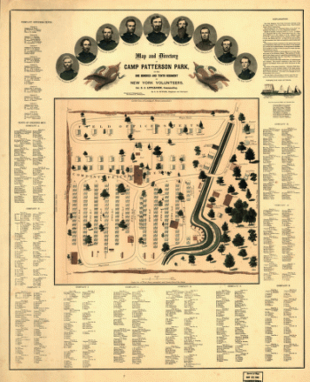
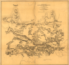
Map and directory of Camp Patterson Park
Price range: $39.95 through $69.95 -
Point Lookout, Md. View of Hammond Genl. Hospital & U.S. genl.
Price range: $39.95 through $69.95 -
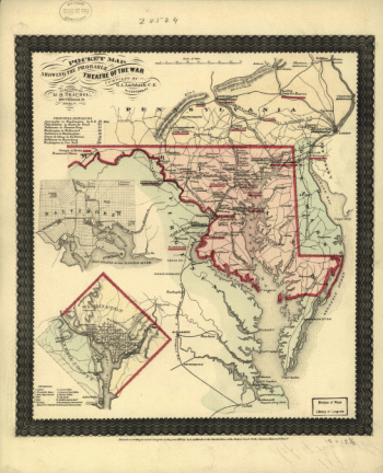
Pocket map showing the probable theatre of the war
Price range: $39.95 through $69.95 -
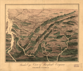
Birds eye view of Maryland and Virginia. S. N. Gaston and Company
Price range: $39.95 through $69.95 -
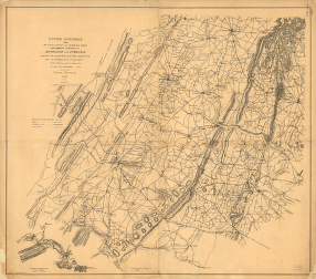
Upper Potomac from McCoy's Ferry to Conrad's Ferry and adjacent portions of Maryland and Virginia.
Price range: $39.95 through $69.95 -
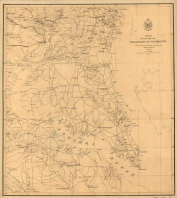
Portion of the Military department of Washington embraching lower counties of Maryland.
Price range: $39.95 through $69.95 -
Map of the vicinity of Hagerstown, Funkstown, Williamsport, and Falling Waters, Maryland
Price range: $39.95 through $69.95 -
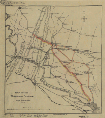
Map of the Maryland Campaign
Price range: $39.95 through $69.95 -
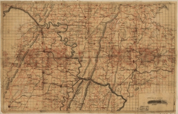
Map of portions of Virginia, West Virginia, and Maryland
Price range: $39.95 through $69.95 -
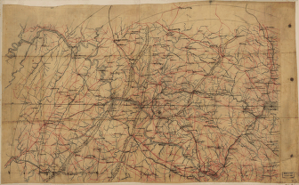
Map of portions of Virginia and Maryland
Price range: $39.95 through $69.95 -
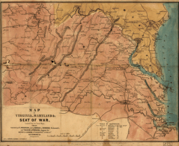
Map of Virginia, Maryland, and Seat of War
Price range: $39.95 through $69.95