Civil War Maps
-

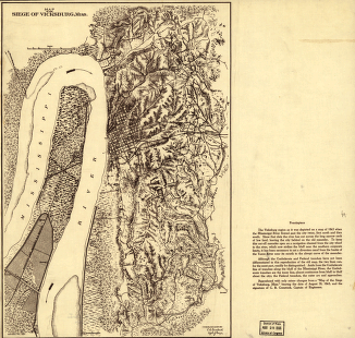
Map of the siege of Vicksburg, Miss
$17.95 – $47.95 -
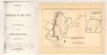
Map showing the route of the late expedition
$17.95 – $47.95 -
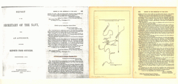
Map of operations of the Yazoo Pass expedition
$17.95 – $47.95 -
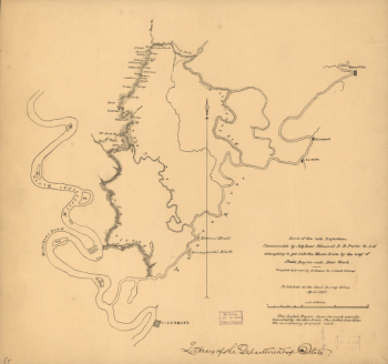
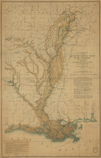
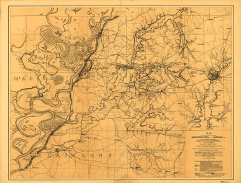
Map of the alluvial region of the Mississippi
$17.95 – $47.95 -
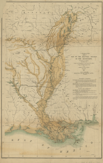
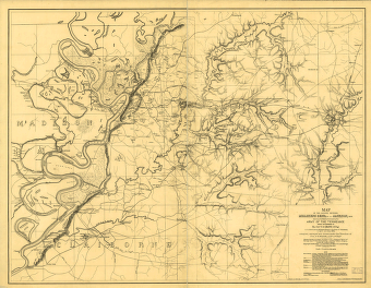
Map of the alluvial region of the Mississippi
$17.95 – $47.95 -
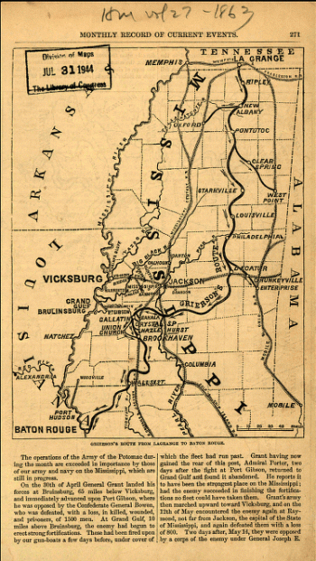
Grierson's route from La Grange to Baton Rouge – Map 1
$17.95 – $47.95 -
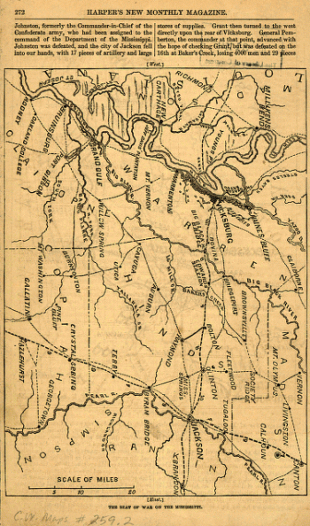
Grierson's route from La Grange to Baton Rouge – Map 2
$17.95 – $47.95 -
Southern Mississippi and Alabama
$17.95 – $47.95 -
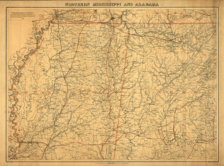
Northern Mississippi and Alabama
$17.95 – $47.95 -
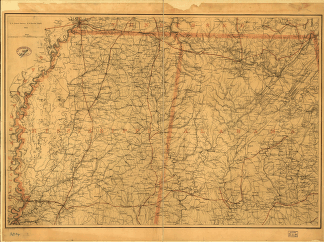
Northern Mississippi and Alabama
$17.95 – $47.95 -
Map of the country between Millikens Bend, La. and Jackson, Miss
$17.95 – $47.95 -
Map of the country between Millikens Bend, La. and Jackson, Miss
$17.95 – $47.95 -
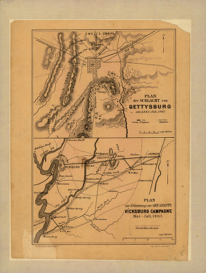
Plan der Schlacht von Gettysburg
$17.95 – $47.95 -
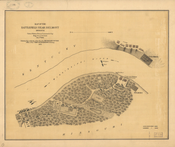
Map of the battlefield near Belmont
$17.95 – $47.95 -
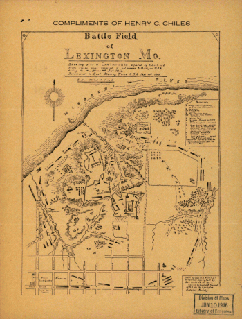
Battle field of Lexington
$17.95 – $47.95 -
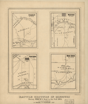
Battle grounds in Missouri
$17.95 – $47.95 -
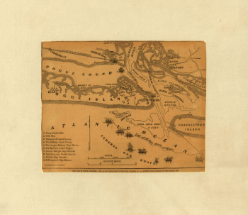
The war in North Carolina
$17.95 – $47.95 -
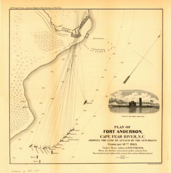
Plan of Fort Anderson, Cape Fear River, N.C
$17.95 – $47.95 -
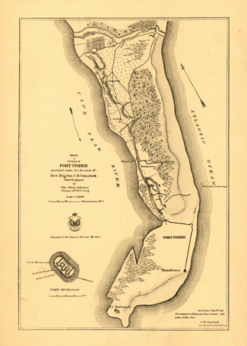
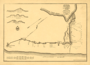
Sketch of vicinity of Fort Fisher
$17.95 – $47.95 -
Plan and sections of Fort Fisher
$17.95 – $47.95 -
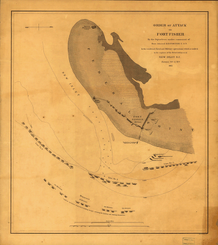
Order of attack on Fort Fisher by the Squadron
$17.95 – $47.95 -
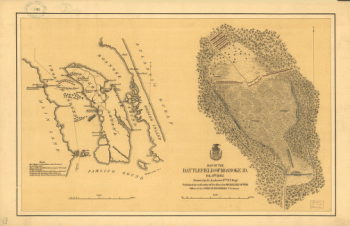
Map of the battlefield of Roanoke
$17.95 – $47.95 -
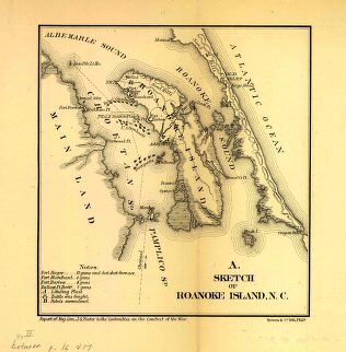
Sketch of Roanoke Island, N.C.
$17.95 – $47.95 -
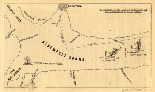
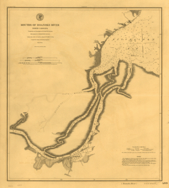
Mouths of Roanoke River, North Carolina
$17.95 – $47.95 -
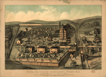
Bird's eye view of Confederate prison pen at Salisbury, N.C.
$17.95 – $47.95 -
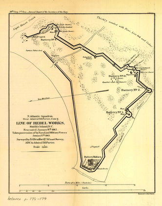
Line of rebel works, Smith's Island, N.C.
$17.95 – $47.95 -
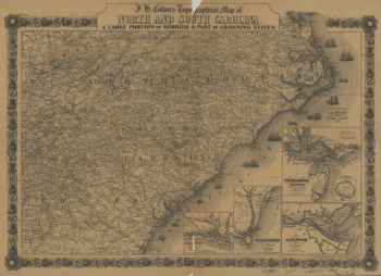
J. H. Colton's topographical map of North and South Carolina
$17.95 – $47.95 -
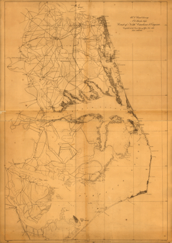
Coast of North Carolina & Virginia
$17.95 – $47.95 -
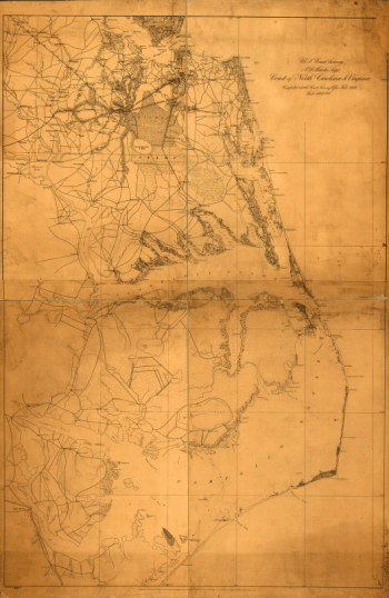
Coast of North Carolina & Virginia
$17.95 – $47.95 -
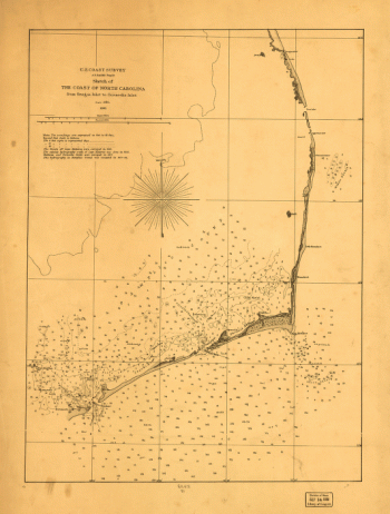
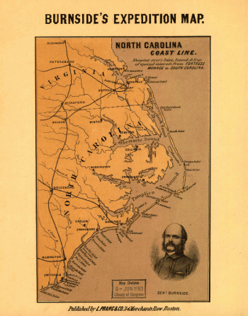
North Carolina coast line
$17.95 – $47.95 -
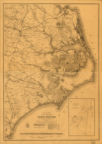
Eastern portion of the military department of North Carolina
$17.95 – $47.95 -
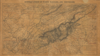
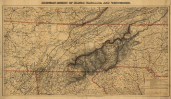
Mountain region of North Carolina and Tennessee
$17.95 – $47.95 -
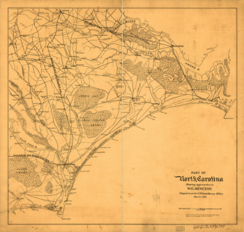
North Carolina showing approaches to Wilmington
$17.95 – $47.95 -
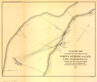
Plan of the attack by gun-boats on Forts Strong and Lee
$17.95 – $47.95 -
Mountain region of North Carolina and Tennessee
$17.95 – $47.95 -
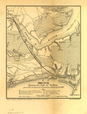
Sketch showing the route to Newbern
$17.95 – $47.95 -
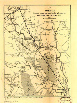
Sketch showing route pursued in the advance to Goldsboro, N.C.
$17.95 – $47.95 -
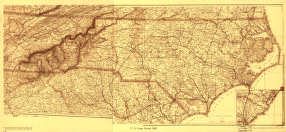
North Carolina Drawn by A. Lindenkohl
$17.95 – $47.95 -
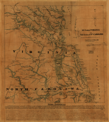
S.E. portion of Virginia and N.E. portion of North Carolina
$17.95 – $47.95 -
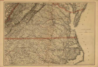
Southern Virginia and northern North Carolina
$17.95 – $47.95 -
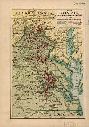
Map of Virginia and neighboring states
$17.95 – $47.95 -
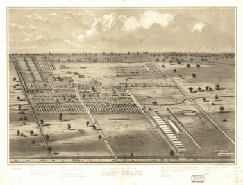
Bird's eye view of Camp Chase near Columbus, Ohio
$17.95 – $47.95 -
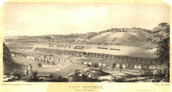
Camp Dennison : taken from Old Aunt Roady's Hill
$17.95 – $47.95