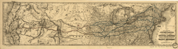
A map of the Virginia Central Railroad, west of the Blue Ridge, and the preliminary surveys, with a profile of the grades. Detailed topographic map between Waynesboro and Covington showing relief by hachures, drainage, county roads and turnpikes, railroad lines, and “preliminary lines,” county names, and boundaries. Distances are indicated at lower right of map. Consolidated in 1868 into the Chesapeake and Ohio Railroad.Citti, L. F. CREATED/PUBLISHED Richmond, Va., Lith. of L. F. Citti [186-?] Scale ca. 1:

Virginia Central Railroad Company
$17.95 – $47.95
SKU: rrsz59
Related products
-

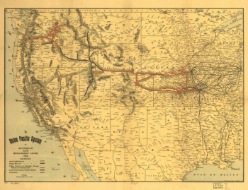
Union Pacific Railroad Company
$17.95 – $47.95 -
Union Pacific Railroad Company
$17.95 – $47.95 -
Western and Atlantic Railroad Company
$17.95 – $47.95 -
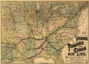
Virginia, Tennessee, and Georgia Air Line Railroad
$17.95 – $47.95