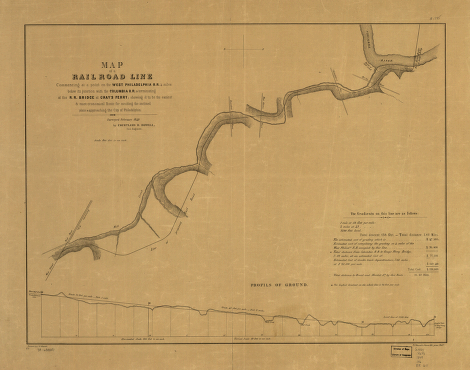
Map of railroad line commencing at a point on the West-Philadelphia R.R. 4 miles below its junction with the Columbia R.R. & terminating at the R.R. bridge at Gray's Ferry; showing it to be the easiest & most economical route for avoiding the inclined plans & approaching the city of Philadelphia; surveyed February, 1849. The distance and cost of grading is tabulated at the lower right of the map. The area covered is along Mill Creek and from the Lancaster Pike to Schuylkill River. Howell, Courtland D. CREATED/PUBLISHED [n.p., 1849] Scale 1:9,600.


