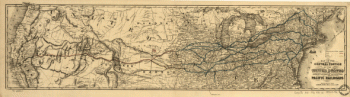
Map of the Virginia Central Rail Road showing the connection between tide water Virginia, and the Ohio River at Big Sandy, Guyandotte and Point Pleasant; made by W. Vaisz Top. Eng. Map of Virginia and parts of adjacent states showing drainage, county boundaries, place names and “McAdamised” roads. Vaisz, W. CREATED/PUBLISHED Philad[elphi]a, [1852] Scale ca. 1:1,250,000.

Virginia Central Railroad Company
$17.95 – $47.95
SKU: rrsz58
Related products
-

Western and Atlantic Railroad Company
$17.95 – $47.95 -
Union Pacific Railroad Company
$17.95 – $47.95 -
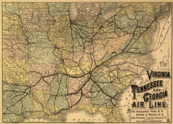
Virginia, Tennessee, and Georgia Air Line Railroad
$17.95 – $47.95 -
Western and Atlantic Railroad Company
$17.95 – $47.95